| Thursday | Thursday Night | Friday | |
|---|---|---|---|
| Cloud Cover: | Clear | Mostly Clear | Partly Cloudy |
| Temperatures: | 45 to 55 deg. F. | 25 to 30 deg. F. | 45 to 55 deg. F. |
| Wind Direction: | East | East | Variable |
| Wind Speed: | 4 to 6 | 6 to 8 | 3 to 5 |
| Snowfall: | 0" in. | 0" in. | 0" in. |
| Snow Line: | 9000' | 6500' | 8000' |
Whitefish Range
Swan Range
Flathead Range and Glacier National Park
How to read the forecast
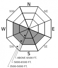
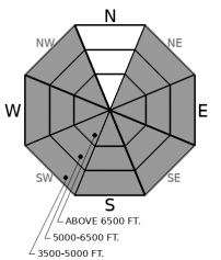
The avalanche danger is directly related to unusual and prolonged warming. The danger will rise to HIGH. We expect more wet snow avalanches that are large, destructive, and that can run long distances. Start and finish your day early. Plan to avoid avalanche terrain as the day warms up.

3. Considerable
?
Above 6500 ft.
4. High
?
5000-6500 ft.
3. Considerable
?
3500-5000 ft.
- 1. Low
- 2. Moderate
- 3. Considerable
- 4. High
- 5. Extreme
-
Type ?
-
Aspect/Elevation ?
-
Likelihood ?CertainVery LikelyLikelyPossible
 Unlikely
 -
Size ?HistoricVery LargeLargeSmall

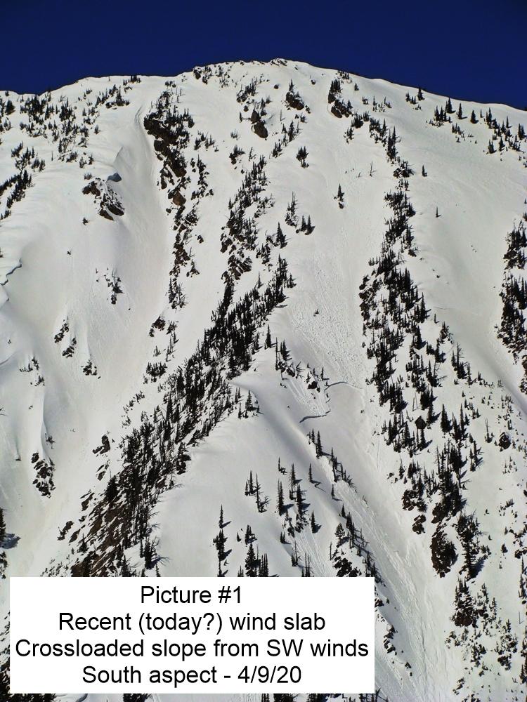
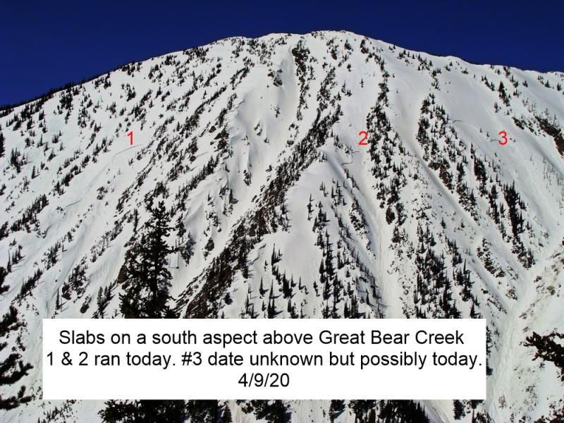
The potential for thick slabs to release naturally on old weak layers is increasing with consecutive days of unusually warm weather and poor overnight refreezes. Yesterday, several destructive slabs failed naturally in John F. Stevens Canyon on southerly and westerly aspects and Whitefish Mountain Resort Ski Patrol triggered a large wet slab with explosives. Wet slab avalanches are unpredictable and rarely give clear feedback underfoot. Choose routes that avoid traveling on or below rocky terrain, especially as the day warms. Slab avalanches have the potential to entrain surprisingly large amounts of wet debris today.
-
Type ?
-
Aspect/Elevation ?
-
Likelihood ?CertainVery LikelyLikelyPossible
 Unlikely
 -
Size ?HistoricVery LargeLargeSmall

Point-release avalanches entraining wet or moist snow will be easy to trigger or can run naturally as the sun softens the snow surface. Numerous loose wet avalanches have occurred each day this week, and in some cases, they have gouged through the entire season's snowpack growing to surprisingly destructive sizes. Yesterday, northerly slope became wet and unstable while they were still in the shade. Plan to be out of avalanche terrain before the snow surface gets slushy or starts to rollerball and pinwheel. After the prolonged warming, expect the snowpack to thaw early. Loose wet avalanches can act as triggers for larger, more dangerous wet slabs.
Wet snow avalanches continue to run on southerly aspects. Most of the recently reported avalanches have been D1 to D2 point releases, but the trend is toward more slabs and slides that can be larger, more destructive, and longer-running. The BNSF Railway Avalanche Safety staff reported many natural wet loose and wet slab avalanches in John F. Stevens Canyon yesterday. WMR ski patrol saw big wet slab results from mitigation work yesterday afternoon. With the relentless warming, the problem is migrating around the compass dial. That’s because snow on northerly aspects is heating up for the first time and becoming more unstable. Zach and I saw new wet loose slides on northwest and northeast slopes yesterday.
On Wednesday, weather stations reported the warmest temperatures so far. Highs reached the upper 50’s in the mountains and even into the 60’s at lower elevations. We have had 3 consecutive nights with temperatures above freezing. The heating trend continues today. Time your day to be out of avalanche terrain before peak thaw. Expect wet snow earlier in the day, especially near rocky outcrops or vegetation and on steep slopes.
It looks like we'll have two more days of warm weather before a return to unsettled, wetter weather occurs this weekend.
This forecast applies only to backcountry areas outside established ski area boundaries. The forecast describes general avalanche conditions and local variations always occur. This forecast expires at midnight on the posted day unless otherwise noted. The information in this forecast is provided by the USDA Forest Service who is solely responsible for its content.


