| Wednesday | Wednesday Night | Thursday | |
|---|---|---|---|
| Cloud Cover: | Clear | Mostly Clear | Mostly Clear |
| Temperatures: | 50 to 55 deg. F. | 35 to 40 deg. F. | 50 to 55 deg. F. |
| Wind Direction: | Southeast | East | East |
| Wind Speed: | 0 to 10 | 0 to 10 | 0 to 10 |
| Snowfall: | 0" in. | 0" in. | 0" in. |
| Snow Line: | 8000' | 6000' | 8000' |
Whitefish Range
Swan Range
Flathead Range and Glacier National Park
How to read the forecast
Here comes the hottest day so far! Start and finish your day early, and move towards shady aspects as the day warms up. The avalanche danger will rise to CONSIDERABLE. We are expecting more large and dangerous natural wet avalanches this afternoon.

3. Considerable
?
Above 6500 ft.
3. Considerable
?
5000-6500 ft.
2. Moderate
?
3500-5000 ft.
- 1. Low
- 2. Moderate
- 3. Considerable
- 4. High
- 5. Extreme
-
Type ?
-
Aspect/Elevation ?
-
Likelihood ?CertainVery LikelyLikelyPossible
 Unlikely
 -
Size ?HistoricVery LargeLargeSmall

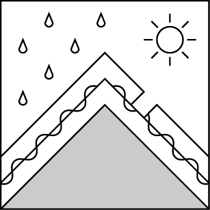
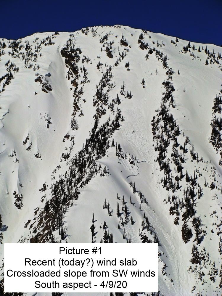
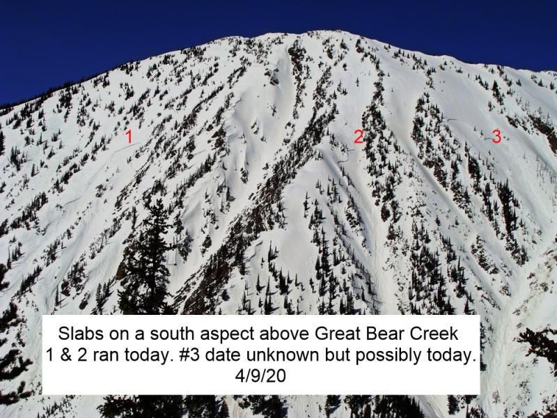
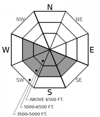
The potential for thick slabs to release naturally on old weak layers is increasing with consecutive days of unusually warm weather and poor overnight refreezes. Several destructive slabs failed recently in Glacier Park on southerly and westerly aspects and a natural wet slab ran yesterday in Whitefish Mountain Resort. Wet slab avalanches are unpredictable and rarely give clear feedback underfoot. Choose routes that avoid traveling on or below rocky, sun-baked terrain, especially later in the day. Slab avalanches have the potential to entrain surprisingly large amounts of wet debris today.
-
Type ?
-
Aspect/Elevation ?
-
Likelihood ?CertainVery LikelyLikelyPossible
 Unlikely
 -
Size ?HistoricVery LargeLargeSmall

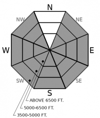
Point-release avalanches entraining wet or moist snow will be easy to trigger or can run naturally as the sun softens the snow surface. Numerous loose wet avalanches have occurred each day this week on sunny terrain, and in some cases, they have gouged through the entire season's snowpack growing to surprisingly destructive sizes. Plan to be on a shadier aspect or lower slope angle before the snow surface gets slushy or starts to rollerball and pinwheel. Use caution below long-running gullies as the day progresses. Loose wet avalanches can act as triggers for larger wet slabs.
Make plans to be drinking a cold beverage and wearing flip flops back at the trailhead before Spring Break 2019 in Cancun, Montana goes into full effect today! The thermostat soared to the mid 50's yesterday in the mountains, and it will crank a few degrees warmer today. Mountain temperatures only dropped to 40 degrees last night, making for consecutive nights without a good freeze - a major red flag. In proper spring break fashion, the mountains have been shedding their winter layers all week. Expect more of the same today. The snow surface shedding cycle peaked on Sunday, but we have continued to observe natural loose wet avalanches each day since then. While most of the reported point releases have been D1 to D2, in particularly rotten or shallow areas, these cement mixers have gouged through the entire snowpack leaving destructive debris piles near valley bottoms. With each passing day of melt-freeze cycle, the snow surface gains some resilience to loose wet instabilities. However, newly wetted snow continues to expand to higher and more shaded aspects as temperatures continue to exceed their previous high mark. Today, you are most likely to encounter natural loose wet avalanches on easterly and northerly terrain at mid and upper elevations, where the snow surface is still transitioning from dry to wet. Rock outcrops on steep slopes are common triggers, but the gullies below them are what magnify the size. Monitor the snow surface for deteriorating stability and you can easily identify and avoid the problem: that is the good news about loose wet avalanches.
The latter can't be said about buried persistent weak layers, which are becoming increasingly worrisome now under sustained warming. Yesterday, we spotted several destructive slab avalanches that recently failed on older weak layers, likely the February 2nd crust. These were all on sun-baked aspects near rocky slopes. Even though the snowpack hasn't become saturated at upper elevations, water can funnel into weak layers from hot spots on the slope - usually rocks - and compromise the strength of the weak layer under a dry-ish slab. In other areas, we are starting to see evidence of saturated wet snow breaking as a slab, such as this slide at WMR or this one at JFS Canyon or this cool video from north of the border. Wet slab concerns are not widespread, but they require conservative decision-making because of their unpredictable and destructive consequences. Reduce your risk by traveling early in the day and choosing routes that minimize your exposure below sun baked start zones. We haven't seen any activity involving dry persistent slab avalanches on northerly aspects this week, but beware, large cornices are starting to sag and can act as triggers for older weak layers if they start trundling down slopes.
A high-pressure ridge is firmly in place over Montana, bringing unseasonably warm temperatures. A pattern change looks to develop by this weekend.
This forecast applies only to backcountry areas outside established ski area boundaries. The forecast describes general avalanche conditions and local variations always occur. This forecast expires at midnight on the posted day unless otherwise noted. The information in this forecast is provided by the USDA Forest Service who is solely responsible for its content.


