| Friday | Friday Night | Saturday | |
|---|---|---|---|
| Cloud Cover: | Mostly Cloudy | Mostly Cloudy | Mostly Cloudy |
| Temperatures: | 27 to 34 deg. F. | 16 to 21 deg. F. | 30 to 37 deg. F. |
| Wind Direction: | Southwest | Southwest | Southwest |
| Wind Speed: | 8 to 13, gusting to 25 | 7 to 12, gusting to 20 | 5 to 10 |
| Snowfall: | 0 in. | 0 in. | 0 in. |
| Snow Line: | 2000 | 2500 | 3000 |
Whitefish Range
Swan Range
Flathead Range and Glacier National Park
How to read the forecast
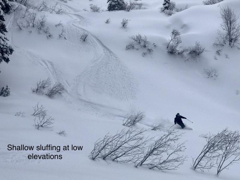
Today you can trigger slides of loose, unconsolidated snow that can be dangerous on steep slopes above terrain traps. These sluffs can involve dry snow in shaded, colder terrain, and wet snow on slopes receiving sustained sun. Reduce your exposure to these hazards with judicious terrain choices: keep your partners in sight, let sluff run away from you, and stay out from under steep, rocky terrain when you see rollerballs or the snow is getting sticky.

2. Moderate
?
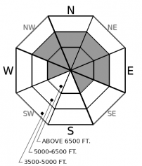
Above 6500 ft.
2. Moderate
?
5000-6500 ft.
1. Low
?
3500-5000 ft.
- 1. Low
- 2. Moderate
- 3. Considerable
- 4. High
- 5. Extreme
-
Type ?
-
Aspect/Elevation ?
-
Likelihood ?CertainVery LikelyLikelyPossible
 Unlikely
 -
Size ?HistoricVery LargeLargeSmall

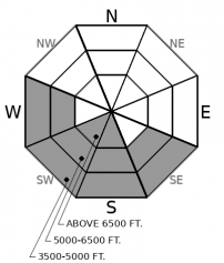
You can trigger sluffs of unconsolidated snow that can be dangerous on steep slopes where you find dry, loose snow that’s boot-top deep or more. Triggered sluffs will entrain the most snow on steep slopes with long, continuous pitches. Be wary of convex rolls where slopes steepen to about 38 degrees or more, especially those above terrain traps like rock bands, gullies, and dense trees. This hazard is most widespread at upper elevations, where this week's storm snow is deeper and remains cold and dry.
-
Type ?
-
Aspect/Elevation ?
-
Likelihood ?CertainVery LikelyLikelyPossible
 Unlikely
 -
Size ?HistoricVery LargeLargeSmall

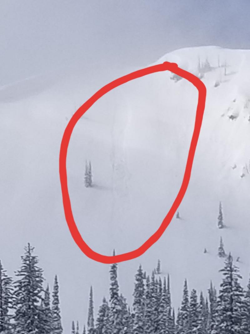
Triggered and natural sluffs of wet snow are likely on steep slopes that receive sustained sun today. These can be hard to escape and dangerous above terrain traps. Weather forecasts are inconsistent, with some models predicting extensive cloud cover, others not. Keep an eye on the cloud cover overhead of your destination, and the water content in the near-surface snow around you. If the snow surface gets sticky and gloppy, or you see rollerballs running near you, head for lower-angled or more shaded slopes.
What we have today:
-3 to 10 inches of dry, unconsolidated snow on shaded slopes above about 4500 feet.
-A combination of crusts and loose snow on sunnier aspects.
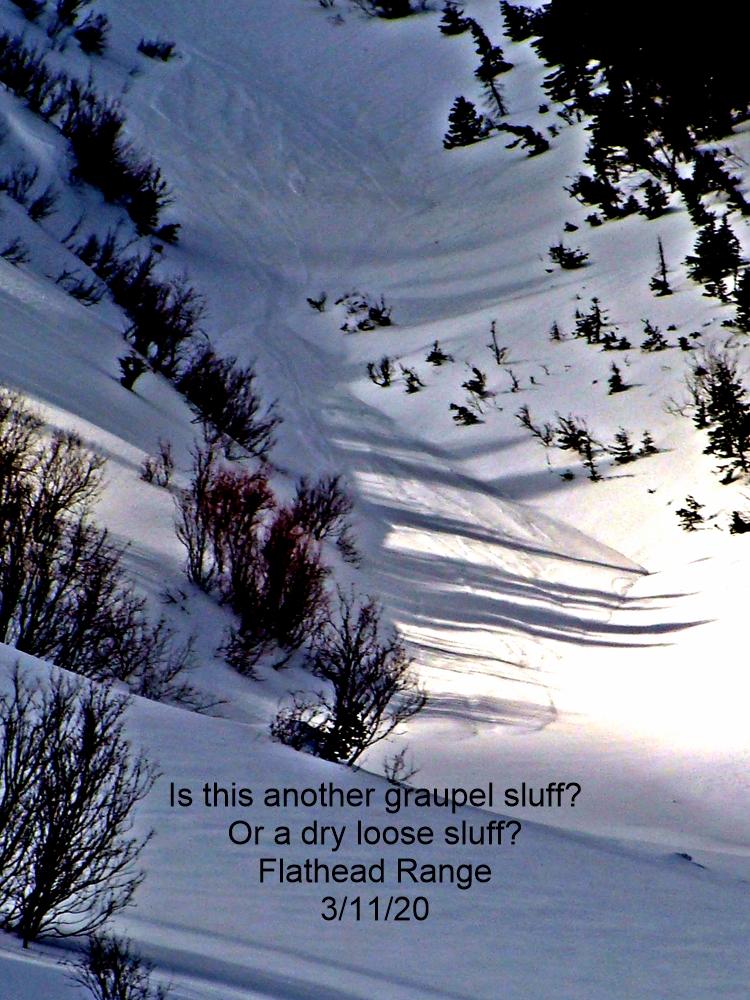
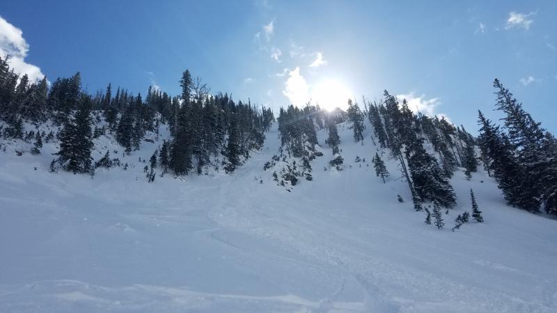
-Reports of triggered loose snow slides on northerly aspects in the Flathead Range and Lake McDonald areas.
-A forecast for a little more sun, particularly in the southern half of the forecast region.
On steep slopes with no evidence of drifting and dry snow that’s boot-top deep, I’d be concerned triggering sluffs that could run far and entrain enough snow to be dangerous. I’d pick lines that kept me in sight of my partners and minimized exposure to terrain traps below me. On similar slopes that are getting sustained sun, my concern would be natural and triggered loose wet avalanches. Avoiding being on or under those slopes is the most straightforward way to reduce exposure to that hazard.
What we don’t have from the past few days:
-Observations from upper elevations in the Swan and Flathead Ranges.
-Wind data from the Swan and Flathead Ranges
-Reports of triggered or natural slabs of drifted snow.
-Sustained winds over 15 mph at the automated stations in other ranges.
That’s not enough evidence to list Wind Slabs as an avalanche problem today. But I’d be looking for them on the lee sides of exposed ridges. And if I found denser snow that cracked around my snowmobile, skis, or board, I’d avoid steep slopes where small slabs could have big consequences. On Wednesday, Mark reported drifting, cracking, and sensitive cornices on the west side of the Swan Range. The soft slabs he found were up to 18 inches but unreactive in ski cuts. The lack of similar reports suggests that any wind slabs from earlier this week are isolated and already well down the road to stabilizing.
A ridge of high pressure is walking this way from the west coast. We can expect intermittent clouds, occasional showers, and warming temperatures until it's overhead early next week. Winds will be light with moderate gusts.
This forecast applies only to backcountry areas outside established ski area boundaries. The forecast describes general avalanche conditions and local variations always occur. This forecast expires at midnight on the posted day unless otherwise noted. The information in this forecast is provided by the USDA Forest Service who is solely responsible for its content.


