| Monday | Monday Night | Tuesday | |
|---|---|---|---|
| Cloud Cover: | Mostly clear | Partly Cloudy | Mostly cloudy |
| Temperatures: | 27 to 32 deg. F. | 16 to 21 deg. F. | 27 to 32 deg. F. |
| Wind Direction: | Southwest | Southwest | Southwest |
| Wind Speed: | 10 to 20 mph, gusting to 30 | 10 to 20 mph, gusting to 30 | 10 to 15 mph, gusting to 25 |
| Snowfall: | 0" in. | 0 to 1" in. | 2" to 4" in. |
| Snow Line: | 1000' | 2000' | 2000' |
Whitefish Range
Swan Range
Flathead Range and Glacier National Park
How to read the forecast
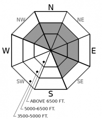
Wind slabs formed late last week continue to strengthen under bluebird-like weather. Generally, stable conditions are found throughout the backcountry. Instabilities may exist in steep terrain where slabs may be thickest. The most enjoyable and safest conditions are found in wind sheltered terrain.

1. Low
?
Above 6500 ft.
1. Low
?
5000-6500 ft.
1. Low
?
3500-5000 ft.
- 1. Low
- 2. Moderate
- 3. Considerable
- 4. High
- 5. Extreme
-
Type ?
-
Aspect/Elevation ?

-
Likelihood ?CertainVery LikelyLikelyPossible
 Unlikely
 -
Size ?HistoricVery LargeLargeSmall

After several days of benign weather, Thursday’s reactive wind slabs seem a distant memory. We have few reports of instabilities from the weekend backcountry crowd, and slabs continue to gain strength. Areas harboring unstable snow will be on steep slopes where slabs could be thicker than 6”. Increasing winds overnight and through the day may form thin slabs on the highest peaks. More enjoyable and safer riding will be found in wind sheltered terrain.
Recent observations described generally stable snow on several large, steep peaks in the Flathead Range. This is in stark contrast to the wind slabs that were reactive to the weight of a skier, or even a shovel blade, on Thursday and 2 skier triggered slides Friday. Warm and dry conditions have healed instabilities in thin slabs formed late last week. Instabilities may linger where thicker slabs remain on steep slopes. Areas harboring this problem will be downwind of saddles/passes, below upper elevation ridgelines, and in cross-loaded gullies. Take note of the bonding between the surface slab and the underlying layer.
With great visibility on tap for today please send us a photo or two of the surface snow where you travel. This will help us track areas affected by the recent winds and allow for a more accurate forecast. Thanks.
One last day of high pressure before a weak system moves into our area overnight and through the day tomorrow. Expect a minor refresh tomorrow with dry weather on tap for the remainder of the week.
This forecast applies only to backcountry areas outside established ski area boundaries. The forecast describes general avalanche conditions and local variations always occur. This forecast expires at midnight on the posted day unless otherwise noted. The information in this forecast is provided by the USDA Forest Service who is solely responsible for its content.


