| Thursday | Thursday Night | Friday | |
|---|---|---|---|
| Cloud Cover: | Partly Cloudy | Overcast | Mostly Cloudy |
| Temperatures: | 23 to 28 deg. F. | 5 to 15 deg. F. | 25 to 30 deg. F. |
| Wind Direction: | Southeast | East | Southwest |
| Wind Speed: | 10 to 15, gusting to 25 | 10 to 15, gusting to 25 | 8 to 12, gusting to 25 |
| Snowfall: | 0 in. | 4-6 in. | 3-4 in. |
| Snow Line: | 500 | 1000 | 2000 |
Flathead Range and Glacier National Park
How to read the forecast
The math remains simple today. And don’t tune out at the word “math,” arts and humanities majors. Lots of snow in a short time equals dangerous avalanche conditions. Today you can still trigger slides that break 1 to 3 feet deep on steep slopes. But you can enjoy great riding with less risk on slopes that are less than 35 degrees, have runouts clear of terrain traps, and aren’t below steeper start zones.

3. Considerable
?
Above 6500 ft.
3. Considerable
?
5000-6500 ft.
3. Considerable
?
3500-5000 ft.
- 1. Low
- 2. Moderate
- 3. Considerable
- 4. High
- 5. Extreme
-
Type ?
-
Aspect/Elevation ?
-
Likelihood ?CertainVery LikelyLikelyPossible
 Unlikely
 -
Size ?HistoricVery LargeLargeSmall

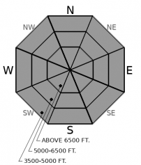
Conservative terrain choices, attention to small changes in slope angle, and careful group management will help you enjoy great riding today while reducing your chances of triggering slabs that break in the storm snow. These slides can break 15 to 30 inches deep, with wide propagation, and dangerous amounts of debris. The chances of triggering one of these will increase as slope angles increase, so reduce your risk by sticking to lower-angled slopes. You'll face significantly more risk on slopes more than about 35 degrees in steepness. Stay out from under start zones near ridges where you see blowing snow.
-
Type ?
-
Aspect/Elevation ?

-
Likelihood ?CertainVery LikelyLikelyPossible
 Unlikely
 -
Size ?HistoricVery LargeLargeSmall

The monsters under the bed are large slides that break on weak snow buried deep in the snowpack. The most worrisome layer right now is facets around the crust buried on Groundhog Day. Triggered slides in the storm snow may step down and produce wider, deeper, and more destructive persistent slab avalanches. These slides can surprise you by propagating unusually wide distances and can be triggered from flat terrain below a steep slope. Defaulting to lower angle terrain is the easiest way to avoid this problem. Whumpfing collapses are a clear sign that these slides are an immediate danger.
-
Type ?
-
Aspect/Elevation ?
-
Likelihood ?CertainVery LikelyLikelyPossible
 Unlikely
 -
Size ?HistoricVery LargeLargeSmall

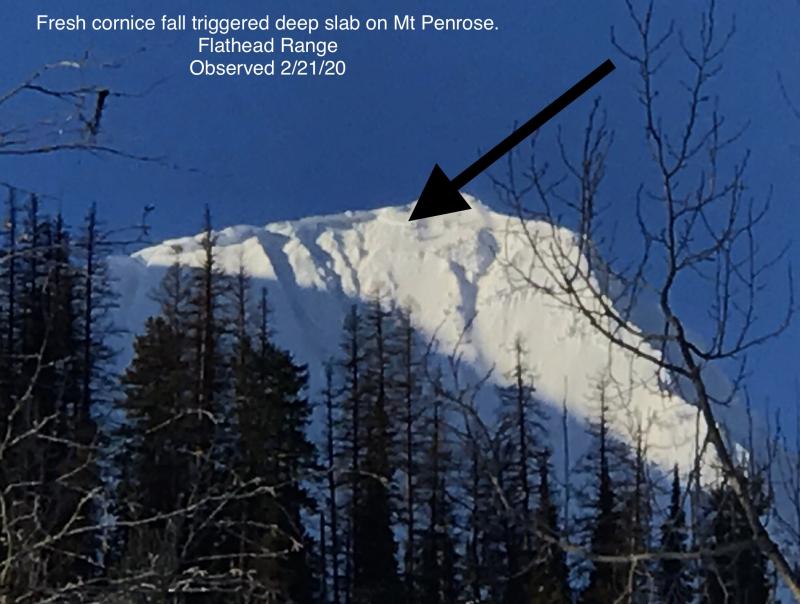
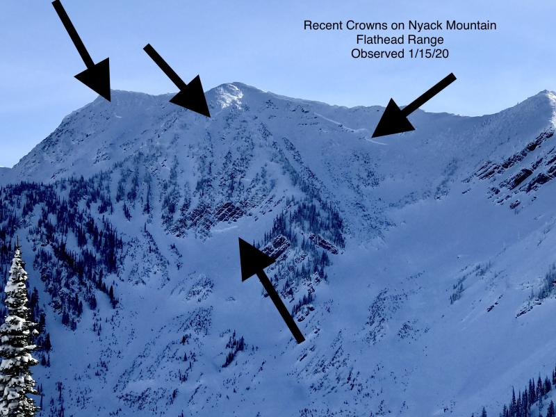
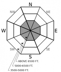
Buried weak layers exist near the ground and have produced very destructive avalanches from alpine terrain in the Flathead Range during major loading events. We are at the tail end of a loading event under a warming trend, the most suspect weather for triggering a deep slab. A smaller slide in the upper snowpack, or a cornice fall, could act as trigger for a deep slab that runs surprisingly far. Choose routes that don't cross below alpine start zones. Slide alder and flagging, or scars on trees are indicators that you are in a runout zone.
Snow tapered off by midday Wednesday, with storm totals over the past few days of 2 to 3 feet across most of the forecast region. Winds yesterday were mostly light and westerly. Temperatures above 6000 feet reached the mid to upper 20s - the warmest day in a week.
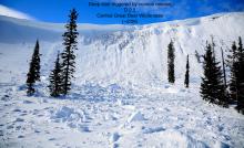
From the limited field observations so far, it’s clear that the heavy snowfall produced a widespread cycle of spontaneous soft slab avalanches. These ran in all elevation bands and in some unusual spots, with debris from one slide burying the Marion Lake trail. The few people out reported whumpfing collapses and/ or shooting cracks. Most of those signs of instability come from the Middle Fork/John F. Stevens Canyon. Zach was out in the Canyon Creek area yesterday, and he was not able to trigger slabs on test slopes.
The math is still pretty simple today, even for a former English Major like me: lots of snow in a short time equals instability and danger. And conservative terrain choices and careful travel add up to fun but safe riding. The storm snow will be settling today and consolidating into more of a slab, so collapses may propagate further and triggered slides may be larger, though signs of instability may be less frequent. They may break deeper as well, on facets above the Groundhog Day crust. That means picking ascent routes and safe zones clear of overhead hazard. While natural avalanches are growing less likely, I’d still steer clear of runouts below westerly start zones, which may see some loading from today’s southeasterly winds.
Snowfall and increasing winds tonight will keep the danger elevated into the weekend.
BNSF will be conducting emergency mitigation today in the Highway 2 corridor east of Essex from about 11:30 to 3:30 today. Several slides impacted the railway yesterday. Depending on results, Highway 2 may be closed at 2 p.m. above and below John F. Stevens Canyon, probably at Essex and at the Snowwlip Inn. Backcountry users should avoid terrain on both sides of Stevens Canyon.
A respite today from cold and stormy weather before the next storm moves in overnight. Expect partly cloudy skies, warming temperatures light to moderate southeasterly winds. These may be gusty near ridges. Snowfall tonight, diminishing tomorrow.
This forecast applies only to backcountry areas outside established ski area boundaries. The forecast describes general avalanche conditions and local variations always occur. This forecast expires at midnight on the posted day unless otherwise noted. The information in this forecast is provided by the USDA Forest Service who is solely responsible for its content.


