| Friday | Friday Night | Saturday | |
|---|---|---|---|
| Cloud Cover: | Overcast | Mostly cloudy | Mostly cloudy |
| Temperatures: | 9 to 14 deg. F. | -21 to -14 deg. F. | -15 to -7 deg. F. |
| Wind Direction: | SW | E | E |
| Wind Speed: | 7 to 12, gusting to 30 | 15 to 20, gusting to 40 | 18 to 23, gusting to 45 |
| Snowfall: | 4 to 6 in. | 1 in. | 0 in. |
| Snow Line: | 0 | 0 | 0 |
Flathead Range and Glacier National Park
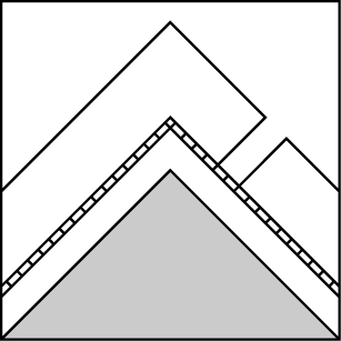
How to read the forecast
Expect increasingly dangerous conditions today as new snow and cold northeast winds create fresh slabs and add weight to buried weak layers. Conservative decision making and cautious route-finding are required to travel in and near avalanche terrain. Dangerously cold windchill and decreasing visibility will complicate backcountry travel by this afternoon.

3. Considerable
?
Above 6500 ft.
3. Considerable
?
5000-6500 ft.
2. Moderate
?
3500-5000 ft.
- 1. Low
- 2. Moderate
- 3. Considerable
- 4. High
- 5. Extreme
-
Type ?
-
Aspect/Elevation ?
-
Likelihood ?CertainVery LikelyLikelyPossible
 Unlikely
 -
Size ?HistoricVery LargeLargeSmall

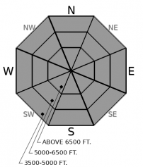
Periods of moderate snowfall may drop up to 11” of new snow and up to 0.8” of snow water equivalent by tomorrow morning. Human triggered storm slabs will be likely where the most snow accumulates. Drifted snow will become more of a problem as the winds shift to the northeast and increase this afternoon. Monitor snow totals and watch for blowing snow. Be wary of slopes steeper than about 30 degrees, especially on the downwind side of ridges. Shooting cracks are a red flag directing you to avoid avalanche terrain.
-
Type ?
-
Aspect/Elevation ?
-
Likelihood ?CertainVery LikelyLikelyPossible
 Unlikely
 -
Size ?HistoricVery LargeLargeSmall

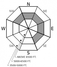
New loading will increase the possibility of triggering buried weak layers of surface hoar and facets today. These continue to fail in snowpack tests between about 6000’ and 6500’. The weight of new snow may re-awaken these layers. Smaller storm slab avalanches or sluffs could step down into these layers and cause a larger, more dangerous slide. These layers are most prevalent in open glades, and on steep convexities at mid elevations. By this afternoon, slabs on top of these layers could be 3 feet or more thick . Whumpfing and deep shooting cracks are direct feedback from the snowpack telling you that you are already in harm’s way.
-
Type ?
-
Aspect/Elevation ?
-
Likelihood ?CertainVery LikelyLikelyPossible
 Unlikely
 -
Size ?HistoricVery LargeLargeSmall

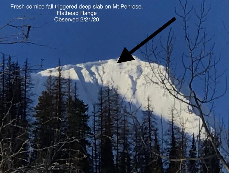
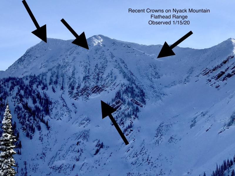
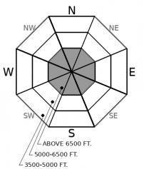
Very large avalanches failing of deeply buried weak layers have been reported in the aftermath of almost every significant loading event this season. The upper elevations of the Flathead Range and Glacier Park, where the snowpack is generally colder and more variable, have been the epicenter of deep slabs. We are concerned that the new loading today may wake up the sleeping dragons. Rocky, convex, alpine terrain is the most likely place that these slabs could fail. Be extra cautious of that type of terrain above you if you ascend to upper elevations today. The consequences of a deep slab avalanche would be sever.
The quite period of small sluffing and isolated wind slabs is over for a few days. Conditions will deteriorate throughout today. By tonight, cold arctic air and strong northeast winds will create dangerous windchill and poor visibility.
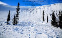
Wind slabs left over from last weekend’s blizzard have grown increasingly isolated. Yesterday a skier in the Flathead Range reported triggering a small wind slab and frequent shooting cracks on the southwest aspect of an alpine ridgeline. In John F. Stevens Canyon, Zach found 3’ deep drifts that cracked with kick testing, but were easy to avoid.
With between 3 and 10” of soft surface snow, loose dry sluffs have been reported across the forecast area. While that the sluffs themselves have not been super interesting, all that loose snow is available for wind transport as the next arctic blast pushes across the Divide today. As winds increase from the northeast, expect drifted snow to be sensitive to your weight.
We have added deep slabs back into the forecast for the Flathead Range and Glacier Park today. We are worried that the new loading may be enough to awaken sleeping dragons. These monsters have slumbered under the cold and variable snowpack of the rocky heights. Very large avalanches could fail where the coverage is thinner in alpine terrain. Pay special attention to this consequential overhead hazard as you ascend.
EDUCATION: Sign up for one of our upcoming classes: Introduction to Avalanches (non-motorized) 02/28/2019 to 03/02/2019.
A Pacific low and arctic air will combine for another bout of very cold, blustery weather. Snow is forecast today and tapers off tonight. Winds remain strong through Saturday.
This forecast applies only to backcountry areas outside established ski area boundaries. The forecast describes general avalanche conditions and local variations always occur. This forecast expires at midnight on the posted day unless otherwise noted. The information in this forecast is provided by the USDA Forest Service who is solely responsible for its content.


