| Thursday | Thursday Night | Friday | |
|---|---|---|---|
| Cloud Cover: | Partly Cloudy | Mostly Cloudy | Overcast |
| Temperatures: | 7 to 15 deg. F. | -2 to 6 deg. F. | 10 to 20 deg. F. |
| Wind Direction: | Southwest | Southwest | Southeast |
| Wind Speed: | 0 to 10 mph, gusting to 20 | 5 to 15 mph, gusting to 25 | 10 to 15 mph, gusting to 30 |
| Snowfall: | 0 in. | 0 to 2 in. | 3 to 6 in. |
| Snow Line: | 0 | 0 | 0 |
Whitefish Range
Swan Range
Flathead Range and Glacier National Park
How to read the forecast
Recent wind slabs 6” to 3’ deep sit atop weak snow and may be slow to heal. Steep open slopes below ridgelines and cross-loaded features are the greatest concern. Sheltered slopes will offer safer, better riding conditions. Cold temperatures will continue to increase the consequences of an accident.

2. Moderate
?
Above 6500 ft.
2. Moderate
?
5000-6500 ft.
1. Low
?
3500-5000 ft.
- 1. Low
- 2. Moderate
- 3. Considerable
- 4. High
- 5. Extreme
-
Type ?
-
Aspect/Elevation ?
-
Likelihood ?CertainVery LikelyLikelyPossible
 Unlikely
 -
Size ?HistoricVery LargeLargeSmall

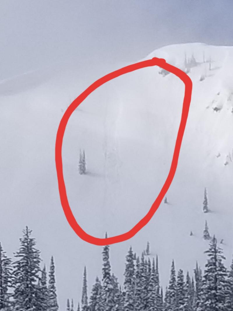
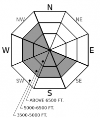
Snow from Sunday’s blizzard was hammered into drifts on atypical, south and westerly aspects at middle and upper elevations. On Tuesday, skiers easily trigged small slabs below ridgelines in the Whitefish Range and Southern Glacier Park. A large natural slab avalanche slid on the south face of Snowslip Mountain. These areas saw the most wind loading during the storm and remain the largest concern. In many wind prone areas recent slabs sit atop weak faceted snow. Riders yesterday reported that wind slabs were still cracking below ridgelines and crossloaded slopes. Watch from recent drifts and be wary of hollow sounding snow below cornices and on the sidewalls of gullies.
-
Type ?
-
Aspect/Elevation ?
-
Likelihood ?CertainVery LikelyLikelyPossible
 Unlikely
 -
Size ?HistoricVery LargeLargeSmall

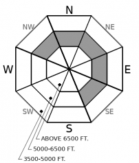
The last report of an avalanche or collapse in buried weak layers was from over a week ago. The Groundhog day crust has generally limited the distribution of the problem to around 6000’ to 6500’. These weak layers, buried 1-2’ deep in the snowpack, continue to show failure in snowpack tests and remain a stubborn concern in isolated areas. Whumpfing or shooting cracks that break on these layers are red flags that you are unlikely to see, but should direct you to shallower slope angles or areas that do not have these persistent layers.
-
Type ?
-
Aspect/Elevation ?
-
Likelihood ?CertainVery LikelyLikelyPossible
 Unlikely
 -
Size ?HistoricVery LargeLargeSmall

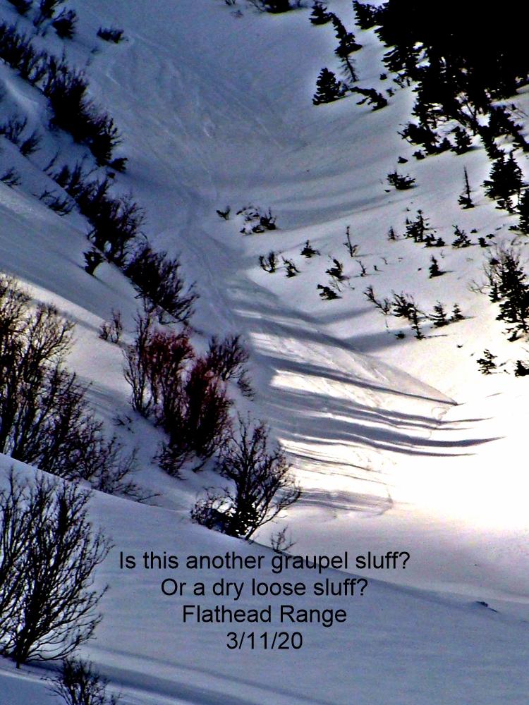
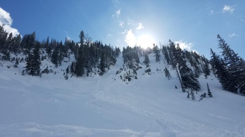
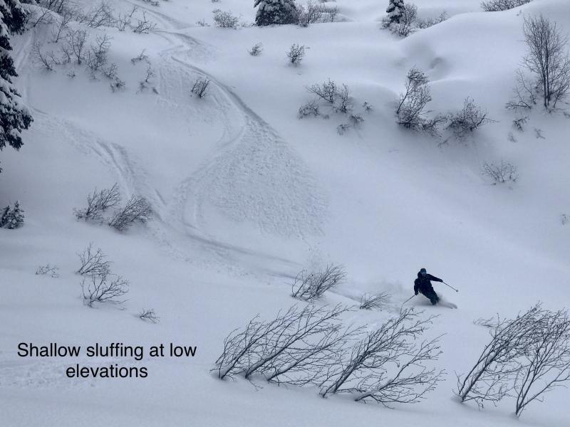
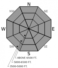
Riders have reported small sluffs running in the recent storm snow on all aspects and elevations. Weather stations overnight are showing an inch or so of settlement which may limit sluffing to all but the steepest terrain. Even small sluffs can be dangerous if they knock you off your feet in extreme terrain or above a terrain trap where the snow can pile up quickly. Manage loose snow avalanches by ski cutting steep slopes before riding, or use other sluff management techniques to allow moving snow to pass you by.
Pleasant, if cold, weather has people out in the mountains again and more observations have been coming in from across the forecast area. In areas that were not hammered by the wind early in the week, the surface snow is mostly incohesive. Riders are reporting small sluffs running in steep terrain. Some weather stations reported an inch of settlement in the new snow overnight which means sluffing may be on a downward trend in all but extreme terrain.
Below upper elevation ridgelines and on crossloaded mid elevation slopes, soft wind slabs are slowly gaining strength. Some of these slabs overly weak, faceted snow and may take longer to heal. Skiers yesterday reported cracking in the stiffest slabs in Canyon Creek and on Paola Ridge. Tuesday was the last day that observers reported slab avalanches. These ran in areas that saw the strongest northeast winds over the weekend: the Whitefish Range and John F. Stevens Canyon. Skiers were able to easily trigger small wind slabs and a 3’ thick slab ran on a south facing slope of Snowslip Mountain.
A stiff melt-freeze crust that was buried on Groundhog Day has been found to around 6000’. So far that’s good news because it has helped lock down the snowpack and limited the range of the persistent slab problem. Test results from about 6000’ to 6500’ continue to show that buried weak layers can still propagate a failure if triggered. I found these layers up to 6800’ near Big Mountain on Tuesday, which is the highest we have seen them this season. No new avalanches, cracking, or whumpfing has been reported as a result of these layers in over a week.
The bad news about the Groundhog crust is that cold temperatures are weakening the snow above and below it. Zach reported a big whumpf yesterday as the 3rd skier on the slope collapsed the facets underneath of the crust. Small trees shook 200 yards away. That spells trouble ahead the next time we see significant loading on top of this weak structure.
For today, however, manage the sluffs that are running on top of the crust in steep terrain. Watch for isolated areas where wind slabs or deeper persistent slabs can still crack under your weight. Get out and enjoy the soft surface snow and stay warm.
EDUCATION: Sign up for one of our upcoming classes: Introduction to Avalanches (non-motorized) 02/28/2019 to 03/02/2019.
Clearing overnight has allowed temperatures to drop below zero again in many areas. Temperatures should rebound slightly today. A disturbance with make its way into the Northern Rockies today with a few inches of snow by Friday morning. Another significant push of Arctic air moves east over the Divide Friday bringing more snow and sub-zero windchill.
This forecast applies only to backcountry areas outside established ski area boundaries. The forecast describes general avalanche conditions and local variations always occur. This forecast expires at midnight on the posted day unless otherwise noted. The information in this forecast is provided by the USDA Forest Service who is solely responsible for its content.


