| Wednesday | Wednesday Night | Thursday | |
|---|---|---|---|
| Cloud Cover: | Decreasing clouds | Mostly clear | Partly Cloudy |
| Temperatures: | 3 to 8 deg. F. | -7 to -12 deg. F. | 10 to 15 deg. F. |
| Wind Direction: | Northeast | Northwest | Southwest |
| Wind Speed: | 5 to 15 | 0 to 10 | 0 to 10 |
| Snowfall: | 0 in. | 0 in. | 0 in. |
| Snow Line: | 0 | 0 | 0 |
Whitefish Range
Swan Range
Flathead Range and Glacier National Park
How to read the forecast
Recent human-triggered and natural wind slabs from 6" to 3' thick highlight the continued threat of slab avalanches in wind affected terrain. You will find safer and softer riding conditions in wind protected terrain: Hunt for the low-density snow and mind your sluffs. Cold temperatures will complicate a rescue or injury today.

2. Moderate
?
Above 6500 ft.
2. Moderate
?
5000-6500 ft.
1. Low
?
3500-5000 ft.
- 1. Low
- 2. Moderate
- 3. Considerable
- 4. High
- 5. Extreme
-
Type ?
-
Aspect/Elevation ?

-
Likelihood ?CertainVery LikelyLikelyPossible
 Unlikely
 -
Size ?HistoricVery LargeLargeSmall

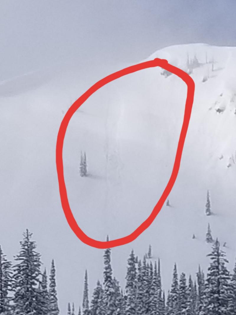
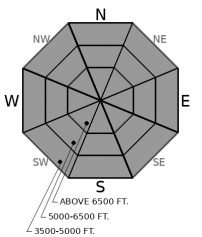
Sunday's blizzard drifted snow into slabs up to 3' thick in some wind affected areas favored by northeast winds. Yesterday, observers traveling in wind affected terrain reported shooting cracks, collapses, and triggered small wind slabs on southerly and westerly aspects. A large natural avalanche also ran yesterday morning. Slabs will be slow to heal under our cold weather pattern, but they can be easily avoided by traveling on windward or wind sheltered terrain. Avoid dense or thick drifts in areas where the wind has obviously been blowing. Soft, fluffy snow is your ticket to steep terrain.
-
Type ?
-
Aspect/Elevation ?
-
Likelihood ?CertainVery LikelyLikelyPossible
 Unlikely
 -
Size ?HistoricVery LargeLargeSmall

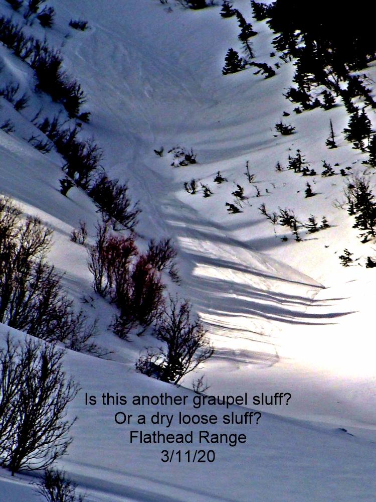
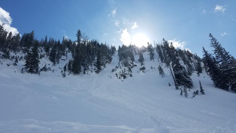
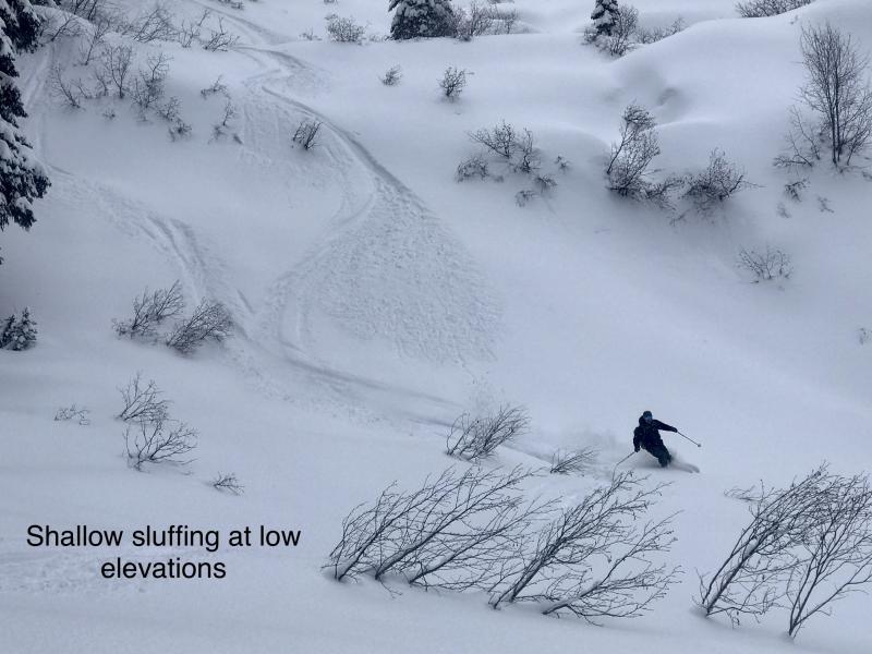
In wind sheltered terrain, the 4" to 10" of low-density surface snow continues to lose cohesion. Riders are frequently triggering small sluffs that run on slick crusts in steep terrain. Loose dry avalanches are more predictable and are generally harmless unless they push you into a gulley, trees, or over rocks. Use slope cuts and sluff management techniques above consequential terrain or opt for lower angle slopes to avoid the problem.
-
Type ?
-
Aspect/Elevation ?
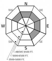
-
Likelihood ?CertainVery LikelyLikelyPossible
 Unlikely
 -
Size ?HistoricVery LargeLargeSmall

Slabs 1' to 2' thick over buried surface hoar and facets remain a stubborn concern in isolated locations. Obvious signs of instability have waned in the past week, but targeted test pits continue to propagate clean failures near the upper end of the middle elevation band. (Example A, Example B). You are most likely to encounter this problem on sparsely-gladed slopes that are sheltered from the wind and sun. The hot spot for lingering concerns appears to be between 6,000' and 6,500', give or take a few hundred feet in elevation.
More merciful wind chills yesterday allowed our field teams to target the areas that have reported the strongest winds since Sunday's blizzard: John F Stevens Canyon and Big Mountain. In both locations, we found reactive wind slabs that produced shooting cracks, collapses, and triggered slides on test slopes. These slabs formed over facets and crusts that take a long time to heal. Fierce winds paired with easily transportable, low-density snow mixed slab formation further downslope that you might expect, and most of the slabs were relatively small and pockety in distribution. However, BNSF Railway forecasters in John F Stevens Canyon noted a fresh D2 slab avalanche out of a heavily windloaded gulley that ran 3/4 track. Near the crest of the Swan Range, observers noted severe wind effects and cracking on leeward, westerly aspects as well.
Meanwhile, observers in sheltered and gladed terrain of the Middle Fork Corridor, Lake McDonald, and Swans have reported minimal wind effect or slab formation - mostly just good old low-density powder riding and sluff management. Over a week has passed since the last persistent slab avalanche that was triggered on mid-January weak layers in this type of terrain. Last week's warmup has helped the problem become more stubborn and isolated, but we remain uneasy about a few types of slopes that are still producing propagating test results. Specifically, steep convexities and rollovers where those large-grained surface hoar layers remain in-tact. A quick hand pit or shovel into the snow can help identify this structure: look for the grey stripe. Clancy found this structure up to 6,800' yesterday near Big Mountain; that is the highest elevation we have noted buried surface hoar in the past month. The most recent crust that formed on February 2nd, aka the "Groundhog Day crust", has helped lock down the snowpack and any buried surface hoar concerns at elevations where it exists. This crust reaches up to around 6,000 feet in most locations, and is already faceting with our cold snap. Sorry folks, Punxsutawney Phil predicts another 6 weeks of persistent slabs, when and if this crust get buried by more than the current distribution of pockety wind slabs. So get after those steep, wind protected lines now while sluff management on the crust is your main concern.
EDUCATION: Sign up for one of our upcoming classes: Introduction to Avalanches (non-motorized) 02/28/2019 to 03/02/2019.
We'll see a few lingering flurries and subtle warming as the arctic air mass shifts east. Mountain temperatures will still be stuck in the single digits today and nudge into the teens tomorrow. A disturbance on Friday will bring slightly warmer temperatures and more snow ahead of another arctic intrusion this weekend.
This forecast applies only to backcountry areas outside established ski area boundaries. The forecast describes general avalanche conditions and local variations always occur. This forecast expires at midnight on the posted day unless otherwise noted. The information in this forecast is provided by the USDA Forest Service who is solely responsible for its content.


