| Wednesday | Wednesday Night | Thursday | |
|---|---|---|---|
| Cloud Cover: | Mostly cloudy | Partly cloudy | Mostly sunny |
| Temperatures: | 22 to 27 deg. F. | 22 to 27 deg. F. | 28 to 33 deg. F. |
| Wind Direction: | Southwest | Southwest | Southwest |
| Wind Speed: | 10 to 15 mph, gusting to 25 | 5 to 10 mph, gusting to 20 | 10 to 15 mph, gusting to 30 |
| Snowfall: | 0 in. | 0 in. | 0 in. |
| Snow Line: | 1500 ft | 500 ft | 2500 ft |
Whitefish Range
Swan Range
How to read the forecast
Another day of mild weather and diminishing avalanche danger. A good day to poke into terrain you’ve been eyeing. Stay watchful for exceptions to the generally stable conditions: recently-formed wind slabs up high, and a lingering danger of slabs breaking 1 to 2 feet deep at mid elevations. Bigger consequences are all the more reason to keep it tight: ride one at a time, watch from avalanche-proof safe zones, carry a full set of rescue gear, and do transceiver checks.

1. Low
?
Above 6500 ft.
2. Moderate
?
5000-6500 ft.
1. Low
?
3500-5000 ft.
- 1. Low
- 2. Moderate
- 3. Considerable
- 4. High
- 5. Extreme
-
Type ?
-
Aspect/Elevation ?
-
Likelihood ?CertainVery LikelyLikelyPossible
 Unlikely
 -
Size ?HistoricVery LargeLargeSmall

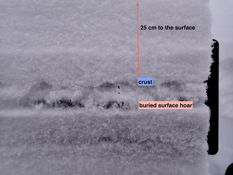
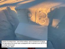
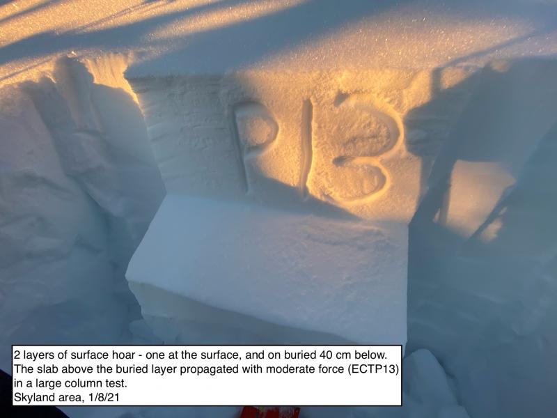
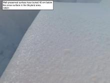
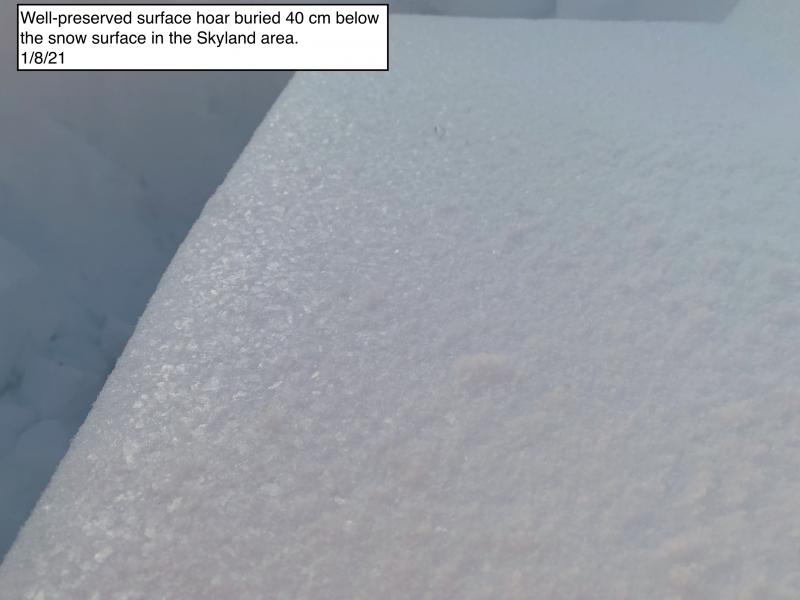
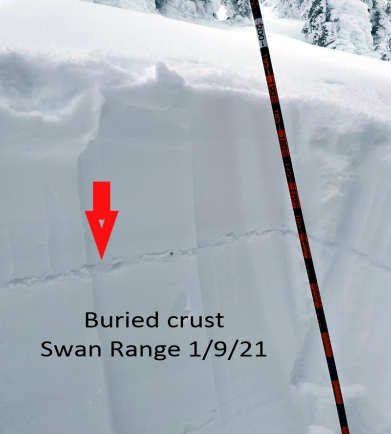
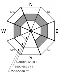
The most troublesome layers in the snowpack? Still the surface hoar and facets that formed during the mid-January dry spell. These are now buried 10-30 inches below the snow surface and often show as a distinct gray stripe visible when you dig down. Steep, mid-elevation slopes open to the sky are the most concerning terrain. Keep your guard up as you pass through terrain like this on your way down from, or up to, ridges. Be suspicious of typically innoucuous slopes like road cuts and gully walls, where small slides can have big consequences. Shooting cracks and whumpfing collapses are red flag signs that this hazard is alive and well.
-
Type ?
-
Aspect/Elevation ?
-
Likelihood ?CertainVery LikelyLikelyPossible
 Unlikely
 -
Size ?HistoricVery LargeLargeSmall

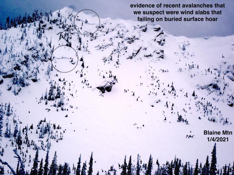
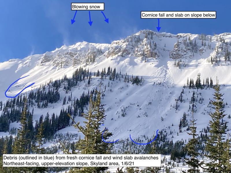
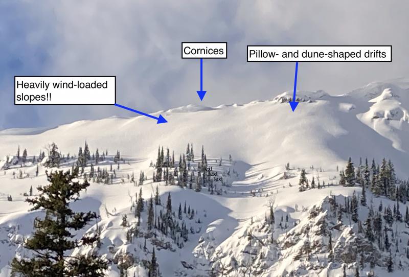
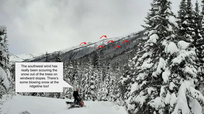
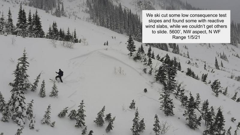
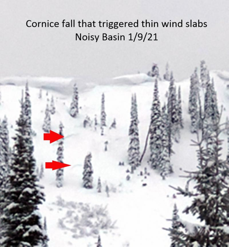
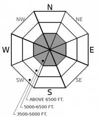
A bout of strong winds Sunday left slabs of drifted snow in exposed terrain at upper elevations. Though the danger these pose is diminishing, avoid steep start zones with signs of recent loading: smooth pillow-shaped drifts, hollow-sounding snow, and overhanging cornices. Small, fresh slabs may form today as winds increase. Shooting cracks and blowing snow are clear indicators that slabs are developing.
You’re dropping off a ridge, you’re midway down a run, and it opens up and steepens up. Normally, great; the riding’s just gonna get better. Now, whoa. That’s where you’re most likely to trigger a slab that breaks 1 to 3 feet deep on surface hoar buried January 17. While this interface is present at all elevations, it seems most reactive at mid-elevations – roughly 5000 to 6500 feet - where it’s visible as a gray stripe 1 to 2 feet below the snow surface. That’s a general but not absolute rule of thumb. It does make it easy to dig down with your hands as you descend (or climb) and identify slopes where it could pose a danger. Shooting cracks and whumpfing collapses are also very obvious warnings of this danger. Stay out of trouble by paying close attention to slope angles and consequences in low-and mid-elevation terrain; avoid steep slopes above terrain traps. Keep your guard up in small openings in the trees that have clear exposure to the sky, which are notorious surface hoar farms.
Sunday saw some dramatic but localized weather in the region, with Marias Pass and John F. Stevens Canyon ground zero. This area saw up to 1” of water, a foot of snow, extreme southwest wind gusts and moderate east winds. Wind slabs that formed during this episode will be thickest in this area. Similarly, there’s more snow in this area available for transport with today’s increasing winds.
We continue to list Deep Persistent Slab (DPS) as an avalanche problem for the Flathead Range and Glacier National Park. It has only been a week since the last reported deep slabs in this area (Skiumah Lake, Essex Creek). That’s not long enough to shelve this concern, because the cold snowpack and rocky terrain of this zone generally harbors deep slab problems longer than the Whitefish or the Swan Ranges. Keep avoiding steep, convex slopes where the snow cover is likely to be variable due to bouts of wind loading and scouring.
EDUCATION: It's a great time to hone your avalanche knowledge or start learning the basics. Ladies Avalanche Awareness Talk - Kalispell Brewing Company -01/30/2019 6:30 PM.
Sign up for one of our upcoming classes: Motorized Introduction to Avalanches 01/31/2019 to 02/02/2019, Companion Rescue Clinic 02/09/2019 and Introduction to Avalanches (non-motorized) 02/28/2019 to 03/02/2019.
A ridge of high pressure remains parked above the forecast region. Winds and clouds increase today, though those changes are notable mostly beacuse conditions are benign and stagnant.
This forecast applies only to backcountry areas outside established ski area boundaries. The forecast describes general avalanche conditions and local variations always occur. This forecast expires at midnight on the posted day unless otherwise noted. The information in this forecast is provided by the USDA Forest Service who is solely responsible for its content.


