| Sunday | Sunday Night | Monday | |
|---|---|---|---|
| Cloud Cover: | Mostly cloudy | Mostly cloudy | Mostly clear |
| Temperatures: | 25 to 35 deg. F. | 2 to 12 deg. F. | 18 to 28 deg. F. |
| Wind Direction: | West | North-notheast | South |
| Wind Speed: | 10 to 20, gusting to 40 | 5 to 15, gusting to 25 | around 5, gusting to 15 |
| Snowfall: | 0 in. | 0 to 2 in. | 0 in. |
| Snow Line: | 3500 ft | 500 ft | 0 ft |
Flathead Range and Glacier National Park
How to read the forecast
There will be an uptick in westerly winds today ahead of a passing cold front. Watch for fresh drifts forming down wind of ridges and on crossloaded features near and above treeline. Especially concerning are new wind slabs that may develop on top of our buried surface hoar at middle elevations. Shooting cracks and collapsing are red flags that should direct you to sheltered, less steep terrain.

2. Moderate
?
Above 6500 ft.
2. Moderate
?
5000-6500 ft.
1. Low
?
3500-5000 ft.
- 1. Low
- 2. Moderate
- 3. Considerable
- 4. High
- 5. Extreme
-
Type ?
-
Aspect/Elevation ?
-
Likelihood ?CertainVery LikelyLikelyPossible
 Unlikely
 -
Size ?HistoricVery LargeLargeSmall

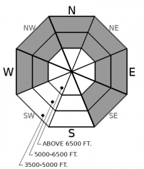
Reports of shooting cracks and collapsing on buried weak layers continue trickle in from across the forecast area. Skiers easily triggered persistent slabs 1-2’ deep on Friday. Surface hoar and facets are the layers of concern. They are most prevalent, and most reactive between 4500’ and 6500’ on sheltered aspects. Large clearings below treeline with steep convexities are more dangerous. Terrain traps like gullies and creek beds can allow an alarming amount of debris to pile up and increase the consequences of a slide. Wind drifts that further bury these layers will add to the complexity of the problem.
-
Type ?
-
Aspect/Elevation ?
-
Likelihood ?CertainVery LikelyLikelyPossible
 Unlikely
 -
Size ?HistoricVery LargeLargeSmall

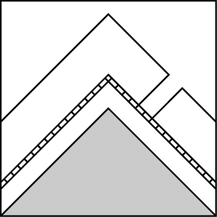
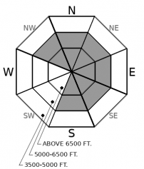
Winds will increase out of the west ahead of a cold front that will drop out of Canada late in the day. Soft snow at middle and upper elevations will drift onto leeward slopes and form denser slabs that will be sensitive to your weight. Blowing snow and growing cornices will point towards wind-loaded terrain. These slab could grow large enough to bury you, especially where they form on top of existing persistent slabs near treeline. Shooting cracks are a red flag directing you to slopes less than about 30 degrees. Terrain sheltered from the effects of the wind will have better riding conditions.
-
Type ?
-
Aspect/Elevation ?
-
Likelihood ?CertainVery LikelyLikelyPossible
 Unlikely
 -
Size ?HistoricVery LargeLargeSmall

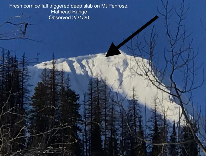
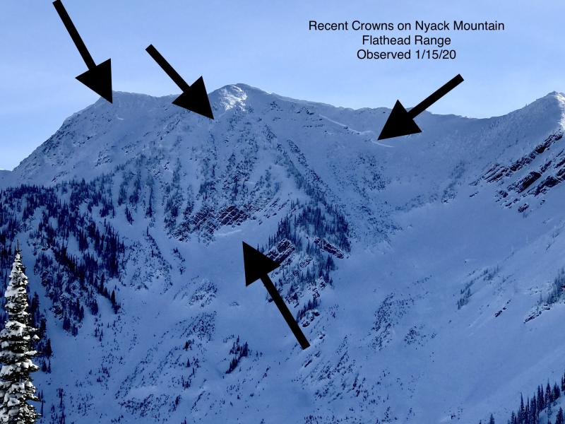
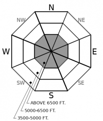
In the rocky, alpine terrain of the Flathead Range and Glacier Park snow cover is variable and persistent weak layers buried early in the season may still be found near the bottom of the snowpack. The likelihood of triggering these layers has grown increasingly difficult. So far this season, very large avalanches have been triggered by cornice falls and smaller wind slabs stepping down into deeply buried weak snow. It is not impossible for a single rider to trigger a big slide. Be wary near rock bands and at the margins of slabs where the snowpack gets thinner. Be mindful of these areas overhead as you ascend.
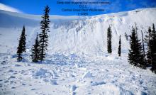
Surface hoar and facets developed on top of a rain crust during a period of high pressure earlier this month. These notorious weak layers were buried on the 17th. Subsequent snowfall has added weight to the overlying slabs. Reports of avalanches (up to D2), shooting cracks, and collapsing on these layers have been consistent ever since. They have been most prevalent and most sensitive between 4500’ and 6500’ on steep slopes or convexities with widely spaced trees. We adopted an “alligators in the moat” metaphor to describe the problem because it’s unusual for the danger to be highest at middle elevations. Most of us feel more exposed as we climb up the rocky castles in the alpine. We begin to let down our guard as we descent below treeline. But that’s where the gators lie in wait. Persistent slab avalanche can break further than you think. Terrain traps like creek beds to thickets of trees can magnify the consequences of even a small slide.
As far as the spires of the castle go, the danger will increase there today as west winds create sensitive new slabs on leeward aspects. Be on the lookout for denser drifts below ridgelines and on crossloaded features. As the incoming cold front passes late today the winds will shift and new slabs may form on atypical aspects by tonight.
EDUCATION: It's a great time to hone your avalanche knowledge or start learning the basics. Ladies Avalanche Awareness Talk - Kalispell Brewing Company -01/30/2019 6:30 PM.
Sign up for one of our upcoming classes: Motorized Introduction to Avalanches 01/31/2019 to 02/02/2019, Companion Rescue Clinic 02/09/2019 and Introduction to Avalanches (non-motorized) 02/28/2019 to 03/02/2019.
Winds from the west will increase ahead of a cold front that drops down from Alberta late in the day. Winds will decrease and shift to the north, and temperatures will crash, as the front passes tonight. Any snowfall should be light.
This forecast applies only to backcountry areas outside established ski area boundaries. The forecast describes general avalanche conditions and local variations always occur. This forecast expires at midnight on the posted day unless otherwise noted. The information in this forecast is provided by the USDA Forest Service who is solely responsible for its content.


