| Saturday | Saturday Night | Sunday | |
|---|---|---|---|
| Cloud Cover: | Mostly cloudy | Mostly cloudy | Mostly cloudy |
| Temperatures: | 25 to 35 deg. F. | 20 to 25 deg. F. | 25 to 35 deg. F. |
| Wind Direction: | West | Southwest | West-southwest |
| Wind Speed: | 5 to 15, gusting to 20 | 5 to 15, gusting to 30 | 10 to 20, gusting to 35 |
| Snowfall: | 0 in. | 0 in. | 0 to 2 in. |
| Snow Line: | 3500 | 4500 | 2500 |
Flathead Range and Glacier National Park
How to read the forecast
Slopes below 6500’ continue to harbor persistent weak layers that can be triggered by your weight. In higher terrain, smaller storm slabs and sluffing are the primary concern. Open glades containing steep convexities and terrain traps deserve a second look.

2. Moderate
?
Above 6500 ft.
2. Moderate
?
5000-6500 ft.
1. Low
?
3500-5000 ft.
- 1. Low
- 2. Moderate
- 3. Considerable
- 4. High
- 5. Extreme
-
Type ?
-
Aspect/Elevation ?
-
Likelihood ?CertainVery LikelyLikelyPossible
 Unlikely
 -
Size ?HistoricVery LargeLargeSmall

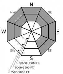
Surface hoar and facets are now preserved under slabs 1-2’ thick. These well-advertised weak layers have produced shooting cracks, collapsing, and triggered avalanches since they were buried last week. They are most prevalent and reactive between 4500’ and 6500’ on sheltered aspects. Even small slides that break on these layers can propagate further than you expect and create large amounts of debris. Avoiding the problem means sticking to slopes less than about 30 degrees, and steering clear of terrain traps like creek beds and gullies.
-
Type ?
-
Aspect/Elevation ?

-
Likelihood ?CertainVery LikelyLikelyPossible
 Unlikely
 -
Size ?HistoricVery LargeLargeSmall

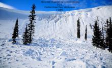
Yesterday, observers triggered several small avalanches that broke at the new snow interface from Wednesday’s storm. These slabs were 5-10” thick on steep, upper elevation slopes. Newer snow is more likely to propagate where it has been stiffened by wind or sun. Pay close attention to cracking in the storm snow, the most obvious sign of instability, before committing to consequential terrain.
-
Type ?
-
Aspect/Elevation ?
-
Likelihood ?CertainVery LikelyLikelyPossible
 Unlikely
 -
Size ?HistoricVery LargeLargeSmall

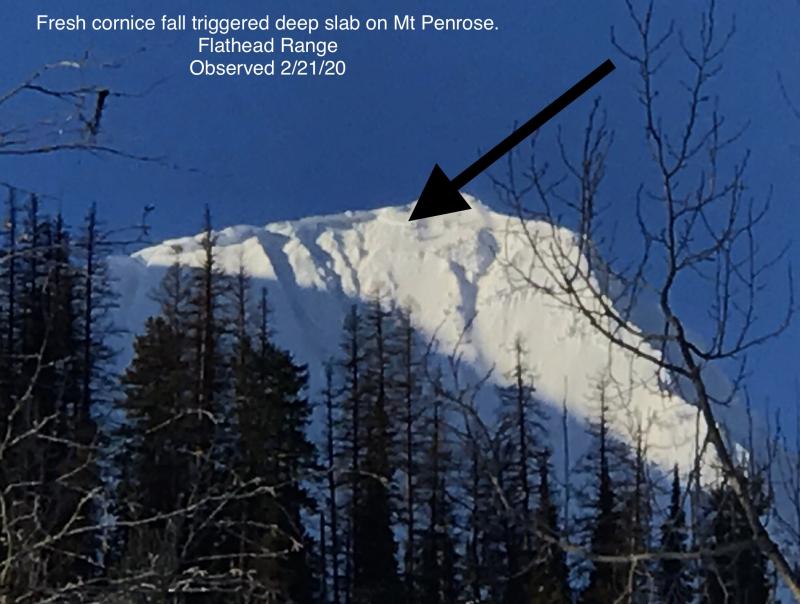
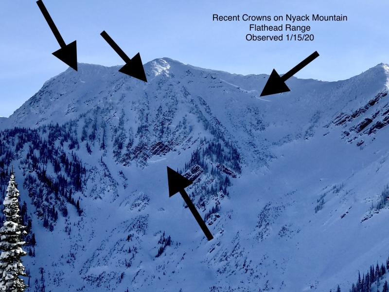
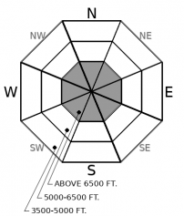
Deep persistent slabs remain a low likelihood, high consequence concern in the alpine terrain of the Flathead Range and Glacier Park. They are becoming increasingly difficult to trigger, but all of the avalanche activity this season has followed loading events, step-down avalanches, or cornice falls. Until we get further out from a storm, or until smaller avalanches become less possible the problem remains in the back of our minds. It is not impossible to find the isolated sour spot where you could trigger the problem. Be wary near rock bands or where a cross-loaded snowpack thins out. Reduce your risk by avoiding convex upper elevation slopes with rocky and variable snow coverage.
Observers in the Whitefish Range yesterday got plenty of feedback from our persistent slab problem. Fragile surface hoar is now buried 1-2 feet below the surface on middle elevation slopes sheltered from wind and sun. On isolated convexities with a clear view of the sky, these older weak layers remain reactive to your weight. On other, nearby slopes, the triggering them appears more stubborn and difficult to trigger. That could be because we lack observations confirming the problem. Or, it could be because of a thin, freezing rain crust laid down at the start of our most recent storm. Observers in John F. Stevens Canyon yesterday triggered a few small storm slabs that failed at the newer snow interface.
So what? So while the danger continues to trend downward, those old lazy gators are still lounging around the moat waiting for us to slip. And it can be easy to slip up because the most treacherous terrain is between 4500’ and 6500’ on slopes that often don’t get a second look. These slopes can be small convexities or steep openings above a gully, creek bed, or thicket. Even low elevation openings deserve a second look. Combining even small slab avalanches with any kind of terrain trap can escalate the consequences of getting caught off guard. This brand of avalanche can easily catch you by surprise by propagating wider than you expect. As you climb past the gators chilling in the moat, more predictable, small storm slabs can still be triggered. Open slopes where the new snow may be thickened by the wind or sun are more suspect. Expect sluffing through denser trees and on steep, warming slopes. Sluffs from above could be just what those gators need to get up and snap.
No one has reported a deep persistent slab avalanche in either the Swan or Whitefish Range in weeks. The problem remains, although it is unlikely, in the Flathead Range and Glacier Park. That area has been the focus of deeply buried instabilities this season. The snowpack is generally shallower and more variable, and the terrain is more alpine. Loading evens, step-down avalanches, and cornice fall have all triggered very large avalanches. So until we get further out from a loading event, or until smaller avalanches are also unlikely, deep persistent slabs remain in the back of our minds.
EDUCATION: It's a great time to hone your avalanche knowledge or start learning the basics. Ladies Avalanche Awareness Talk - Kalispell Brewing Company -01/30/2019 6:30 PM.
Sign up for one of our upcoming classes: Motorized Introduction to Avalanches 01/31/2019 to 02/02/2019, Companion Rescue Clinic 02/09/2019 and Introduction to Avalanches (non-motorized) 02/28/2019 to 03/02/2019.
A ridge of high pressure builds across our area today with clouds in the valleys and near average temperatures. A cold front will push south across the Divide Sunday night bringing colder temperatures, increasing winds, and a few inches of snow.
This forecast applies only to backcountry areas outside established ski area boundaries. The forecast describes general avalanche conditions and local variations always occur. This forecast expires at midnight on the posted day unless otherwise noted. The information in this forecast is provided by the USDA Forest Service who is solely responsible for its content.


