| Friday | Friday Night | Saturday | |
|---|---|---|---|
| Cloud Cover: | Mostly cloudy | Mostly cloudy | Mostly cloudy |
| Temperatures: | 24 to 29 deg. F. | 17 to 22 deg. F. | 27 to 32 deg. F. |
| Wind Direction: | West | West | Southwest |
| Wind Speed: | 10 to 15 gusting to 25 | 10 to 15 gusting to 25 | 10 to 15 gusting to 25 |
| Snowfall: | 1 to 3 in. | 0 to 1 in. | 0 to 1 in. |
| Snow Line: | 2500 | 2500 | 3000 |
Flathead Range and Glacier National Park
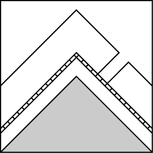
How to read the forecast
You will have to travel through a ring of challenging buried weak layers to get to smaller and easier to manage problems up high. Be wary of sparsley gladed, steep rollovers and gullies below 6,000' where surface hoar and facets are lurking 1 to 2 feet below the snow surface.

2. Moderate
?
Above 6500 ft.
2. Moderate
?
5000-6500 ft.
2. Moderate
?
3500-5000 ft.
- 1. Low
- 2. Moderate
- 3. Considerable
- 4. High
- 5. Extreme
-
Type ?
-
Aspect/Elevation ?
-
Likelihood ?CertainVery LikelyLikelyPossible
 Unlikely
 -
Size ?HistoricVery LargeLargeSmall

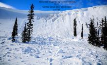
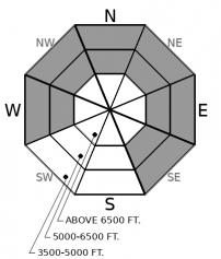
Buried surface hoar and facets at mid and low elevations have consistently produced avalanches, shooting cracks, and collapses during the past week. Slides are breaking 18" to 24" deep and can surprise you by propagating long distances into adjacent terrain, or even above you. The most reactive slabs are at unusually low elevations, and are more prevalent on colder aspects and open slopes with a clear view of the sky. Slides on small slopes can produce alarming amounts of debris into creek beds and gullies, the type of terrain that could get you in trouble as you descend in elevation. The easiest and most reliable way to avoid this problem is staying on terrain that is consistently less than 30 degrees in steepness where weak layers are present. Crusts and near surface facets at this same interface also exist at upper elevations, but have shown limited signs of instability.
-
Type ?
-
Aspect/Elevation ?

-
Likelihood ?CertainVery LikelyLikelyPossible
 Unlikely
 -
Size ?HistoricVery LargeLargeSmall

An observer yesterday noted cracking in the storm snow, which ranges from 5" to 10" deep around the forecast area. Shallow storm instabilities from Wednesday's storm are generally healing up, but you may find lingering issues in very steep terrain or slopes with recent wind drifting. Ease into consequential terrain by testing smaller slopes and paying attention to surface clues such as cracking or wind drifting. Be cautious above terrain traps and gullies.
-
Type ?
-
Aspect/Elevation ?
-
Likelihood ?CertainVery LikelyLikelyPossible
 Unlikely
 -
Size ?HistoricVery LargeLargeSmall

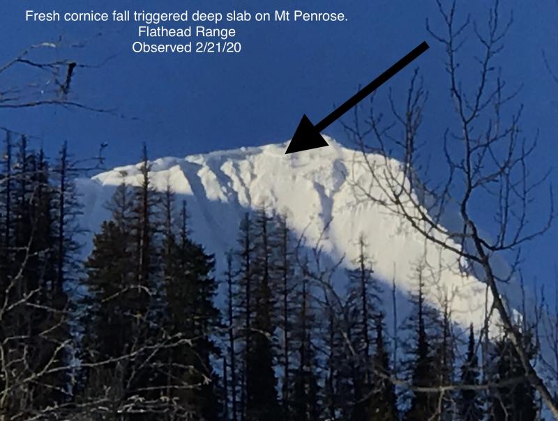
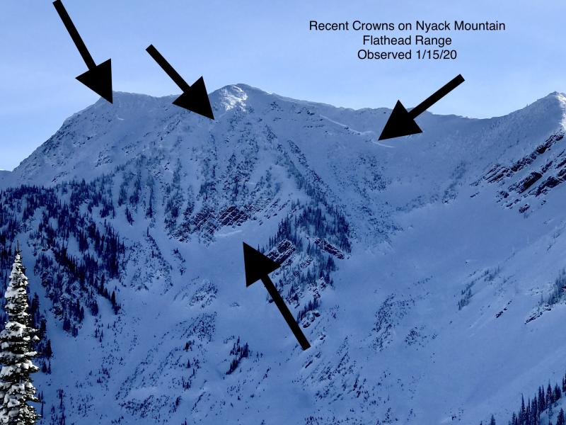
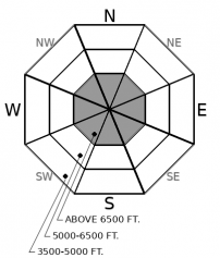
Deep persistent slabs remain a low likelihood, high consequence concern in high alpine terrain. We have observed a handful of very destructive avalanches breaking on deeply buried weak layers this month in the Flathead Range. They are becoming increasingly difficult to trigger, and all of the avalanche activity in the past few weeks has been associated with loading events, step-down avalanches, or cornice falls. In isolated locations, you may still be able to find the sour spot from a shallow point on the slope such as near rock bands or where a cross-loaded snowpack thins out. Reduce your risk by avoiding convex upper elevation slopes with rocky and variable snow coverage.
A handful of observations are trickling in from around the forecast area reporting fewer persistent slab avalanches than we expected from Wednesday's storm. Perhaps this is because of a widespread freezing rain crust that arrived at the onset of the storm and added a bit of strength to the upper snowpack. Perhaps not. Regardless, observations are suggesting that the problem is becoming more difficult to trigger and the danger is trending down to "Nervous Moderate". Nervous because we have only a handful of observations post-storm and our confidence is low. (Send us your observations!) Nervous because we know the types of slopes that are most worrisome are the types of slopes that often get overlooked: steep mid to low elevation slopes that drain into terrain traps such as gullies or into trees. Mark found consistent propagating tests in Rescue Creek on Thursday and my field team triggered a couple persistent slabs on small tests slopes on Wednesday in Canyon Creek. The danger is trending down but the problem has not gone away. Maintain a healthy amount of distrust of "the moat", where alligators are still stirring. This ring of instability has generally been documented between about 4500' to 5800', although local variations are to be expected. Our observations page is a great resource for more information on this problem.
Above the ring of fragile weak layers, your primary concern is handling shallow instabilities that may be lingering from Wednesday's storm. We have dropped deep persistent slabs from the problem list in the Whitefish Range and Swan Range. It has been 3 weeks since our last reported deep slab in these areas. Let us know if you find otherwise. The Flathead Range and Glacier Park has been the epicenter for avalanche activity on deep weak layers all season. The snowpack in this region is generally shallower, colder, more variable, and with more alpine terrain: all of the ingredients that seem to be contributing to infrequent but very large avalanches during loading events.
EDUCATION: It's a great time to hone your avalanche knowledge or start learning the basics. Name That Tune, Name That Avalanche - Montana Tap House- 01/24/2019 7:00 PM and Ladies Avalanche Awareness Talk - Kalispell Brewing Company -01/30/2019 6:30 PM.
Sign up for one of our upcoming classes: Motorized Introduction to Avalanches 01/31/2019 to 02/02/2019, Companion Rescue Clinic 02/09/2019 and Introduction to Avalanches (non-motorized) 02/28/2019 to 03/02/2019.
Snow showers will linger through the morning before the weather quiets down into Saturday. Our next shot of measurable snow gets delivered from Alberta on Sunday evening: limited moisture, but some winds and cold temps are associated with the cold front.
This forecast applies only to backcountry areas outside established ski area boundaries. The forecast describes general avalanche conditions and local variations always occur. This forecast expires at midnight on the posted day unless otherwise noted. The information in this forecast is provided by the USDA Forest Service who is solely responsible for its content.


