| Wednesday | Wednesday Night | Thursday | |
|---|---|---|---|
| Cloud Cover: | Overcast | Mostly Cloudy | Mostly Cloudy |
| Temperatures: | 26 to 31 deg. F. | 11 to 16 deg. F. | 22 to 27 deg. F. |
| Wind Direction: | Northwest | Northwest | Southwest |
| Wind Speed: | 10 to 15 gusting to 30 | 5 to 10 gusting to 30 | 10 to 15 gusting to 30 |
| Snowfall: | 6 to 9 in. | 0 to 1 in. | 0 to 2 in. |
| Snow Line: | 1500 | 500 | 1000 |
Swan Range
Flathead Range and Glacier National Park
How to read the forecast
Keep it tight today. New snow has created very dangerous and complex avalanche conditions. Today, it will be easy to trigger avalanches that break 1 to 2 feet deep at all elevations, and long-running natural avalanches are a serious threat. The most dangerous conditions exist at mid-elevations, where weak layers have consistently produced avalanches all week. Avoid traveling on or below any slope steeper than about 30 degrees, even small slopes above creeks and gullies.

3. Considerable
?
Above 6500 ft.
4. High
?
5000-6500 ft.
3. Considerable
?
3500-5000 ft.
- 1. Low
- 2. Moderate
- 3. Considerable
- 4. High
- 5. Extreme
-
Type ?
-
Aspect/Elevation ?
-
Likelihood ?CertainVery LikelyLikelyPossible
 Unlikely
 -
Size ?HistoricVery LargeLargeSmall

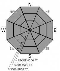
New snow is increasing the likelihood and potential size of avalanches breaking on weak layers buried in mid-January. You can trigger slides that break 1-2 feet deep and propagate long distances into terrain adjacent to or above you. The most reactive slabs will be at unusually low elevations - 4500 to 5800 feet. Slides on small slopes can produce alarming amounts of debris. Whumpfing collapses, shooting cracks, and recent avalanches are red flag warnings of this danger. Plan for surprises by riding one at a time. Don't stop in the tracks or runouts of avalanche paths, and avoid riding in or above gullies and creek beds. The easiest and most reliable way to avoid this problem is staying on terrain that is consistently less than 30 degrees in steepness.
-
Type ?
-
Aspect/Elevation ?

-
Likelihood ?CertainVery LikelyLikelyPossible
 Unlikely
 -
Size ?HistoricVery LargeLargeSmall

Slabs of new and drifted snow will be sensitive to human triggers on steep slopes. They can be dangerous where they are more than about 8 inches thick or above terrain traps like gullies, trees, or rock bands. These slabs will be larger and more sensitive to a person's weight where they've been thickened and stiffened by drifted snow. With northerly winds, expect them on the southerly sides of ridges and cross-loaded terrain. Shooting cracks and recent avalanches are red flag warnings of this danger. Small slides in today's new snow can gain volume and step down to larger avalanches deeper in the snowpack.
-
Type ?
-
Aspect/Elevation ?
-
Likelihood ?CertainVery LikelyLikelyPossible
 Unlikely
 -
Size ?HistoricVery LargeLargeSmall

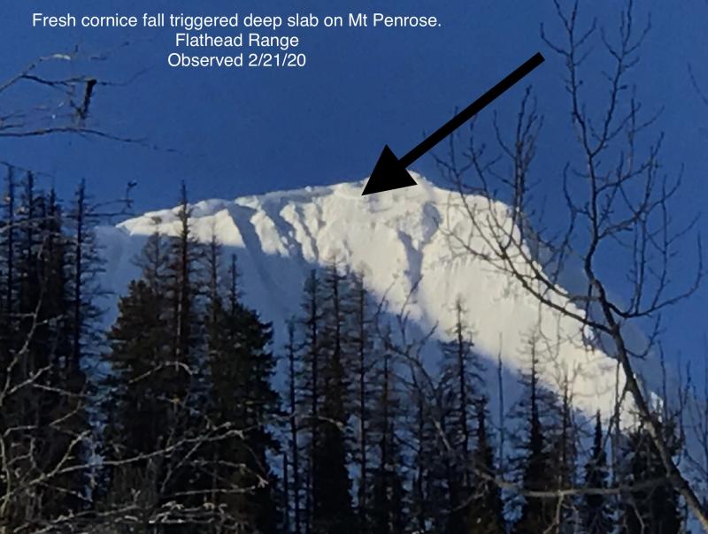
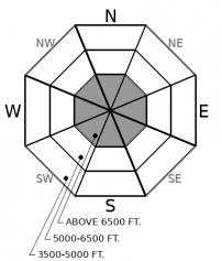
Prior to the mid-January dry spell, avalanches breaking deep in the snowpack were the primary avalanche concern. They're still a concern, though they've grown increasingly difficult to trigger. You might find the sour spot, however, on steep, unsupported and/ or convex slopes. Or the debris from cornice falls or small slides in the near-surface snow could trigger these deeply buried weak layers. Avoiding traveling on or in the runouts of steep, convex upper elevation slopes with variable snow cover is the most reliable way of avoiding the serious consequences of triggering one of these capricious beasts.
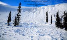
The gators are out of the moat. And they’re larger and more unpredictable. A storm has dropped 3 to 8 inches of snow so far, with about the same expected today before snowfall tapers off. The Swan Range is favored. The snow last night and today is creating dangerous and complex avalanche conditions. Dangerous, because the likelihood and potential size of triggered slides is increasing as slabs above the mid-January weak layers grow thicker and stiffer. Complex, because multiple avalanche problems exist, and because the danger is distributed in unusual ways. Specifically, mid-elevation terrain is where you’ll encounter the most reactive slabs, and winds have been loading southerly slopes.
The potential for natural and remotely-triggered avalanches at all elevations requires sticking tightly to safe travel protocols today. Ride with a full set of rescue gear – beacon, shovel, probe. Avoid riding on or under slopes steeper than about 30 degrees, even small slopes that are normally innocuous, like gully walls, road cuts and creek beds. Don’t let your guard down as you descend into lower elevations. These protocols keep you out of harms way if you remotely trigger a slide or natural avalanches occur.
The primary concern today is weak snow that formed in mid January. Those weak layers include surface hoar and facets, often just above rain or sun crusts. They’re now buried by slabs 1 to 2 feet thick. That’s an ideal structure for avalanches – weak layer, bed surface, slab. There’s plenty of evidence that this structure is unstable – avalanches, shooting cracks, propagation in tests – and the fresh snow is increasing the likelihood and potential size of avalanches breaking on this layer.
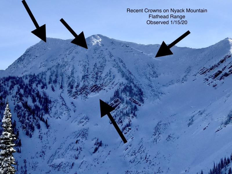
And then there’s the lingering Deep Persistent Slab problem. It remains a concern on convex, rocky and/ or unsupported slopes. Over the weekend, shallow natural storm slabs triggered larger slides that broke several feet deep on older, weak snow in Skiumah and Essex Creeks. These slides demonstrate that triggered avalanches might have exaggerated consequences, even though your weight may not be enough to trigger these slabs except in a few spots.
EDUCATION: It's a great time to hone your avalanche knowledge or start learning the basics. Name That Tune, Name That Avalanche - Montana Tap House- 01/24/2019 7:00 PM and Ladies Avalanche Awareness Talk - Kalispell Brewing Company -01/30/2019 6:30 PM.
Sign up for one of our upcoming classes: Motorized Introduction to Avalanches 01/31/2019 to 02/02/2019, Companion Rescue Clinic 02/09/2019 and Introduction to Avalanches (non-motorized) 02/28/2019 to 03/02/2019.
Snow will continue today, with the potential for high snowfall rates before the precipitation turns more showery this afternoon. The Swan Range is favored for the highest accumulations.
This forecast applies only to backcountry areas outside established ski area boundaries. The forecast describes general avalanche conditions and local variations always occur. This forecast expires at midnight on the posted day unless otherwise noted. The information in this forecast is provided by the USDA Forest Service who is solely responsible for its content.


