| Tuesday | Tuesday Night | Wednesday | |
|---|---|---|---|
| Cloud Cover: | Mostly cloudy | Overcast | Overcast |
| Temperatures: | 18 to 23 deg. F. | 17 to 22 deg. F. | 25 to 30 deg. F. |
| Wind Direction: | Southwest | Southwest | Southwest to Northwest |
| Wind Speed: | 15 to 25, gusting to 40 mph | 10 to 20, gusting to 40 | 5 to 15, gusting to 30 |
| Snowfall: | 0 to 3 in. | 5 to 8 in. | 4 to 8 in. |
| Snow Line: | 500 | 2000 | 2500 |
Whitefish Range
Swan Range
Flathead Range and Glacier National Park
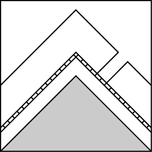
How to read the forecast
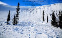
In the past two days, people have reported natural avalanches, triggered avalanches, shooting cracks, and collapses across the forecast region. Today, the gators are still in the moat: mid-elevation slopes with little tree cover where recent snow has buried surface hoar. Short, steep slopes above creeks and other terrain traps may be surprisingly dangerous. The avalanche danger will rise tomorrow as heavy snowfall overloads recently-formed weak layers.

2. Moderate
?
Above 6500 ft.
2. Moderate
?
5000-6500 ft.
2. Moderate
?
3500-5000 ft.
- 1. Low
- 2. Moderate
- 3. Considerable
- 4. High
- 5. Extreme
-
Type ?
-
Aspect/Elevation ?
-
Likelihood ?CertainVery LikelyLikelyPossible
 Unlikely
 -
Size ?HistoricVery LargeLargeSmall

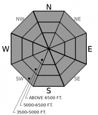
You can trigger slabs that break 8 to 18 inches deep. While these slabs may exist at all elevations, they have been most reactive at mid-elevations where they are sitting on buried surface hoar and other weak layers that formed in mid-January. This combination is most widespread on steep slopes sheltered from wind and sun (west through north to southeast). Also hazardous are steep leeward and cross-loaded start zones below ridges, where the stiffer, thicker slabs formed during the storm. In either case, red flags of danger include cracks shooting across a slope, collapses, or recent avalanches.
-
Type ?
-
Aspect/Elevation ?
-
Likelihood ?CertainVery LikelyLikelyPossible
 Unlikely
 -
Size ?HistoricVery LargeLargeSmall

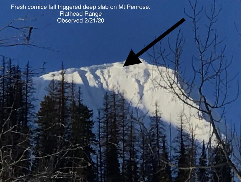
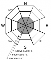
Prior to the mid-January dry spell, avalanches breaking deep in the snowpack were the primary avalanche concern. They're still a concern, though they've grown increasingly difficult to trigger. You might find the sour spot, however, on steep, unsupported and/ or convex slopes. Or the debris from cornice falls or small slides in the near-surface snow could trigger these deeply buried weak layers. Avoiding suspect terrain is the most reliable way of avoiding the serious consequences of triggering one of these capricious beasts.
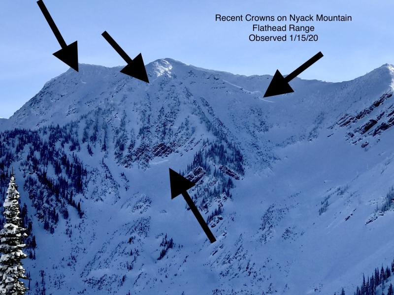
A minefield. A moat. Whatever you call it, people are reporting a ring of reactive slabs at mid elevations. The slabs are breaking 12 to 18 inches deep, on surface hoar and other weak layers that formed during the mid-January high pressure. While many of the natural and triggered slides are small, some could bury a person, particularly if they caught a rider in a creek bed or gully below a short, steep slope.
So there’s a moat with gators loose in it. You might sneak through to the castle – or sneak out of the castle - if you avoid steep, open slopes. In this case, “open” means the snow surface is mostly exposed to the sky. Slopes like these typically allow surface hoar to form, and to grow larger when it does form. The openings needn’t be large – a gully wall without trees might be enough. Stick to lower angled or forested slopes to avoid the gators. Don’t let your guard down as you descend into the mid-elevation moat. Or if you don’t observe any red flags. As the recent snow consolidates, the slabs may grow more stubborn but larger.
And there are other hazards out there. At upper elevations, you are most likely to trigger slides where winds during the storm left thicker, stiffer slabs. With winds increasing today, slopes where the wind is actively drifting snow may also be more reactive to your weight or the weight of your snowmachine. And then there’s the lingering Deep Persistent Slab problem. It remains a concern on convex, rocky and/ or unsupported slopes. One shallow natural storm slab in Skiumah Creek triggered a larger slide that broke several feet deep on older, weak snow. That illustrates that while your weight may not be enough to trigger these slabs except in a few spots, triggered avalanches might have exaggerated consequences.
EDUCATION: It's a great time to hone your avalanche knowledge or start learning the basics. Name That Tune, Name That Avalanche - Montana Tap House- 01/24/2019 7:00 PM and Ladies Avalanche Awareness Talk - Kalispell Brewing Company -01/30/2019 6:30 PM.
Sign up for one of our upcoming classes: Motorized Introduction to Avalanches 01/31/2019 to 02/02/2019, Companion Rescue Clinic 02/09/2019 and Introduction to Avalanches (non-motorized) 02/28/2019 to 03/02/2019.
Place-holder weather today, before a vigorous storm sweeps in tonight. Winds will increase in advance of the storm. Snow showers may drop a few inches of snow.
This forecast applies only to backcountry areas outside established ski area boundaries. The forecast describes general avalanche conditions and local variations always occur. This forecast expires at midnight on the posted day unless otherwise noted. The information in this forecast is provided by the USDA Forest Service who is solely responsible for its content.


