| Monday | Monday Night | Tuesday | |
|---|---|---|---|
| Cloud Cover: | Mostly Cloudy | Partly Cloudy | Mostly Cloudy |
| Temperatures: | 20 to 25 deg. F. | 5 to 10 deg. F. | 18 to 23 deg. F. |
| Wind Direction: | N | W | WSW |
| Wind Speed: | 7 to 12, gusting to 25 | 10 to 15, gusting to 25 | 15 to 20 mph, gusting to 35 mph |
| Snowfall: | 1 to 2 in. | 0 in. | 0 to 2 in. |
| Snow Line: | 1500 FT | 1000 FT | 1000 FT |
Flathead Range and Glacier National Park
How to read the forecast
Continued snow and wind are thickening recently-formed slabs that buried a variety of weak layers and crusts. Slabs will be thickest below ridgelines and on cross-loaded slopes. Evaluate new snow totals, and look for blowing snow. Avoid steep slopes with active wind loading and more than about 8 inches of new and drifted snow.

3. Considerable
?
Above 6500 ft.
2. Moderate
?
5000-6500 ft.
2. Moderate
?
3500-5000 ft.
- 1. Low
- 2. Moderate
- 3. Considerable
- 4. High
- 5. Extreme
-
Type ?
-
Aspect/Elevation ?

-
Likelihood ?CertainVery LikelyLikelyPossible
 Unlikely
 -
Size ?HistoricVery LargeLargeSmall

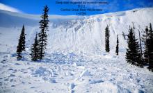
Westerly winds earlier in the weekend drifted new snow onto typical leeward slopes forming slabs up to 16" thick. Wind direction shifted to the north-east yesterday with thin slabs forming on atypical slopes. Slabs are forming on crusts and weak layers which will add to their instability. Observation Saturday from southern Glacier Park noted a reactive wind slab at mid and upper elevations. An upside down snow surface may produce an audible collapse (whumpf) which is a red flag. Shooting cracks confirm that the slab has the ability to propagate. Wind sheltered slopes will hold softer snow.
-
Type ?
-
Aspect/Elevation ?

-
Likelihood ?CertainVery LikelyLikelyPossible
 Unlikely
 -
Size ?HistoricVery LargeLargeSmall

Up to 12" of snow has accumulated since Thursday on weak layers capping a rain crust. These layers exist at all elevations but are most prevalent and weakest at middle elevations. Limited storm slab activity has been noted in the Flathead Range and GNP due to the incohesive nature of the fresh slabs. As these slabs become cohesive avalanches may surprise us with propagation further than expected. Skier triggered slides Sunday in the Whitefish Range, and Friday in the Swan Range, failed on buried surface hoar at middle elevations. Utilize hand pits to evaluate bonding with the underlying crust. Shooting cracks are an obvious red flag.
-
Type ?
-
Aspect/Elevation ?

-
Likelihood ?CertainVery LikelyLikelyPossible
 Unlikely
 -
Size ?HistoricVery LargeLargeSmall

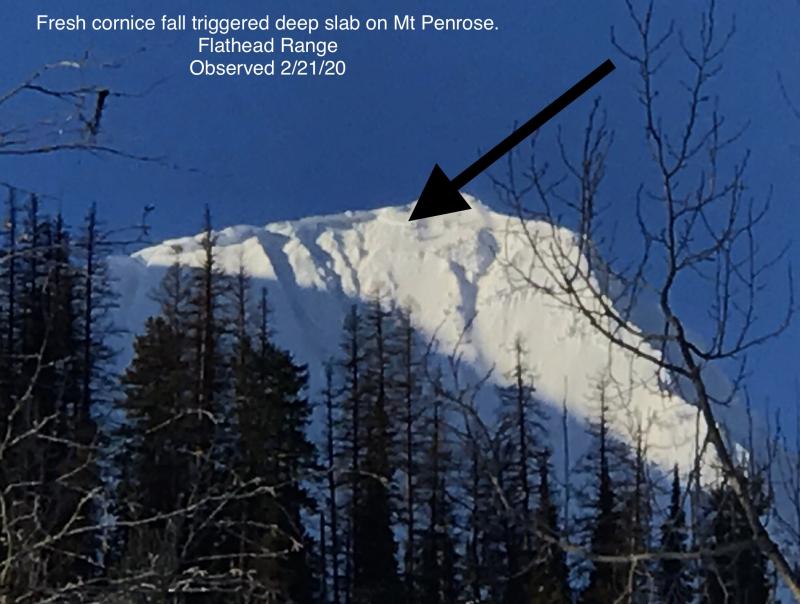
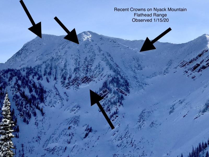
Weak faceted snow buried deeply in our snowpack remains a concern, especially during loading events. These layers can awaken naturally by loading from snowfall or wind, small slides, and cornice falls. They can also still be triggered by a rider hitting the "Not-So-Sweet" spot on a slope where the slab thins. Deep slabs surprise us with their ability to propagate above a rider and across multiple slopes. Avoidance of steep rocky areas is the answer to this complex problem. Well supported, concave slopes with a uniform snowpack are preferred.
We have issued a separate avalanche forecast for each range in our area for the past 4 days. This can be confusing, but it is the only way to accurately depict the avalanche problems and danger ratings given our recent weather. We hope to trim back to one or two forecasts as we enter a short period of dry weather.
Yesterday, we replaced storm slabs with wind slabs as our #1 problem in the Whitefish Range based on weather station data and limited observations. Zach traveled to Canyon Creek Sunday where he was able to intentionally trigger 8-10" deep storm slabs at mid-elevations failing on buried surface hoar. He noted numerous signs of skier triggered slides and shooting cracks from previous days. Due to the reactivity of the buried surface hoar layer, we are listing storm slabs as our #1 problem in the Whitefish Range.
In the Flathead Range and GNP moderate winds earlier in the weekend formed reactive slabs in southern Glacier Park. Due to their proximity to the Continental Divide, these areas experience the effects of east winds and we are keeping wind slabs as the #1 problem.
The Swan Range has received the most snow since Thursday and we are keeping Storm Slabs as our #1 problem. Natural and skier triggered slides occurred in the Jewel Basin on Friday.
Expect a few lingering snow showers this morning. Partly cloudy skies tonight will allow strong radiational cooling and cold temperatures Tuesday morning. Winds increase Tuesday in advance of the next system.
This forecast applies only to backcountry areas outside established ski area boundaries. The forecast describes general avalanche conditions and local variations always occur. This forecast expires at midnight on the posted day unless otherwise noted. The information in this forecast is provided by the USDA Forest Service who is solely responsible for its content.


