| Friday | Friday Night | Saturday | |
|---|---|---|---|
| Cloud Cover: | Overcast | Mostly Cloudy | Overcast |
| Temperatures: | 27 to 32 deg. F. | 22 to 27 deg. F. | 30 to 35 deg. F. |
| Wind Direction: | WSW | SW | SW |
| Wind Speed: | 9 to 19 mph, gusting to 35 mph | 15 mph, gusting to 35 mph | 20 mph, gusting to 45 mph |
| Snowfall: | 2 to 4 in. | O to 2 in. | 1 to 5 in. |
| Snow Line: | 3000 FT | 3500 FT | 4000 FT |
Whitefish Range
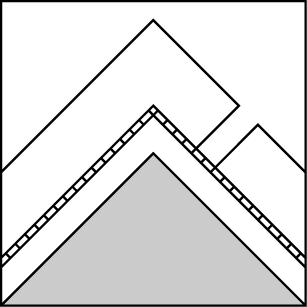
How to read the forecast
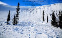
New snow is loading fragile surface hoar and crusts. You are likely to trigger fresh storm slabs today, especially at middle elevations where these layers are weakest. Careful snowpack evaluation and conservative decision making are required to travel in avalanche terrain. Shooting cracks or fresh avalanche activity are red flags.

2. Moderate
?
Above 6500 ft.
3. Considerable
?
5000-6500 ft.
2. Moderate
?
3500-5000 ft.
- 1. Low
- 2. Moderate
- 3. Considerable
- 4. High
- 5. Extreme
-
Type ?
-
Aspect/Elevation ?
-
Likelihood ?CertainVery LikelyLikelyPossible
 Unlikely
 -
Size ?HistoricVery LargeLargeSmall

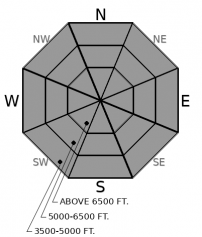
4" to 8” of new snow is loading on top of weak surface hoar, facets, and crusts. These layers exist at all elevations but are most prevalent and weakest at middle elevations. Storm slabs failing on these layers could propagate farther across the slope than expected. Natural avalanches and shooting cracks are obvious signs of danger. Be extra cautious of areas that received more snow or windloading. Shooting cracks are a red flag. Be conservative and choose terrain away from large, steep slopes and terrain traps to minimize the consequences of triggering a slide.
-
Type ?
-
Aspect/Elevation ?
-
Likelihood ?CertainVery LikelyLikelyPossible
 Unlikely
 -
Size ?HistoricVery LargeLargeSmall

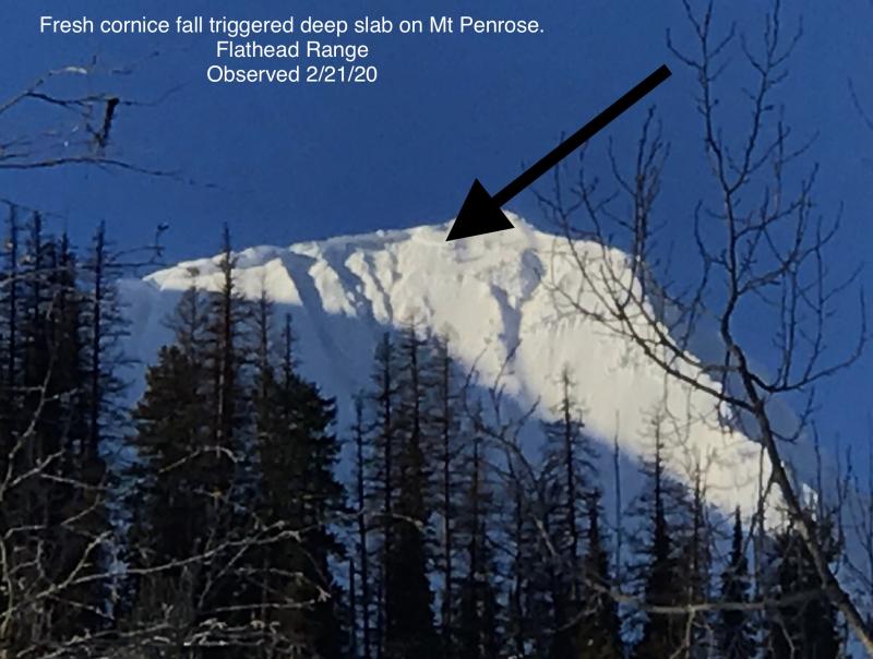
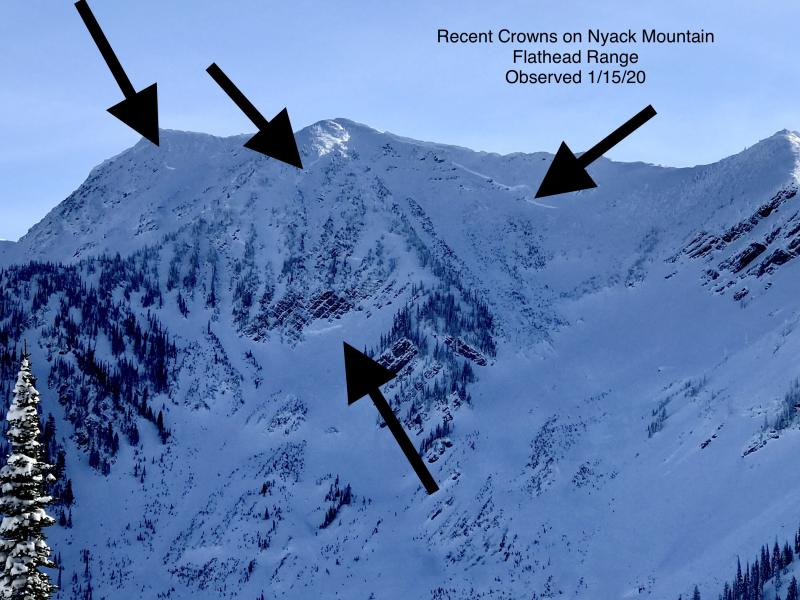
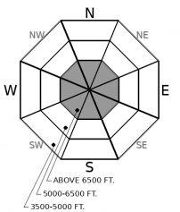
We have observed thick, hard slabs breaking on deeply buried weak layers with every major storm cycle this winter. The most recent was a number of very destructive slides that broke up to 5 feet deep at upper elevations in the Flathead Range and Glacier Park. These slides have been commonly triggered by cornice falls or small avalanches in the upper snowpack. Given today’s loading and expected uptick in avalanche activity, be wary of overhead hazards from alpine start zones. Choose terrain that minimizes your exposure below steep, rocky, variable start zones.
Last night's storm produced less snowfall than forecasted, and we did not meet criteria for an AVALANCHE WARNING today. We have canceled the WATCH and are issuing a Special Avalanche Bulletin for the Swan and Flathead Ranges. Exceptionally weak layers are being loaded and we expect surprising avalanches and dangerous conditions for human triggers.
Thus far, the Whitefish Range, Flathead Range, and Glacier Park have received between 3” and 5” of new snow. The Swan Range has seen up to 8”. More snowfall is expected today with the Swan again receiving the lion’s share. We expect another 3” to 9” today. Winds have shifted from easterly to westerly and are set to increase. All of this new loading is burying weak layers of surface hoar, which has been found extensively on middle elevation, shady slopes. Observers reported crusts and faceted snow on most aspects and elevations prior to the storm. All of these now-buried layers spell poor bonding with the new snow. Avalanches can fail in surprising ways and be larger than expected under these conditions.
Diminishing snow showers will be accompanied by increasing west winds today with another, warmer storm expected for tomorrow.
This forecast applies only to backcountry areas outside established ski area boundaries. The forecast describes general avalanche conditions and local variations always occur. This forecast expires at midnight on the posted day unless otherwise noted. The information in this forecast is provided by the USDA Forest Service who is solely responsible for its content.


