Whitefish Range
Swan Range
Flathead Range and Glacier National Park
How to read the forecast
Increasing winds will form thin slabs on Wednesday that could remain sensitive to human triggers for several days. At upper elevations, evaluate recently wind loaded terrain below ridgelines and in gulleys. Generally stable conditions are found elsewhere, apart for shallow sluffing. Early season obstacles can increase the consequences of an avalanche.

No Rating
?
Above 6500 ft.
No Rating
?
5000-6500 ft.
No Rating
?
3500-5000 ft.
-
Type ?
-
Aspect/Elevation ?

-
Size ?HistoricVery LargeLargeSmall

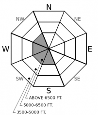
On Wednesday, a pulse of east winds is expected to drift recent snow into shallow soft slabs on atypical (westerly) aspects. These wind slabs will form on a variety of weak surfaces which may inhibit bonding. With thin snow coverage area wide, getting caught in a small slide can drag a skier or rider into unsavory terrain. Evaluate leeward and cross-loaded slopes before committing to them. Cracking beneath your feet or machine is an obvious sign of slab instability.
A weak, cold storm system is expected to graze the Northern Rockies on Wednesday, introducing periods of light snow over the Continental Divide along with breezy east winds. A period of high pressure lasting through the weekend will follow. There is hope on the horizon with a series of Pacific storms expected to head our way next week. Fingers crossed!
Our snow surface is mostly composed of low-density new snow and facets. It won't take much wind to easily drift this snow into shallow soft slabs. Wednesday's wind forecast is calling for easterly winds gusting to 30 mph at high elevations. If the forecast verifies, shallow soft slabs will form on facets, crusts, and powder and will likely be sensitive to human triggers for several days. Pay attention for signs of wind transport as you gain elevation. On wind protected slopes, the snowpack is generally stable apart from shallow sluffs in very steep terrain. Natural loose snow avalanches are possible from solar warming: mind your overhead hazards below long running gullies.
Area wide our snowpack is extremely thin below about 6000' with snowdepths between 2-3' above 6000'. The combination of thin snow cover and cold temperatures has left us with a weak snowpack foundation. Think of building your dream house with a foundation made of 2x4"s. If next weeks storms come to fruition avalanche danger will rapidly increase. Think of adding a floor of 8x8"s, steel I-Beams or perhaps even a slab of concrete. To find out more about our snowpack, weather and what's new with FAC check out Zach's recent blog post.
This is an early season snowpack update. The FAC will continue to monitor conditions and update information as conditions warrant. Daily advisories will begin on Sunday, December 9th. If you get into the mountains, let us know what you see.
Our next Avalanche Awareness talk is this Thursday (12/6) at the Kalispell Sportsmans & Ski Haus at 6:30 p.m.!
We will be producing mountain weather forecasts during our regular season operations. You can find daily backcountry specific weather forecasts from NOAA here.
This forecast applies only to backcountry areas outside established ski area boundaries. The forecast describes general avalanche conditions and local variations always occur. This forecast expires at midnight on the posted day unless otherwise noted. The information in this forecast is provided by the USDA Forest Service who is solely responsible for its content.
Call
Contact
In Partnership With

In Partnership With


