Whitefish Range
Swan Range
Flathead Range and Glacier National Park
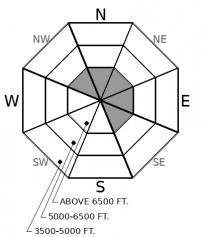
How to read the forecast
A series of storms will bring increasing avalanche hazard to high elevations into the holiday weekend. Pay attention to local storm totals and be cautious of wind loaded slopes: newly formed slabs will not bond well to existing snow coverage. Early season obstacles can increase the consequences of an avalanche. The snowpack remains generally too shallow on low elevation or brushy slopes for avalanche concerns.

No Rating
?
Above 6500 ft.
No Rating
?
5000-6500 ft.
No Rating
?
3500-5000 ft.
-
Type ?
-
Aspect/Elevation ?

-
Size ?HistoricVery LargeLargeSmall

Moderate to strong southwest winds will accompany snowfall accumulations on Thursday and Friday, transporting the new snow into thicker drifts below leeward ridgelines and in wind loaded terrain features. Fresh wind slabs forming over old snow layers will be sensitive to human triggers, and could result in an unpleasant ride over rocky, shallow snow coverage. Avoid steep terrain if you observe active wind loading or feel the snow becoming thicker and denser from wind transport.
-
Type ?
-
Aspect/Elevation ?

-
Size ?HistoricVery LargeLargeSmall

The potential for storm slab instabilities will increase as snow accumulations thicken on Friday into the weekend. Slabs formed from new snow will have difficulty bonding to the current snow surface comprised of surface hoar, crusts, and facets. Monitor storm totals where you travel. If you encounter more than 6" of new snow, use caution on open or unvegetated slopes. Cracking in the snow or storm totals of more than a foot are red flags to avoid slopes steeper than 35 degrees.
A much-anticipated Thanksgiving pattern change is underway today. A series of increasingly potent Pacific storms will move over the Western US over the next two days. The brunt of the action is forecasted to steer south of our region, but we are still looking at Thanksgiving leftovers in the 5"-9" range by Saturday morning. The southern Swan Range has the best chance at grabbing an extra scoop of gravy and could see double digit snow totals. Southwest winds will be blowing in the mid-teens, gusting to 40 mph.
Coming out of a prolonged dry spell, our snow surface has grown weak and faceted. Feathery surface hoar layers are capping sugary, faceted snow (Example A, Example B). Forecasted storm totals are a little too meager for a knock-out punch this holiday weekend, but these layers will become reactive to human triggers if we pick up enough new snow for slab formation. Wind loaded slopes will be the first terrain features to become a problem. Watch for sensitive slabs below fresh cornices or in crossloaded gullies. If we see the high end of snow forecasts, we may see instabilities becoming more widespread into wind protected terrain. Most wind and storm slab instabilities will be localized to high elevations, where there is more terrain with smooth snow coverage. Many mid and low elevation slopes are too brushy for avalanche concerns at the moment, but be cautious of open, unvegetated slopes such as road cuts or gulley walls if we get more than 6" of new snow.
This is an early season snowpack update. The FAC will continue to monitor conditions and update information as conditions warrant. Daily advisories will begin in December. If you are traveling in the high country, send us an observation!
We will be producing mountain weather forecasts during our regular season operations. You can find daily backcountry specific weather forecasts from NOAA here.
This advisory applies only to backcountry areas outside established ski area boundaries. This advisory describes general avalanche conditions and local variations always occur. This advisory expires at midnight on the posted day unless otherwise noted. The information in this advisory is provided by the USDA Forest Service who is solely responsible for its content.
Call
Contact
In Partnership With

In Partnership With


