| Saturday | Saturday Night | Sunday | |
|---|---|---|---|
| Cloud Cover: | Mostly sunny | Clear and cool | Continued sunny |
| Temperatures: | 32 to 37 deg. F. | 15 to 20 deg. F. | 35 to 40 deg. F. |
| Wind Direction: | SW | S | SW |
| Wind Speed: | 1to 11mph | 1 to 11 mph | 0 to 5 mph |
| Snowfall: | 0 in. | 0 in. | 0 in. |
| Snow Line: |
Whitefish Range
Swan Range
Flathead Range and Glacier National Park
How to read the forecast

3. Considerable
?
Above 6500 ft.
3. Considerable
?
5000-6500 ft.
2. Moderate
?
3500-5000 ft.
- 1. Low
- 2. Moderate
- 3. Considerable
- 4. High
- 5. Extreme
-
Type ?
-
Aspect/Elevation ?
-
Likelihood ?CertainVery LikelyLikelyPossible
 Unlikely
 -
Size ?HistoricVery LargeLargeSmall

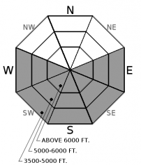
Up to 10" of recent dense snow rests on the sun crust formed Wednesday. Today's sunshine and warming may initiate a wet loose avalanche cycle at all elevations on sunny aspects. Resulting slides may travel long distances due to the underlying firm bed surface. Rollerballs and pinwheels are the first sign that the surface snow is warming. Forming a snowball with the surface snow is a sign of moist snow and time to move to a different aspect. East aspects will warm first followed by southerlies and finally westerlies. Stay ahead of the sun or simply recreate on shady slopes to avoid the loose wet problem. Avoid traveling in or above terrain traps and long-running gullies.
-
Type ?
-
Aspect/Elevation ?
-
Likelihood ?CertainVery LikelyLikelyPossible
 Unlikely
 -
Size ?HistoricVery LargeLargeSmall

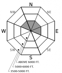
Recent snow and moderate southwest winds formed slabs up to 2-3' thick on leeward aspects at upper elevations. It is likely that a rider could trigger a wind slab avalanche today. Avoid lens-shaped pillows below ridgelines and on steep convex or cross-loaded terrain. Cracking in the snow is a sign of instability with shooting cracks an obvious red flag! Evaluate all wind loaded terrain before committing to a slope.
-
Type ?
-
Aspect/Elevation ?
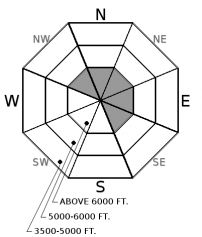
-
Likelihood ?CertainVery LikelyLikelyPossible
 Unlikely
 -
Size ?HistoricVery LargeLargeSmall

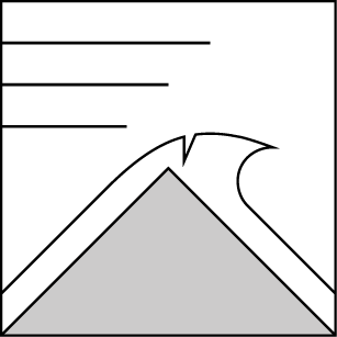
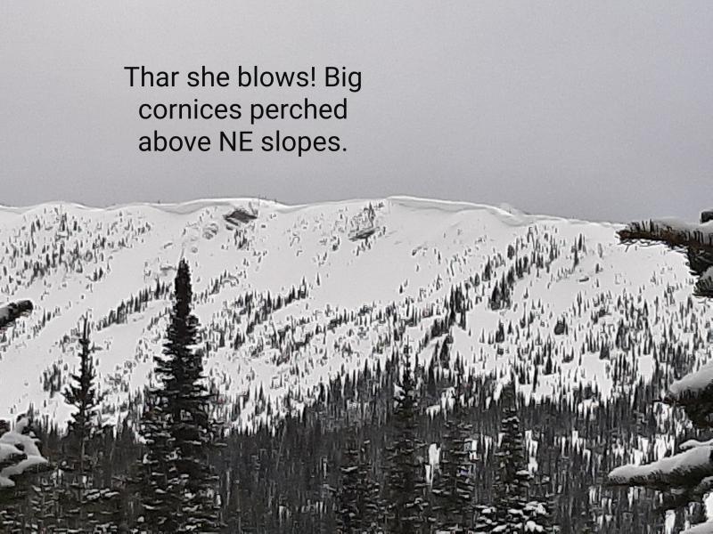
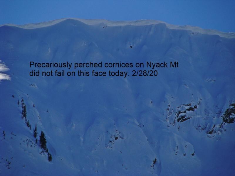
This season's westerly wind and bountiful snowfall formed large cornices on leeward ridgelines at upper elevations. Today will be the first substantial warming event these features have been subjected to in several weeks. Cornices can fail without warning and resulting debris may trigger a deeper slab avalanche on the slopes below. These features extend much further beyond solid ground than expected. Avoid traveling on or below cornices during this weakening phase.
Prolonged sunshine and warm temperatures return to the Flathead for the first time since 2017. We are anticipating a wet loose avalanche cycle to occur at all elevations on sunny aspects over the next few days. Wednesdays warming produced minimal wet loose avalanches due to a moderate wind that kept the snow surface cool. If winds diminish expect the snow surface at upper elevations to eventually moisten and become unstable. Resulting slides could run long distances due to the underlying slick sun crust. Debris could destroy the integrity of the underlying crust and entrain additional snow.
The recent storm ended last night after depositing between 1-2" of SWE at upper elevation stations. Due to warm temperatures, snowfall depth was not impressive but warm dense snow transported by moderate southwest winds is the perfect recipe for wind slab development. Expect slabs up to 3' thick on leeward aspects at upper elevations. These slabs will be reactive to a rider today and should be viewed with suspicion.
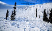
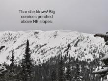
Cornices around the area are HUGE!. The likelihood of a cornice failure will increase over the next few days with continued warming. Continue to give cornices a wide berth; they have grown to dangerously large sizes this season and can also act as triggers for larger avalanches (photo).
Don't miss out on our final two avalanche education lectures this season at Penco Power Products in Kalispell and Whistling Andy Distillery in Bigfork. Thanks to all who participated in our avalanche education program this season and we're already planning next years line-up!
High pressure moves into our area for the next few days. Plentiful sunshine, calm winds and slightly above average temperatures are expected. Enjoy!
This advisory applies only to backcountry areas outside established ski area boundaries. This advisory describes general avalanche conditions and local variations always occur. This advisory expires at midnight on the posted day unless otherwise noted. The information in this advisory is provided by the USDA Forest Service who is solely responsible for its content.


