| Sunday | Sunday Night | Monday | |
|---|---|---|---|
| Cloud Cover: | Snow developing and increasing with windy conditions. | Snow and winds taper | Drying trend |
| Temperatures: | 22 to 27 deg. F. | 10 to 15 deg. F. | 20 to 25 deg. F. |
| Wind Direction: | SW | SW | SW |
| Wind Speed: | 10 to 20 mph, gusts to 40 | 5 to 15 mph, gusts to 25 | 1 to 11 mph |
| Snowfall: | 5 to 7 in. | 1 to 3 in. | 0 in. |
| Snow Line: |
Whitefish Range
Swan Range
Flathead Range and Glacier National Park
How to read the forecast
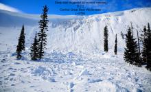
The avalanche hazard is increasing with moderate to strong southwest winds forming slabs on leeward aspects. Snow returns this morning and intensifies through the day possibly forming storm slabs in sheltered terrain. Slabs will thicken through the day with continued wind and snow. Watch for signs of instabilities in the new snow and wind-deposited snow such as cracking or collapsing.

3. Considerable
?
Above 6500 ft.
2. Moderate
?
5000-6500 ft.
2. Moderate
?
3500-5000 ft.
- 1. Low
- 2. Moderate
- 3. Considerable
- 4. High
- 5. Extreme
-
Type ?
-
Aspect/Elevation ?
-
Likelihood ?CertainVery LikelyLikelyPossible
 Unlikely
 -
Size ?HistoricVery LargeLargeSmall

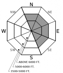
Yesterday, up to 8" of low-density snowfall was reported in the Swan and the Whitefish Range. Overnight, increasing southwest winds redistributed this snow forming slabs on leeward aspects. Slabs will thicken throughout the day with continued wind and snowfall. Due to the strong winds, slabs may form lower on slopes than normal and at mid elevations. Lens-shaped features behind trees and rock outcroppings or pillows of snow below ridgelines and in gullies identify wind loaded terrain. Cracking and collapsing in the snow is an obvious sign of instability. Evaluate all wind loaded terrain before committing to a slope.
-
Type ?
-
Aspect/Elevation ?
-
Likelihood ?CertainVery LikelyLikelyPossible
 Unlikely
 -
Size ?HistoricVery LargeLargeSmall

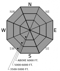
Snowfall will intensify through the day, and the potential for fresh storm slab instabilities will increase. Watch for instabilities in the new snow, breaking as soft slabs or sluffs, in wind protected terrain at all elevations. Use hand pits or test slopes to see how the new snow is bonding with the underlying layer. Cracking under your feet or machine is an obvious sign of a tender slab. Use caution above gullies and terrain traps.
-
Type ?
-
Aspect/Elevation ?

-
Likelihood ?CertainVery LikelyLikelyPossible
 Unlikely
 -
Size ?HistoricVery LargeLargeSmall

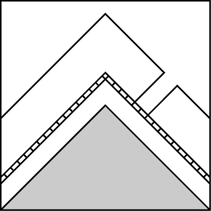
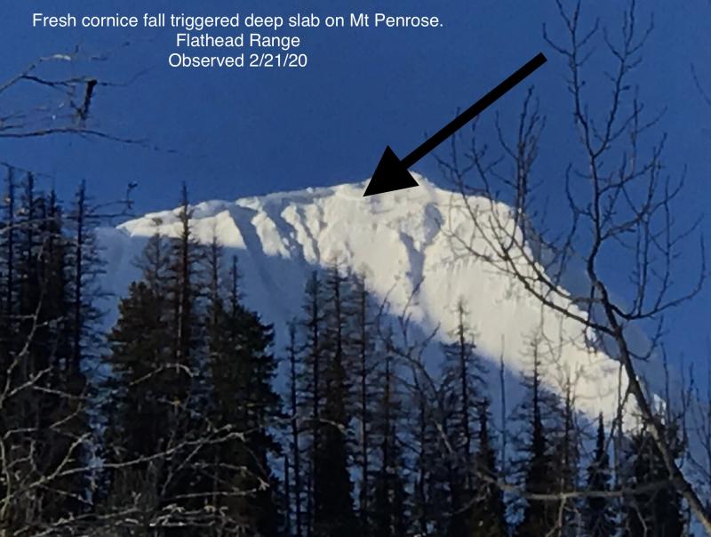
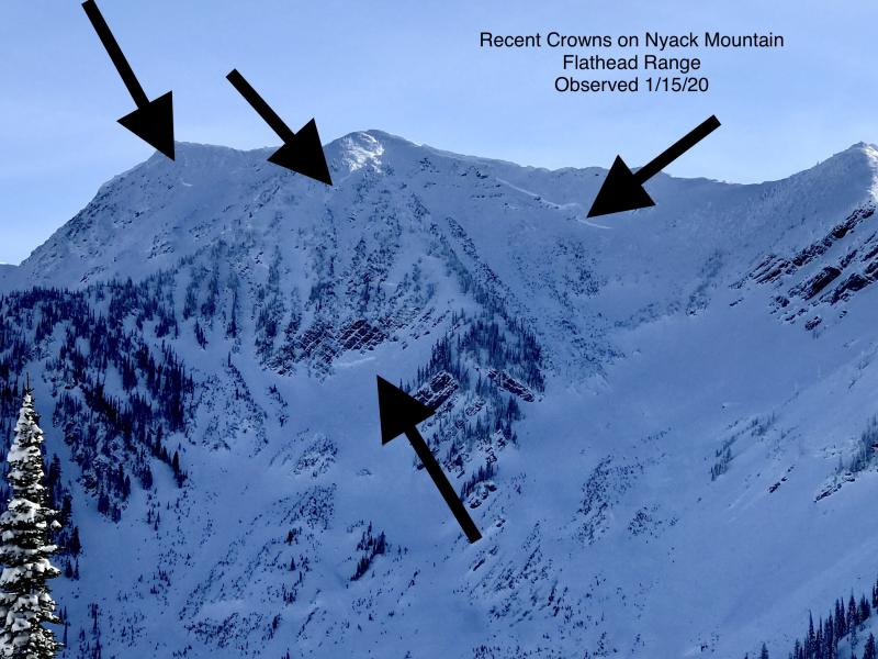
Deep slabs remain a low likelihood, high consequence problem. We have limited observations of deep slabs failing naturally during the last storm cycle and confined to the Flathead Range. These large and deadly avalanches are becoming more stubborn to human triggers as snow depths increase. Deep slabs are most likely triggered from shallow, rocky terrain or cornice falls in alpine terrain. Choose slopes well anchored by trees or supported by concave terrain features along with deep, uniform snow cover at higher elevations. This blog post provides more insight into the problem.
Wind is today's nemesis. Southwest winds increased overnight and will remain elevated throughout the day. Moderate sustained wind with strong gusts has been recorded at Hornet in the northern Whitefish Range and at Snowslip in John F. Stevens Canyon. Recent low-density snow is being redistributed by these winds and forming slabs on typical leeward aspects. A potent shot of moisture will move into our area this morning and intensify as the day progresses. With 6” to 8” in the forecast, storm slabs may develop, especially at mid and upper elevations. Anticipate instabilities within the new snow breaking as soft slabs or sluffs. The new and windblown snow may have a difficult time bonding with the underlying firm or low density surfaces.
Moderate to strong southwest winds developed overnight and will continue through the day. Moisture will enter our area this morning and increase as the day progresses. Expect snow and southwest winds to taper tonight leading to a dry and calm start to the work week.
This advisory applies only to backcountry areas outside established ski area boundaries. This advisory describes general avalanche conditions and local variations always occur. This advisory expires at midnight on the posted day unless otherwise noted. The information in this advisory is provided by the USDA Forest Service who is solely responsible for its content.


