| Tuesday | Tuesday Night | Wednesday | |
|---|---|---|---|
| Cloud Cover: | Polar bear weather | Brrrrr | Cold and partly cloudy |
| Temperatures: | 5 to 10 deg. F. | -15 to -10 deg. F. | 13 to 18 deg. F. |
| Wind Direction: | SW | SW | SW |
| Wind Speed: | 0 to 10 | 0 to 10 | 0 to 10 |
| Snowfall: | 0 in. | 0 in. | 0 in. |
| Snow Line: |
Whitefish Range
Swan Range
Flathead Range and Glacier National Park
How to read the forecast

2. Moderate
?
Above 6500 ft.
2. Moderate
?
5000-6500 ft.
2. Moderate
?
3500-5000 ft.
- 1. Low
- 2. Moderate
- 3. Considerable
- 4. High
- 5. Extreme
-
Type ?
-
Aspect/Elevation ?
-
Likelihood ?CertainVery LikelyLikelyPossible
 Unlikely
 -
Size ?HistoricVery LargeLargeSmall

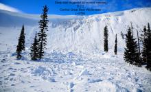
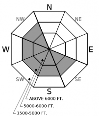
Strong northeast winds over the weekend drifted snow into thick slabs on leeward and cross-loaded terrain features. Recent collapses and shooting cracks highlight the continued potential for human triggering (Example A, Example B). Pay close attention to the snow surface, and avoid pillow shaped lenses of snow or thicker drifts. Following our unusual wind event, wind slabs exist in atypical locations and further downslope than you might expect.
-
Type ?
-
Aspect/Elevation ?
-
Likelihood ?CertainVery LikelyLikelyPossible
 Unlikely
 -
Size ?HistoricVery LargeLargeSmall

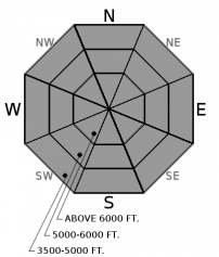
Last week's snowfall has settled into soft slabs 1 to 2 feet thick in wind sheltered locations. Storm slabs are becoming harder to trigger, but they formed over a faceted rain crust in many locations, which delays the healing process. Yesterday, a snowmobiler in the Swan Range set off a storm slab on this icy crust layer (Observation). Stay vigilant in wind-sheltered terrain. Test small slopes before stepping out.
-
Type ?
-
Aspect/Elevation ?
-
Likelihood ?CertainVery LikelyLikelyPossible
 Unlikely
 -
Size ?HistoricVery LargeLargeSmall

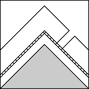
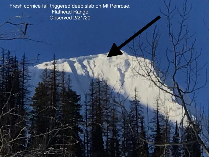
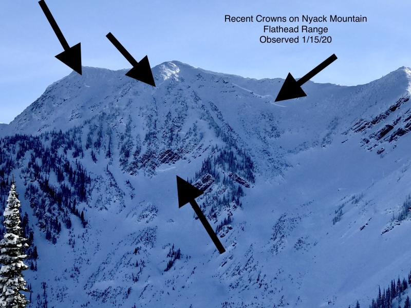
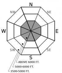
Deep, hard slabs have become very stubborn to human triggers, but the severe consequences of a slide failing near the ground demands your attention. Deep slabs are most likely to be triggered from shallow, rocky areas or from cornice falls. The problem is confined to alpine terrain. If you are traveling at higher elevations, choose well-supported slopes with deep, uniform snow coverage. This blog post provides more insight into the problem.
With good visibility yesterday, observers confirmed an avalanche cycle occurred on Saturday night with numerous large, storm slab, wind slab, and loose snow avalanches (up to D2 in size) and at least two deep slabs in the Flathead Range (over D3 in size). Storm instabilities during the cycle were breaking on mid-storm layers or on the faceted rain crust that marked the beginning of the storm on Valentine's Day. This crust reaches as high as 6,200' and is capped by small-grained facets. You can easily identify the bottom of the storm by shoving a glove or ski pole down until it hits the crust. Despite an unnerving weak layer above this rain crust, the storm slab problem has been relatively quiet in the wake of Saturday's cycle (based on limited observations). Soft, low-density slabs are finding a balance with this buried weak layer. A snowmobiler in the Swan Range yesterday found an example of the opposite; he triggered a storm slab on a lingering problem slope. As this slab continues to settle and stiffen, we'll move it into the persistent slab problem bin, and I suspect it will become more reactive with the next loading or warmup event. For now, the smoking gun for our avalanche concerns has been wind drifting. Winds provided the right amount of cohesion and load to create a longer-lasting, more reactive issue. We have received reports the last two days of large collapses and shooting cracks from wind loaded terrain features and pillows. The easy solution today is to avoid wind loaded slopes by paying attention to wind drifting patterns and snow texture. The riding quality will be softer and better in sheltered areas anyway.
COLD sums up the day pretty well in one word. An arctic airmass remains entrenched over NW Montana. Winds have graced us with calm conditions, but the mercury has bottomed out well below zero at all mountain weather stations. A weak disturbance will bring a dusting of snow later today, and cold, showery weather persists through the work week.
This advisory applies only to backcountry areas outside established ski area boundaries. This advisory describes general avalanche conditions and local variations always occur. This advisory expires at midnight on the posted day unless otherwise noted. The information in this advisory is provided by the USDA Forest Service who is solely responsible for its content.


