| Sunday | Sunday Night | Monday | |
|---|---|---|---|
| Cloud Cover: | Cold temperatures and windy conditions | COLD! | Continued cold with winds decreasing |
| Temperatures: | 5 to 10 deg. F. | -10 to -5 deg. F. | 5 to 10 deg. F. |
| Wind Direction: | NE | NE | NE |
| Wind Speed: | 10 to 20 mph, gusting to 40 mph | 10 to 20 mph, gusting to 30 mph | 5 to 15 mph, gusting to 25 |
| Snowfall: | 2-4 in. | 0 in. | 0 in. |
| Snow Line: |
Whitefish Range
Swan Range
Flathead Range and Glacier National Park
How to read the forecast
Yesterday's heavy snowfall tapered overnight but dangerous avalanche conditions remain. Thick storm slabs can be found on all aspects at all elevations. Gusty east winds are forming wind slabs several feet thick on atypical aspects. Loading is stressing deeply buried weak layers in our snowpack which may result in very large avalanches. Conservative terrain selection is advised while we let our snowpack adjust to this heavy loading event.

3. Considerable
?
Above 6500 ft.
3. Considerable
?
5000-6500 ft.
3. Considerable
?
3500-5000 ft.
- 1. Low
- 2. Moderate
- 3. Considerable
- 4. High
- 5. Extreme
-
Type ?
-
Aspect/Elevation ?
-
Likelihood ?CertainVery LikelyLikelyPossible
 Unlikely
 -
Size ?HistoricVery LargeLargeSmall

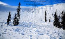
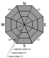
Our recent storm deposited up to 20"+ of snow at all elevations. At low and mid elevations this snow is resting on a rain crust capped by a thin layer of facets (weak snow). This is a perfect recipe for a slab avalanche which was confirmed Wednesday night with storm slabs sliding long distances on the smooth bed surface (video). With more snow in the equation, avalanches will be deeper and entrain more snow. Variable wind direction formed thicker storm slabs on all aspects at upper elevations. Shooting cracks and recent avalanche activity are clear signs to stick to conservative, low angle terrain.
-
Type ?
-
Aspect/Elevation ?

-
Likelihood ?CertainVery LikelyLikelyPossible
 Unlikely
 -
Size ?HistoricVery LargeLargeSmall

Yesterday, west winds formed wind slabs 1-2' thick on leeward aspects. East winds overnight redistributed substantial low-density surface snow forming 1-3' thick wind slabs on atypical aspects. Continued east winds will thicken slabs throughout the day. Look for pillows of snow below ridgelines, in gullies and on cross-loaded features at mid-elevations. Surface cracking, hollow sounds (similar to beating on a drum) along with whumpfing are all signs of instability. Sheltered terrain will have the most enjoyable snow to recreate in today.
-
Type ?
-
Aspect/Elevation ?
-
Likelihood ?CertainVery LikelyLikelyPossible
 Unlikely
 -
Size ?HistoricVery LargeLargeSmall

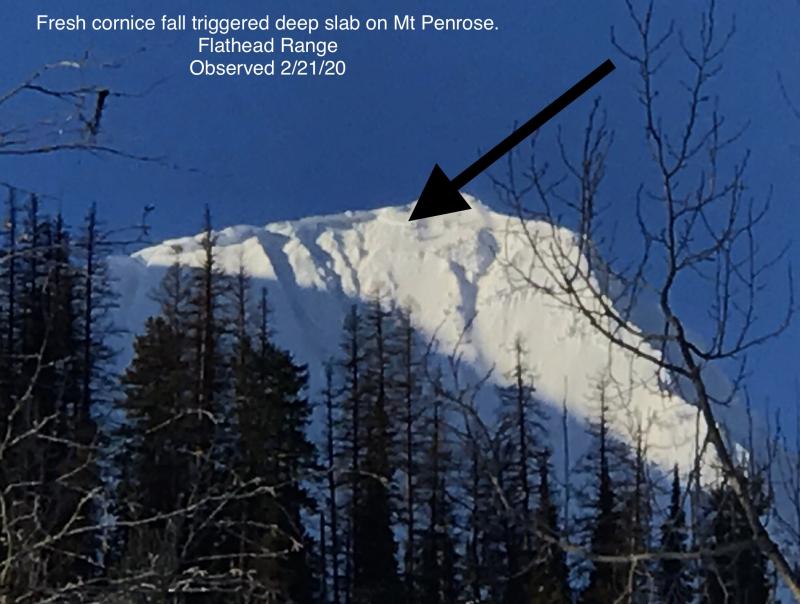
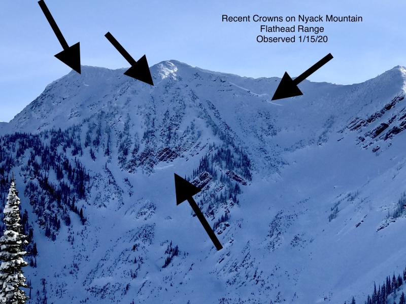
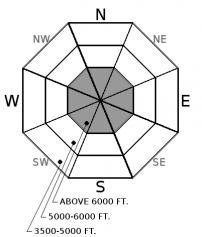
Weak snow near the ground continues to plague the advisory area with several deep, hard slab avalanches occurring as recently as last week (observation 1, observation 2, observation3). Deep slab avalanche activity has been associated with every heavy loading event this season. Continued wind loading increases the likelihood of natural and human triggered slides. These slides have been noted in steep upper elevation terrain where the slab is not of uniform thickness due to rock outcrops. Terrain management entails well-supported slopes with a deep and uniform snow cover.
Snowfall tapered off late last night with 10"+ recorded at many locations with Noisy Basin the winner in both SWE (1.8") and snowfall (14"). A strong arctic air mass intruded yesterday afternoon delivering blustery east winds and cold temperatures. The cold arctic air was responsible for lowering the density of the snow at the tail end of the storm but also redistributed the snow due to the winds. If you were out enjoying the incohesive powder yesterday expect to find different conditions today in areas affected by the wind.
Our in your face problems today are storm slabs at all elevations and wind slabs at upper elevations. Storm slabs will be 2-3 feet thick and are resting on the February 8 rain crust which will act as a slippery bed surface. In sheltered locations, a thin layer of facets is sitting on top of the crust which will exacerbate the problem. Wind slabs can be found on all aspects at upper elevations but the thickest slabs will form throughout the day on atypical west aspects. Avalanches have the potential to run long distances and entrain substantial snow. Paying attention to overhead hazards is important today.
Today's wind loading has the potential to reawaken weak snow found near the bottom of our pack. The persistent weak layers have produced very large destructive avalanches after every heavy loading event this season. Both small storm slabs and cornice fall can act as triggers for deep slabs, another reason to use conservative decision making today.
To find out more about our deep slab problem, please visit our forecaster’s corner blog post: http://www.flatheadavalanche.org/forecast-corner
Copious moisture moved into our area yesterday depositing substantial snowfall before a strong arctic air mass intrusion early evening. Today, expect occasional light snow with cold temperatures and gusty east winds. Cold and dry conditions are on tap for tonight and tomorrow with continued east winds.
This advisory applies only to backcountry areas outside established ski area boundaries. This advisory describes general avalanche conditions and local variations always occur. This advisory expires at midnight on the posted day unless otherwise noted. The information in this advisory is provided by the USDA Forest Service who is solely responsible for its content.


