| Saturday | Saturday Night | Sunday | |
|---|---|---|---|
| Cloud Cover: | Heavy snow and windy conditions developing | Heavy snow continues with strong east winds | Snow tapering with cold windy conditions |
| Temperatures: | 20 to 25 deg. F. | -5 to 0 deg. F. | 4 to 9 deg. F. |
| Wind Direction: | SW | NE | NE |
| Wind Speed: | 5 to 15 mph, gusting to 30 mph | 10 to 20 mph, gusting to 30 mph | 10 to 20 mph, gusting to 30 |
| Snowfall: | 6-8 in. | 8-10 in. | 2-4 in. |
| Snow Line: |
Whitefish Range
Swan Range
Flathead Range and Glacier National Park
How to read the forecast
An Avalanche Warning is in effect. Today, the avalanche danger starts out as CONSIDERABLE but is expected to rise to HIGH later today or tonight. Heavy snow, accompanied by southwest winds, will thicken storm slabs on a weak surface. Heavy loading may reawaken deeply buried weak layers in our snowpack resulting in very large avalanches. Expect dangerous avalanche conditions to develop as the storm intensifies. Travel in and below avalanche terrain is not recommended.

4. High
?
Above 6500 ft.
4. High
?
5000-6500 ft.
3. Considerable
?
3500-5000 ft.
- 1. Low
- 2. Moderate
- 3. Considerable
- 4. High
- 5. Extreme
-
Type ?
-
Aspect/Elevation ?
-
Likelihood ?CertainVery LikelyLikelyPossible
 Unlikely
 -
Size ?HistoricVery LargeLargeSmall

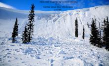
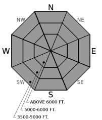
Heavy snow and moderate to strong southwest winds will form fresh storm slabs and thicken existing slabs throughout the day. Slabs will form on recent low-density snow resting on a rain crust. In sheltered locations, there is a layer of weak faceted snow on top of the crust which will exacerbate the storm slab problem. A widespread natural avalanche cycle occurred Wednesday night with storm slabs sliding long distances on the smooth bed surface (video). Avalanches have the ability to travel long distances and entrain substantial snow. Slabs will become more reactive as the storm ramps us this afternoon and early evening. Shooting cracks and recent avalanche activity are clear signs to stick to conservative, low angle terrain.
-
Type ?
-
Aspect/Elevation ?
-
Likelihood ?CertainVery LikelyLikelyPossible
 Unlikely
 -
Size ?HistoricVery LargeLargeSmall

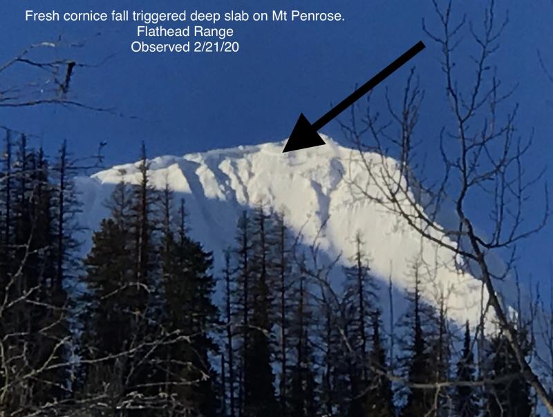
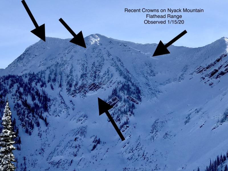
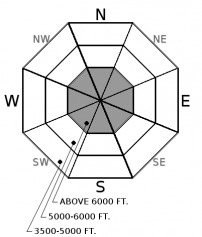
Weak snow near the ground continues to plague the advisory area with several deep, hard slab avalanches occurring as recently as last week(observation 1, observation 2, observation3). Deep slab avalanche activity has been associated with every heavy loading event this season. The storm entering our area today increases the likelihood of natural and human triggered slides. These slides have been noted in steep upper elevation terrain where the slab is not of uniform thickness due to rock outcrops. Terrain management entails well-supported slopes with a deep and uniform snow cover. Today, we recommend avoiding avalanche terrain to minimize this hazard.
A potent storm moves into our area today creating dangerous avalanche conditions. The avalanche danger starts as CONSIDERABLE but is expected to rise to HIGH as the storm intensifies later today or tonight. The timing of the transition to HIGH danger is unknown and may not occur until after sunset. Our #1 problem today is thickening storm slabs at all elevations. Slabs will be 2-3 feet thick in the Flathead Range, 1-2 feet in the Swan and the Whitefish Range. Slabs rest on the February 8 rain crust which will act as a slippery bed surface. In sheltered locations, a thin layer of facets is sitting on top of the crust which will exacerbate the problem. Avalanches have the potential to run long distances and entrain substantial snow. Paying attention to overhead hazards is important today.
The loading event on tap for today and tonight has the potential to reawaken weak snow found near the bottom of our pack. The persistent weak layers have produced very large destructive avalanches after every heavy loading event this season. Both small storm slabs and cornice fall can act as triggers for deep slabs, another reason to use conservative decision making today.
To find out more about our deep slab problem, please visit our forecaster’s corner blog post: http://www.flatheadavalanche.org/forecast-corner
A potent storm will move into our area today resulting in heavy snow and increasing west winds. Snow continues tonight with winds shifting to the east as an arctic air mass intrudes into the Flathead Valley. Downright brutal conditions can be expected overnight and tomorrow morning due to the strong east winds, cold temperatures and blowing snow.
This advisory applies only to backcountry areas outside established ski area boundaries. This advisory describes general avalanche conditions and local variations always occur. This advisory expires at midnight on the posted day unless otherwise noted. The information in this advisory is provided by the USDA Forest Service who is solely responsible for its content.


