| Friday | Friday Night | Saturday | |
|---|---|---|---|
| Cloud Cover: | Snow showers increasing in intensity this afternoon | Tapering snow showers | Snow |
| Temperatures: | 25 to 30 deg. F. | 11 to 16 deg. F. | 23 to 28 deg. F. |
| Wind Direction: | SW->W | W | S->E |
| Wind Speed: | 5 to 15 mph, gusting to 35 mph | 10 to 20 mph, gusting to 35 mph | 5 to 15 mph, gusting to 30 |
| Snowfall: | 5-8 in. | 3-5 in. | 10-14 in. |
| Snow Line: |
Whitefish Range
Swan Range
Flathead Range and Glacier National Park
How to read the forecast
An Avalanche Watch is in effect. Dangerous conditions exist due to thickening storm slabs formed on a weak surface. Expect danger to rise as a series of potent storms move into the region with abundant snowfall and increasing winds. Given the widespread distribution of reactive storm slabs it is important to choose conservative, low angle terrain to ski or ride in, and avoid lingering in run-out zones.

3. Considerable
?
Above 6500 ft.
3. Considerable
?
5000-6500 ft.
3. Considerable
?
3500-5000 ft.
- 1. Low
- 2. Moderate
- 3. Considerable
- 4. High
- 5. Extreme
-
Type ?
-
Aspect/Elevation ?
-
Likelihood ?CertainVery LikelyLikelyPossible
 Unlikely
 -
Size ?HistoricVery LargeLargeSmall

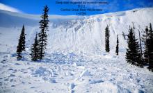
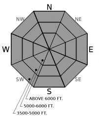
Our recent rain crust and facet layer was buried on Valentine's Day and already started causing problems. A small, but widespread natural avalanche cycle occurred Wednesday night with thin, soft storm slabs sliding long distances on the smooth bed surface (video). With continued snowfall expected today and tomorrow these slabs will thicken, become more reactive, and more dangerous. Expect to see thicker slabs along ridgelines and gullies where light to moderate winds drifted the recent snow. Shooting cracks and recent avalanche activity are clear signs to stick to conservative, low angle terrain.
-
Type ?
-
Aspect/Elevation ?
-
Likelihood ?CertainVery LikelyLikelyPossible
 Unlikely
 -
Size ?HistoricVery LargeLargeSmall

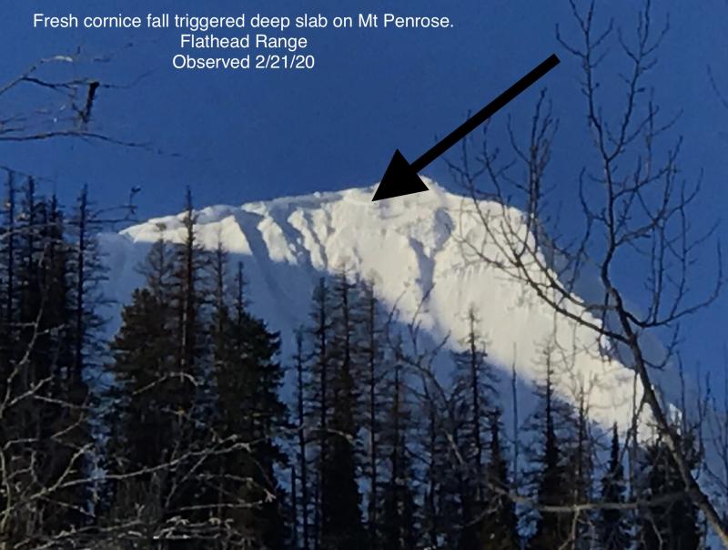
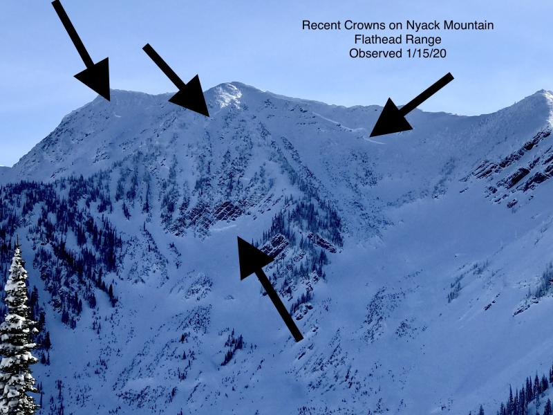
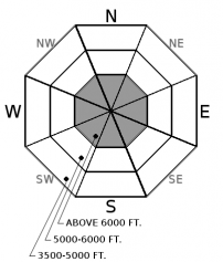
Weak snow near the ground continues to plague the advisory area. Several deep, hard slab avalanches occurred as recently as last week(observation 1, observation 2, observation3), and appear to reactivate in steep, upper elevation terrain with each substantial storm load. This is a tricky problem to manage as most stability tests will not illustrate the problem and the snow pack will not offer any sign of instability. The key is to chose well-supported slopes with a deep and uniform snow cover if traveling on upper elevation slopes and be mindful of overhead hazards at all elevations. Keep in mind that rapid stress from cornice fall and smaller avalanches can trigger these deeper beasts.
Abundant snow fall and increasing winds are expected over the next 24 hours. Pay close attention to changing weather conditions like heavy snow and increasing winds that will contribute to rising avalanche danger. With the weak, faceted snow formed during the recent high pressure on top of last week's rain crust the incoming storms will likely create very dangerous conditions. Small avalanches that occurred in the last 48 hours were observed running long distances.
Another substantial loading event is on tap for the weekend stressing our deep persistent weak layers. Don't let your guard down on the deep slab problem, they demand respect until they stop producing very destructive avalanches like we’ve observed after every major loading cycle this season. Both small storm slabs and cornice fall can act as triggers for deep slabs, another reason to use conservative decision making today.
To find out more about our deep slab problem, please visit our forecaster’s corner blog post: http://www.flatheadavalanche.org/forecast-corner
Today, snow showers will increase in intensity and become more widespread as the first of a series of potent storms pushes into the region. Expect temperatures in the mid-20s, and winds out of the southwest at 5-15 mph. This afternoon winds should become more westerly and increase to 10-20 mph with stronger gusts near the Continental Divide. Snow tapers tonight with another brief lull ahead the next surge of moisture tomorrow morning.
This advisory applies only to backcountry areas outside established ski area boundaries. This advisory describes general avalanche conditions and local variations always occur. This advisory expires at midnight on the posted day unless otherwise noted. The information in this advisory is provided by the USDA Forest Service who is solely responsible for its content.


