| Thursday | Thursday Night | Friday | |
|---|---|---|---|
| Cloud Cover: | Partly to Mostly Cloudy | Cloudy | Snow |
| Temperatures: | 19 to 24 deg. F. | 10 to 15 deg. F. | 25 to 30 deg. F. |
| Wind Direction: | NW | SW | SW |
| Wind Speed: | 5 to 10 mph, gusting to 20 mph | 15 to 20 mph, gusting to 40 mph | 20 to 25 mph, gusting to 50 |
| Snowfall: | 0 in. | 0 in. | 3 to 6 in. |
| Snow Line: |
Whitefish Range
Swan Range
Flathead Range and Glacier National Park
How to read the forecast

3. Considerable
?
Above 6500 ft.
3. Considerable
?
5000-6500 ft.
2. Moderate
?
3500-5000 ft.
- 1. Low
- 2. Moderate
- 3. Considerable
- 4. High
- 5. Extreme
-
Type ?
-
Aspect/Elevation ?
-
Likelihood ?CertainVery LikelyLikelyPossible
 Unlikely
 -
Size ?HistoricVery LargeLargeSmall

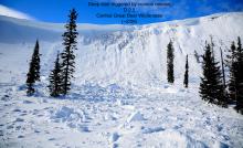
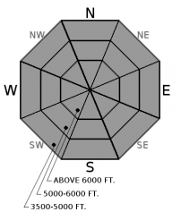
6"-14” of new snow fell in the past 36 hours, with one area in the northern Whitefish Range receiving over 2 feet of low density snow. Yesterday, observations suggest storm slabs are easy to trigger and became more cohesive with propagating surface cracks. Storm slabs are sitting above a faceted rain crust at mid and lower elevations and wind-stiffened snow at upper elevations. Both snow surfaces are a slippery sliding surface for these slabs to run fast and far. Evaluate storm totals and use small test slopes to assess ease of human triggering before traveling in bigger or steeper terrain. Cracking snow or recent avalanche activity are signs to stick to lower angled terrain.
-
Type ?
-
Aspect/Elevation ?
-
Likelihood ?CertainVery LikelyLikelyPossible
 Unlikely
 -
Size ?HistoricVery LargeLargeSmall

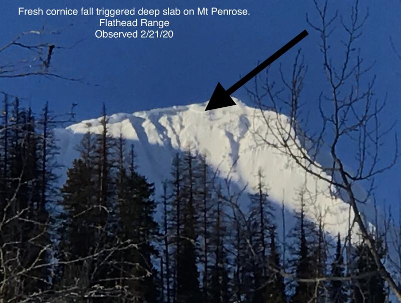
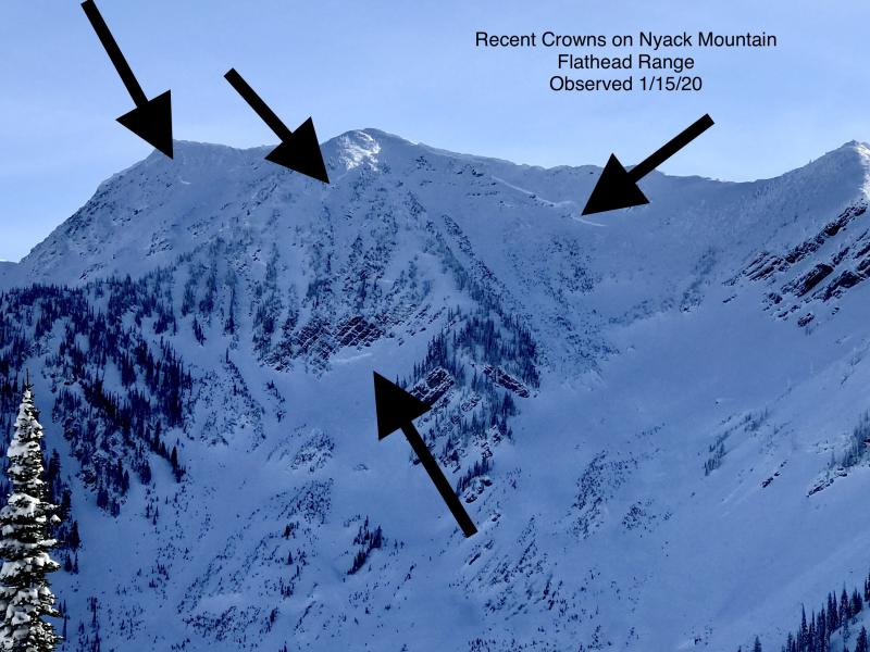
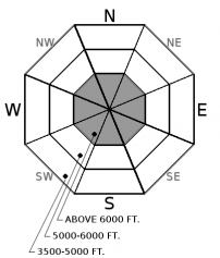
Our Thanksgiving crust/ facet combo near the ground just won’t go away and remains our most active weak layer deep in our snowpack. As with each major loading event this season, several deep, hard slab avalanches producing very destructive avalanches and running long distances were observed last week (observation 1, observation 2, observation 3). These slabs are most likely triggered where the overlying slab is shallow, in rocky terrain, or from a cornice fall. Well-supported slopes with a deep and uniform snow cover are your best options if traveling on steep, upper elevation slopes. Lingering below cornices is not advised.
Weather stations around the area are showing 8 to 12" of new snow (up to 1.1" of SWE) over the past 36 hours and is now burying a faceted rain crust at mid and lower elevations and wind-stiffened snow at upper elevations. The storm snow is settling into a cohesive slab, evidenced by numerous reports of small slab avalanches and cracking yesterday afternoon. Most avalanches occur during or immediately after a storm. Yesterday, storm slabs were easy to trigger. Today, the size will be larger and distribution is more widespread. I anticipate easy triggering again today, along with slabs failing naturally in steep, wind-loaded terrain. Expect these slabs to run fast and far and possibly entraining all the new snow above our slick sliding surfaces.
Around 1” of SWE is most likely not the load needed to reactivate our deep persistent weak layers, but we have been surprised before. As long as deep weak layers exist in our snowpack, they demand respect until they stop producing very destructive avalanches like we’ve observed after every major loading cycle this season. Storm slabs can act as triggers for deep slabs, another reason to use conservative decision making today.
To find out more about our deep slab problem, please visit our forecaster’s corner blog post: http://www.flatheadavalanche.org/forecast-corner
Overnight, cold front moved to our southwest and is currently positioned along the MT/ ID border at 4 am. Northwest flow aloft is being observed over northwest Montana with cold east surface winds pushing arctic air over the Continential Divide. Temperatures this morning are in the single digits but should warm into the high teens to low 20's by this afternoon under partly to mostly cloudy skies. Today and tonight is a lull in precipitation before our next storm system Friday and Saturday. Our next storm system comes in warm and wet along with strong westerly winds and storm totals could be measured in feet with this system. Stay tuned.
This advisory applies only to backcountry areas outside established ski area boundaries. This advisory describes general avalanche conditions and local variations always occur. This advisory expires at midnight on the posted day unless otherwise noted. The information in this advisory is provided by the USDA Forest Service who is solely responsible for its content.


