| Wednesday | Wednesday Night | Thursday | |
|---|---|---|---|
| Cloud Cover: | Moderate snowfall | Heavy snowfall | Cold and clouds decreasing |
| Temperatures: | 25 to 30 deg. F. | -3 to 2 deg. F. | 15 to 20 deg. F. |
| Wind Direction: | Southwest | Northeast | North |
| Wind Speed: | 5 to 15, gusting to 25 | 2 to 12, gusting to 20 | 0 to 10 |
| Snowfall: | 3 to 6 in. | 6 to 9 in. | 0 to 1 in. |
| Snow Line: |
Whitefish Range
Swan Range
Flathead Range and Glacier National Park
How to read the forecast
The avalanche danger will begin to increase today and rise to CONSIDERABLE overnight. Watch for shallow storm instabilities to develop, especially in wind loaded or snowfall favored areas. Thicker, older slabs remain a stubborn but consequential problem at high elevations.

2. Moderate
?
Above 6500 ft.
2. Moderate
?
5000-6500 ft.
1. Low
?
3500-5000 ft.
- 1. Low
- 2. Moderate
- 3. Considerable
- 4. High
- 5. Extreme
-
Type ?
-
Aspect/Elevation ?

-
Likelihood ?CertainVery LikelyLikelyPossible
 Unlikely
 -
Size ?HistoricVery LargeLargeSmall

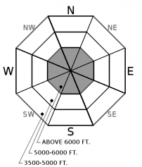
5" to 7" of new snow is in the forecast for today, under gusty southwest winds. As new snow accumulates, watch for shallow soft slabs to develop, most commonly below leeward terrain features at higher elevations. These new instabilities overlap with stubborn wind slabs that formed earlier in the week, up to several feet thick. You can avoid both of these problems by traveling in wind protected terrain and monitoring snowfall accumulations. Watch for shooting cracks or more than 6" of new or drifted snow to identify problem areas.
-
Type ?
-
Aspect/Elevation ?
-
Likelihood ?CertainVery LikelyLikelyPossible
 Unlikely
 -
Size ?HistoricVery LargeLargeSmall

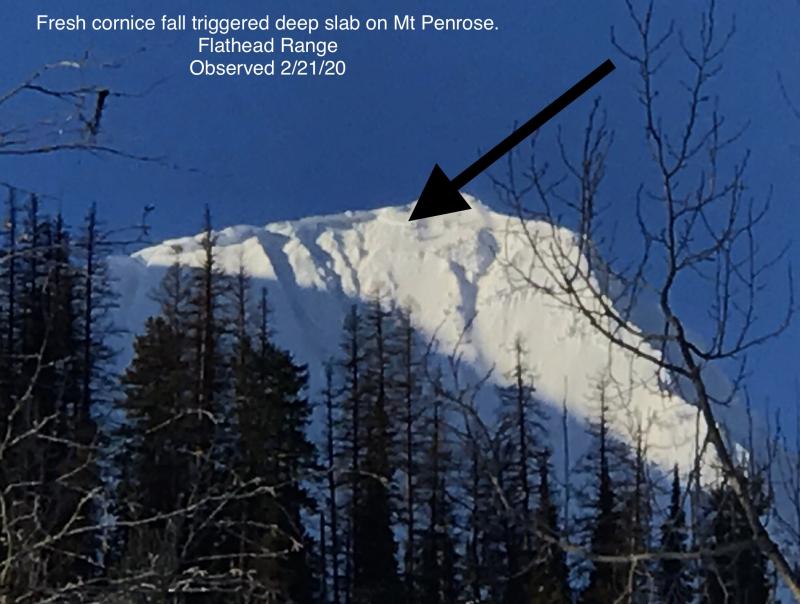
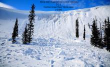
The most active weak layer in our snowpack is the Thanksgiving rain crust/facet layer near the ground. A large storm last week triggered a number of hard slab avalanches and produced very destructive and long-running debris piles (Observation 1, observation 2, observation 3). Deep slabs are most likely to be triggered in alpine terrain near rock outcrops or shallow areas, especially from cornice falls. Choose well-supported slopes with deep and uniform snow coverage if you are traveling in steep, high elevation terrain. Don't linger below cornices.
Roses are red, violets are blue. Sugar snow is sweet, until its buried by a foot of new.
Our snow surface is primed for another avalanche cycle, with low density, faceted snow (weak layer) capping a slick rain crust (bed surface). The only missing ingredient is a slab. You can find these slabs on some high elevation slopes right now, the product of Sunday's wind event. You will also find these slabs starting to develop today with new snowfall and southwest winds. We are only expecting 6" by sunset, so if the weather plays nice today, new slabs will be small and localized to drifted areas near ridges, below cornices, and in gullies. Conditions will quickly turn dangerous once we pick up enough snow to form a widespread and cohesive storm slab. That should happen tonight, with another 8" to 10" expected by tomorrow morning. I expect to see natural avalanche activity tonight. Watch for changing conditions and increasing danger today.
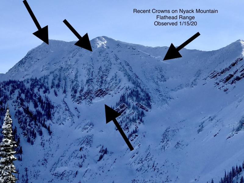
Our deep slab camels have had a long and stressful winter but just just came off of a nice 5-day rest period. Today we start adding straws again. I don’t suspect today’s snow will be enough to break the camel’s back. Camels are ornery, untrustworthy beasts. If we start to see moving snow tonight, such as natural storm slabs or cornice falls, I start to get nervous. There were numerous deep slab avalanches that ran last week, from D3 to D4 in size, during our warm and wet storm cycle. To find out more about our deep slab problem please visit our forecaster's corner blog post: http://www.flatheadavalanche.org/forecast-corner
Radar shows a band of snow moving into our mountains this morning from a Pacific front. The Northern Whitefish Range has already picked up a few inches, and we should see around 6" of new snow by sunset and over a foot by tomorrow morning. Southwest winds are blowing 15 to 30 mph this morning. Winds should diminish through the day, switching to northeast as a backdoor front finishes off this first round of snow. Friday and Saturday bring a stronger system across Montana. Get ready for a powdery weekend!
This advisory applies only to backcountry areas outside established ski area boundaries. This advisory describes general avalanche conditions and local variations always occur. This advisory expires at midnight on the posted day unless otherwise noted. The information in this advisory is provided by the USDA Forest Service who is solely responsible for its content.


