| Tuesday | Tuesday Night | Wednesday | |
|---|---|---|---|
| Cloud Cover: | Mostly sunny and warming temps | Increasing clouds | Moderate snowfall |
| Temperatures: | 22 to 27 deg. F. | 15 to 20 deg. F. | 25 to 30 deg. F. |
| Wind Direction: | Southwest | Southwest | Southwest |
| Wind Speed: | 10 to 20, gusting to 30 | 10 to 20, gusting to 30 | 5 to 15, gusting to 25 |
| Snowfall: | 0 in. | 0 to 2 in. | 3 to 5 in. |
| Snow Line: |
Whitefish Range
Swan Range
Flathead Range and Glacier National Park
How to read the forecast
Recent wind drifting and deeply buried weak layers require cautious travel at higher elevations, especially on wind loaded slopes or in rocky, shallow areas. Lower elevations have a safer snowpack.

2. Moderate
?
Above 6500 ft.
1. Low
?
5000-6500 ft.
1. Low
?
3500-5000 ft.
- 1. Low
- 2. Moderate
- 3. Considerable
- 4. High
- 5. Extreme
-
Type ?
-
Aspect/Elevation ?

-
Likelihood ?CertainVery LikelyLikelyPossible
 Unlikely
 -
Size ?HistoricVery LargeLargeSmall

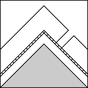
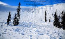
Shifting winds on Sunday and last night formed stiff wind slabs on various aspects at high elevations and some mid elevation slopes. Recent natural wind slabs observed in the Flathead Range (here) and Southern GNP (here) exemplify the problem. These slabs formed over low density snow or slick rain crusts, which prevent good bonding. They are hard enough that they could break above you without giving good feedback. Avoidance is the easy solution. Wind slabs are most likely to be found below ridgelines, rollovers, and in gullies in wind loaded or crossloaded terrain. Carefully observe recent wind drifting patterns and look for thicker or denser lenses of snow to identify the problem.
-
Type ?
-
Aspect/Elevation ?
-
Likelihood ?CertainVery LikelyLikelyPossible
 Unlikely
 -
Size ?HistoricVery LargeLargeSmall

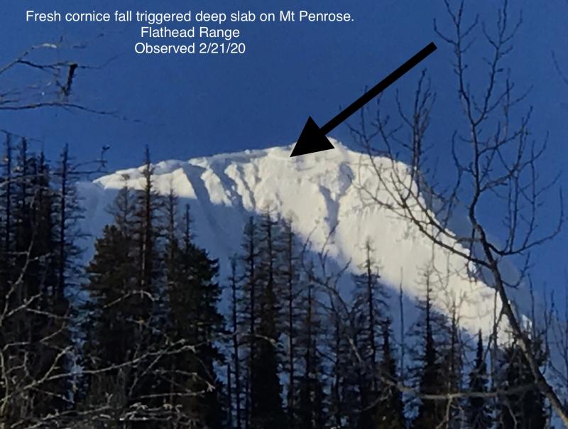
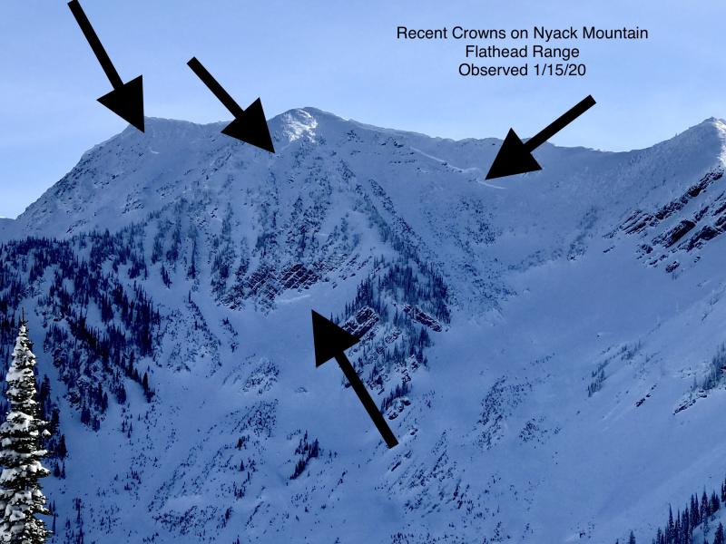
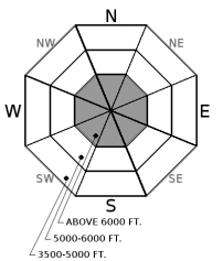
The most active buried weak layer in our snowpack is the Thanksgiving rain crust/facet near the ground. Our last storm triggered another round of hard slab avalanches that produced very destructive and long-running debris piles (Observation 1, observation 2, observation 3). Deep slabs are most likely to be triggered on alpine terrain near rock outcrops or shallow areas, especially from cornice falls. Choose well-supported slopes with deep and uniform snow coverage if you are traveling in steep, high elevation terrain. Don't linger below cornices.
Observations from the last few days suggest a mixed bag of surface conditions at higher elevations. A skier yesterday near Felix Peak noted some shallow cracks up to 6 feet long, evidence that the wind slab problem has not gone away. Varying snow amounts from Thursday's cold front (up to 14" in the Flathead/Glacier) have been redistributed by strong winds, first from the west switching to northeast on Sunday, and today from the southwest. The drifted snow is shallow and benign in some places, but in favored locations, you could trigger a slab large enough to drag you into a terrain trap or bury you. Wind slabs may exist on atypical slopes from recent northeast winds, so be attentive on all aspects today. Reading the surface texture is your best weapon. The natural avalanche reported yesterday in John F Stevens Canyon highlights where the problem is most concerning: areas that recieved more low density snow on Thursday and more wind transport on Sunday.
Deep slab avalanches tend to be less active during prolonged periods of dry and cold weather. Yet, their behavior is notoriously tricky. The odds are low today, but the consequences remain severe. There were numerous deep slab avalanches that ran last week, from D3 to D4 in size, during our warm and wet storm cycle. To find out more about our deep slab problem please visit our forecaster's corner blog post: http://www.flatheadavalanche.org/forecast-corner
Wind chill is topping the charts this morning with mountain temperatures in the single digits and blustery southwest winds gusting into the 30s. Temperatures will thankfully warm through the day ahead of our next Pacific system which is onboarding the BC Coastline this morning. Take advantage of our last day of sunny weather before we enter into an active weather pattern through the weekend. A welcomed surface refresh is on the way; about a 6" to 12" is on tap by Thursday morning.
This advisory applies only to backcountry areas outside established ski area boundaries. This advisory describes general avalanche conditions and local variations always occur. This advisory expires at midnight on the posted day unless otherwise noted. The information in this advisory is provided by the USDA Forest Service who is solely responsible for its content.


