| Monday | Monday Night | Tuesday | |
|---|---|---|---|
| Cloud Cover: | Mostly sunny | Clear and cold | Partly sunny and warmer |
| Temperatures: | 11 to 16 deg. F. | -2 to 3 deg. F. | 22 to 27 deg. F. |
| Wind Direction: | SE with NW in the WF Range | SW | SW |
| Wind Speed: | 3 to 13 mph, gusting to 25 mph | 5 to 15 mph, gusting to 25 | 8 to 18 mph, gusting to 40 |
| Snowfall: | 0 in. | 0 in. | 0 in. |
| Snow Line: |
Whitefish Range
Swan Range
Flathead Range and Glacier National Park
How to read the forecast
Yesterday's strong wind event formed stiff slabs on all aspects at upper elevations. Evaluate wind loaded terrain below ridgelines, in gulleys and below normal loading locations. Weak snow near the ground is capable of producing very large avalanches. Avoid the deep slab problem with conservative terrain selection. A surface rain crust allows for safer conditions below the recent rain line.

2. Moderate
?
Above 6500 ft.
1. Low
?
5000-6500 ft.
1. Low
?
3500-5000 ft.
- 1. Low
- 2. Moderate
- 3. Considerable
- 4. High
- 5. Extreme
-
Type ?
-
Aspect/Elevation ?
-
Likelihood ?CertainVery LikelyLikelyPossible
 Unlikely
 -
Size ?HistoricVery LargeLargeSmall

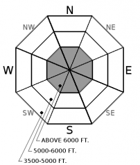
Yesterday's wind event produced unusual loading at all elevations. Strong west winds formed slabs on east aspects before strong east winds deposited slabs on west aspects. Limited snow was available for transport at low and mid elevations where slabs will be thin and few. Upper elevation slabs will be more widespread and up to 3' thick due to up to 14" of low-density surface snow. Slabs may be found below normal loading locations. Slabs are forming on low-density snow above the recent rain line and on a rain crust below that. Fresh slabs are beneath ridgelines and in gulleys with cracking in the snow and hollow sounding snow obvious red flags. Look for pillow shaped features, thicker drifts and test all wind loaded terrain before committing to a slope.
-
Type ?
-
Aspect/Elevation ?

-
Likelihood ?CertainVery LikelyLikelyPossible
 Unlikely
 -
Size ?HistoricVery LargeLargeSmall

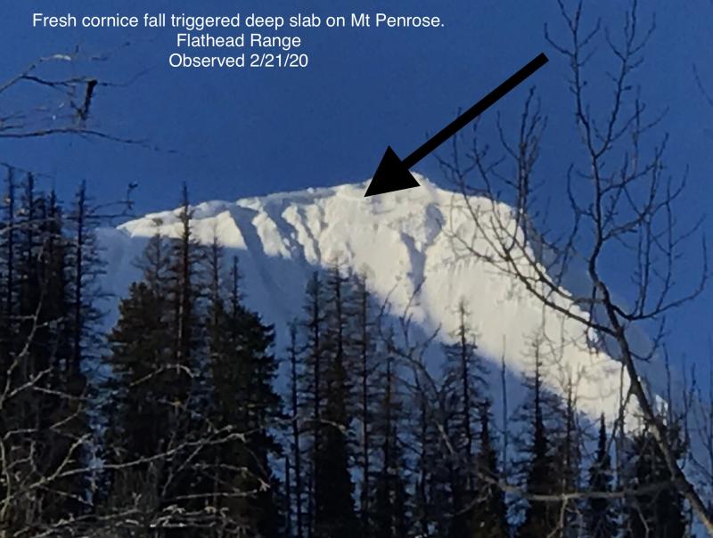
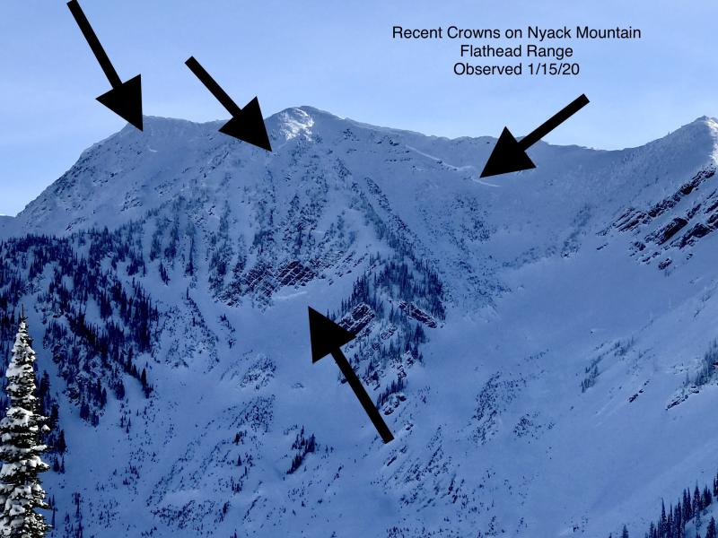
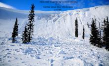
The main weak layer in our snowpack is the Thanksgiving rain crust/facet combo near the bottom of our pack. Recent very large destructive avalanches (observation, observation 2, observation 3) failed 8-12' below the surface. Slides initiated due to heavy loading events and cornice fall in thin rocky areas on steep upper elevation slopes. Choosing conservative terrain is the best way to manage this unpredictable problem.
The Arctic air intruded midday Sunday producing moderate to strong north to east winds at all elevations. Despite limited snow for transport, blowing snow was almost everywhere! Whitefish Mountain Resort recorded 11 consecutive hours of high gusts (>25 mph). These winds formed stiff slabs on west aspects. Before the arctic, moderate to strong west winds formed softer slabs on east aspects. Slabs will form below ridgelines and in gulleys but also farther down the slope than normal due to the strong winds. In some locations, cracking in the slab will occur but in others, the stiff slab may produce a hollow sound like beating on a drum. With a firm snow surface in many locations, slabs may travel long distances.
The Thursday night/Friday rain event left us with a surface crust at low, middle and in some areas upper elevations. In the Swan and the Whitefish Range, this crust reaches to 6500' and 6200' in the western Flathead. The eastern Flathead and southern Glacier Park have a crust to 5500'. At the upper end of the rain line, this crust is up to 7" thick bridging the snow below. In these areas, snowpack stability is good and aggressive riding encouraged. Above the rain crust, a deep slab avalanche problem remains with conservative terrain selection still advised.
To find out more about our deep slab problem please visit our forecaster's corner blog post: http://www.flatheadavalanche.org/forecast-corner
Clearing skies and arctic air have allowed temperatures to plummet at all elevations this morning. Temperatures will remain cool throughout the day despite abundant sunshine. Fortunately, wind speeds have decreased and will remain light through the day. Clear skies tonight will lead to another cold morning but temperatures will warm back to seasonal readings tomorrow with increasing southwest winds. Precipitation looks to return to our area on Wednesday into Thursday.
This advisory applies only to backcountry areas outside established ski area boundaries. This advisory describes general avalanche conditions and local variations always occur. This advisory expires at midnight on the posted day unless otherwise noted. The information in this advisory is provided by the USDA Forest Service who is solely responsible for its content.


