| Sunday | Sunday Night | Monday | |
|---|---|---|---|
| Cloud Cover: | Increasing clouds with light snow | Partial clearing and cold | Mostly sunny and cold |
| Temperatures: | 14 to 19 deg. F. | -5 to 0 deg. F. | 11 to 16 deg. F. |
| Wind Direction: | NE | ENE | S |
| Wind Speed: | 5 to 15 mph, gusting to 25 mph | 5 to 15 mph, gusting to 25 | 1 to 11 mph, gusting to 20 |
| Snowfall: | 0 to 1 in. | 0 in. | 0 to 1 in. |
| Snow Line: |
Whitefish Range
Swan Range
Flathead Range and Glacier National Park
How to read the forecast
Increasing west winds are transporting low-density snow forming slabs on leeward aspects. Today winds will switch to the northeast forming slabs on the other side of the compass. Evaluate wind loaded terrain below ridgelines and in gulleys. Weak snow near the bottom of the snowpack resulted in recent very large avalanches. Conservative terrain selection is the best way to manage the deep slab problem. Safer and more stable snow is at low and mid elevations.

2. Moderate
?
Above 6500 ft.
1. Low
?
5000-6500 ft.
1. Low
?
3500-5000 ft.
- 1. Low
- 2. Moderate
- 3. Considerable
- 4. High
- 5. Extreme
-
Type ?
-
Aspect/Elevation ?
-
Likelihood ?CertainVery LikelyLikelyPossible
 Unlikely
 -
Size ?HistoricVery LargeLargeSmall

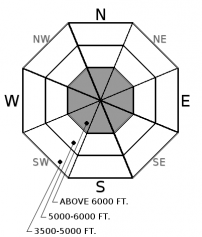
Friday's arctic intrusion deposited up to 7" of low-density snow at low elevations and 14" at upper elevations. West-southwest winds increased overnight forming thin slabs on leeward aspects. Winds will shift to the northeast today and form slabs on west aspects this afternoon. Slabs are forming on low-density snow above the recent rain line and on a rain crust below that. Fresh slabs are beneath ridgelines and in gulleys with cracking in the snow an obvious red flag. Look for pillow shaped features, thicker drifts and test all wind loaded terrain before committing to a slope.
-
Type ?
-
Aspect/Elevation ?

-
Likelihood ?CertainVery LikelyLikelyPossible
 Unlikely
 -
Size ?HistoricVery LargeLargeSmall

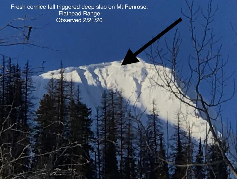
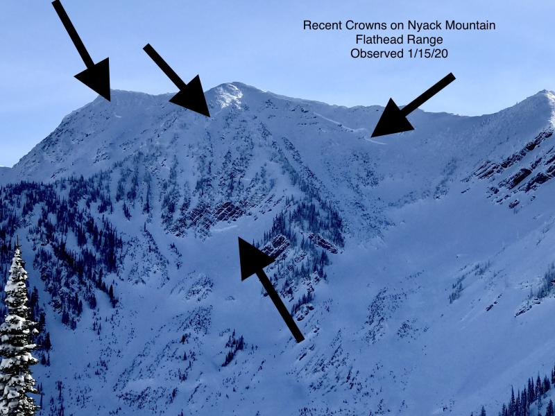
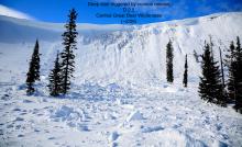
The main weak layer in our snowpack is the Thanksgiving rain crust/facet combo near the bottom of our pack. Recent very large destructive avalanches (observation) failed 8-12' below the surface. Slides initiated due to heavy loading events and cornice fall in thin rocky areas on steep upper elevation slopes. Choosing conservative terrain is the best way to manage this unpredictable problem.
Winds have returned to our area resulting in a wind slab avalanche problem. Low-density snow is on the surface at all elevations and available for transport. West-southwest winds increased overnight with Snowslip, in John F. Stevens Canyon, reporting 8 hours of moderate (16 to 25 mph) sustained winds and high gusts (>25 mph). Winds will switch direction and load westerly slopes this afternoon. In isolated areas winds will form slabs at middle elevations. The eastern Flathead Range and southern Glacier Park received the most snow during Friday's storm with wind slab development more widespread.
The Thursday night/Friday rain event left us with a surface crust at low, middle and in some areas upper elevations. In the Swan and the Whitefish Range, this crust reaches to 6500' and 6200' in the western Flathead. The eastern Flathead and southern Glacier Park have a crust to 5500'. At the upper end of the rain line, this crust is up to 7" thick bridging the snow below. In these areas, snowpack stability is good and aggressive riding encouraged. Above the rain crust, a deep slab avalanche problem remains with conservative terrain selection still advised.
To find out more about our deep slab problem please visit our forecaster's corner blog post: http://www.flatheadavalanche.org/forecast-corner
An arctic high-pressure system situated over northern Alberta will track south-southeast towards central and eastern Montana. While this is occurring, an incoming trough will bring lowering pressures over central and southern Idaho. These two pieces will allow for a strong northeast to easterly wind gradient to develop over the Northern Rockies. Cold temperatures and wind chills along with blowing snow will develop through the day. Clearing tonight and tomorrow with continued cold temperatures.
This advisory applies only to backcountry areas outside established ski area boundaries. This advisory describes general avalanche conditions and local variations always occur. This advisory expires at midnight on the posted day unless otherwise noted. The information in this advisory is provided by the USDA Forest Service who is solely responsible for its content.


