| Friday | Friday Night | Saturday | |
|---|---|---|---|
| Cloud Cover: | AM snow | Cloudy to broken skies | Clear to partly cloudy |
| Temperatures: | 10 to 15 deg. F. | -10 to -5 deg. F. | 17 to 23 deg. F. |
| Wind Direction: | NE | N | W |
| Wind Speed: | 5 to 10 mph, gusting to 15 mph | 5 to 10 mph | 5 to 10 mph |
| Snowfall: | 0 to 1 in. | 0 in. | 0 in. |
| Snow Line: |
Whitefish Range
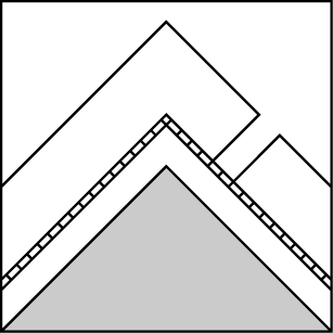
How to read the forecast
Continued snowfall allows for dangerous avalanche conditions to prevail as you gain elevation. Slopes with weak layers may produce very large and destructive avalanches capable of traveling to valley bottom. Use patience and conservative route-finding as our snowpack adjust to the new load. Be aware of overhead hazards when traveling up in elevation. Generally safer and more stable snow is found at lower elevations.

3. Considerable
?
Above 6500 ft.
2. Moderate
?
5000-6500 ft.
1. Low
?
3500-5000 ft.
- 1. Low
- 2. Moderate
- 3. Considerable
- 4. High
- 5. Extreme
-
Type ?
-
Aspect/Elevation ?

-
Likelihood ?CertainVery LikelyLikelyPossible
 Unlikely
 -
Size ?HistoricVery LargeLargeSmall

Yesterday’s snowfall of approx. 2”/ 0.3” SWE and 48-hour snowfall totals ranging 4-7”/ 0.5-0.8” SWE in the Whitefish Range have formed widespread storm slabs. These slabs are more sensitive during and in the days following a storm. Surface cracking is bulls-eye data that storm slabs are sensitive to human triggering and could fail naturally in steep, wind-loaded terrain. Evaluate storm totals and freezing levels before going into steeper terrain while avoiding lens shaped pillows.
-
Type ?
-
Aspect/Elevation ?

-
Likelihood ?CertainVery LikelyLikelyPossible
 Unlikely
 -
Size ?HistoricVery LargeLargeSmall

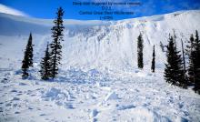
Over the past two weeks, 2 to 4 foot hard slabs formed on some slopes burying multiple rain crust and wind-stiffened slabs. These rain crust and wind slabs could harbor small grain facets that most likely formed during the roller coaster battle of warm, Pacific air and cold arctic air during our last two storms. On Tuesday night, a snowcat triggered a persistent slab avalanche along the Werner Peak road burrying the machine under 8 to 10' of debris. The snowpack is still recovering from two, back-to-back loading events and management of this problem is to avoid steep, un-supported slopes with convexities and stick to lower angle, well-supported slopes.
-
Type ?
-
Aspect/Elevation ?
-
Likelihood ?CertainVery LikelyLikelyPossible
 Unlikely
 -
Size ?HistoricVery LargeLargeSmall

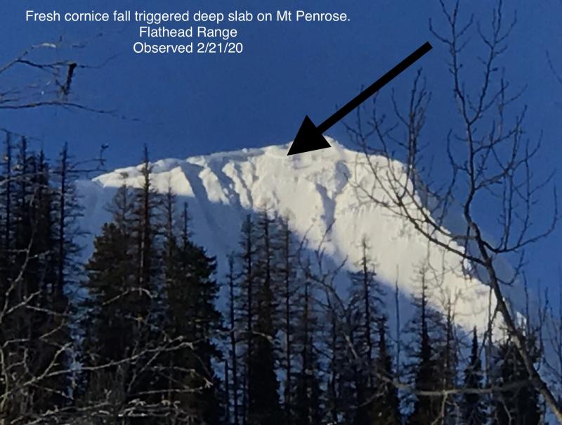
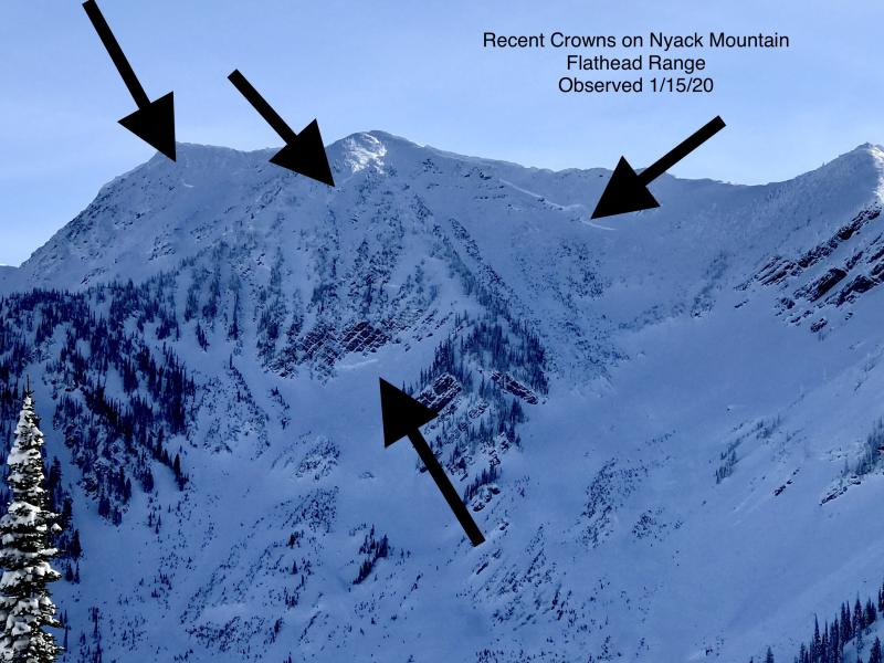
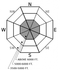
Basal facets and the Thanksgiving facet/ crust layer is now buried under an 4-6+ foot dense, hard slab. Several deep slabs, estimated 8 to 12’ thick, ran after our 6” SWE loading event earlier this week in neighbooring ranges. Nearly an inch of rain at lower elevations and close to an inch of SWE in the Whitefish Range over the past 48-hours is adding more load and stress to these lurking weak layers. These slab avalanches are capable of reaching their historic runouts and will kill anyone in them. Weak layers near the ground are most reactive on high elevation slopes with likely trigger locations near shallow areas of the overlying slab or near rock outcrops. Conservative terrain selection at upper elevations is the approach to this unpredictable, deadly problem.
Our recent storm cycle is coming to an end but not after we received another hefty snow and rain load stressing numerous buried weak layers in our snowpack. 48-hour storm totals range from 10-20”/ 2-3” SWE in the Swan and Flathead Ranges as well, southern GNP and lesser amounts along with higher rain levels in the Whitefish Range. The snowpack will need time to recover from this one-two-punch which produced several large avalanches earlier this week and I suspect that more ran yesterday and overnight.
Colder temperatures and the return to snow versus rain at lower elevations will improve the stability but make for some scary and challenging riding conditions at lower elevations. Storm slabs at mid and upper elevations will be more sensitive to human triggering and could fail naturally, especially in steep, wind-loaded terrain. Our persistent and deep persistent slab problems are still a lower likelihood, but high consequence event that is nothing to mess with. Give a wide berth when traveling around or below large, high elevations slopes as these problems behave in unpredictable and erratic ways. Treat all slopes as if they could avalanche until proven otherwise and remember that good habits save lives.
Cold front moved to our southwest overnight spurring widespread, light snowfall throughout the forecast area. At 4 am, light northwest flow is observed over northwest Montana and the focus of precipitation shifts to our south today. Weak high pressure builds over the region for Saturday and Sunday with clearing skies and cold temperatures. The next shot of precipitation arrives Sunday night with overall light accumulations expected.
This advisory applies only to backcountry areas outside established ski area boundaries. This advisory describes general avalanche conditions and local variations always occur. This advisory expires at midnight on the posted day unless otherwise noted. The information in this advisory is provided by the USDA Forest Service who is solely responsible for its content.


