| Thursday | Thursday Night | Friday | |
|---|---|---|---|
| Cloud Cover: | Snow and Rain | Snow | Snow |
| Temperatures: | 33 to 37 deg. F. | 5 to 10 deg. F. | 15 to 20 deg. F. |
| Wind Direction: | NW | NE | NE |
| Wind Speed: | 15 to 20 mph, gusting to 25 mph | 15 to 20 mph, gusting to 30 mph | 15 to 20 mph, gusting to 25 |
| Snowfall: | 2 to 4 in. | 3 to 7 in. | 1 to 2 in. |
| Snow Line: |
Whitefish Range
How to read the forecast
An Avalanche Warning is in effect for the Flathead Range and GNP and the danger is HIGH in all 3 ranges. A potent storm system funneling copious amounts of heavy snow, rain, and winds is stressing numerous weak layers that produced large avalanches earlier this week. Natural avalanches are likely and human-triggered avalanches very likely today. Some slopes have the potential to produce very destructive avalanches that could reach valley bottoms. Travel in and below avalanche terrain is not recommended.

4. High
?
Above 6500 ft.
3. Considerable
?
5000-6500 ft.
3. Considerable
?
3500-5000 ft.
- 1. Low
- 2. Moderate
- 3. Considerable
- 4. High
- 5. Extreme
-
Type ?
-
Aspect/Elevation ?

-
Likelihood ?CertainVery LikelyLikelyPossible
 Unlikely
 -
Size ?HistoricVery LargeLargeSmall

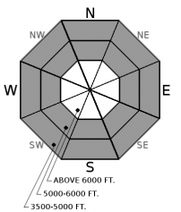
24-hour snowfall totals of 2 to 5”/ 0.3-0.6” SWE in the Whitefish Range formed widespread and reactive storm slabs overnight. Heavy snowfall is forecasted for today. These slabs will be thicker and more widespread at upper elevations or above the rain/ snow line, but will develop at mid and lower elevations as cooler temperatures arrive later today. Evaluate storm totals, wind-loading, and freezing levels. More than a foot of new snow, cracking/collapes, or recent avalanche activity are clear signs to avoid terrain traps, slopes greater than 35 degrees or lower angled slopes connected to steeper terrain above.
-
Type ?
-
Aspect/Elevation ?
-
Likelihood ?CertainVery LikelyLikelyPossible
 Unlikely
 -
Size ?HistoricVery LargeLargeSmall

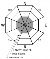
Nearly an inch of rain has saturated the snowpack at lower and mid elevations overnight. Loose wet avalanches are very likely today until cooler air arrives mid day. Slides will be larger and more frequent at mid elevations where deeper unconsolidated snow exists. Look for roller balls or pinwheels as warning signs to avoid traveling through terrain traps or on slopes steeper than 35 degrees.
-
Type ?
-
Aspect/Elevation ?
-
Likelihood ?CertainVery LikelyLikelyPossible
 Unlikely
 -
Size ?HistoricVery LargeLargeSmall

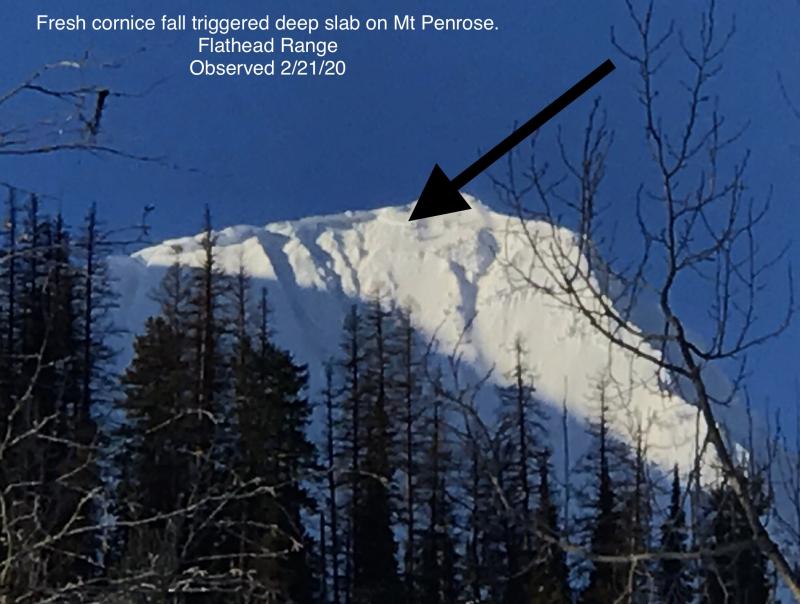
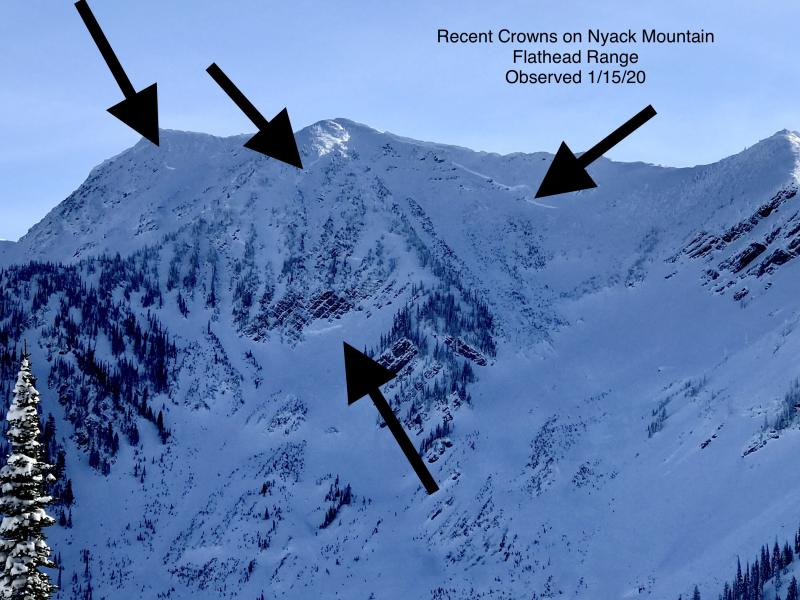
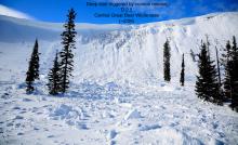
Several deep slabs, estimated 8 to 12’ thick, and persistent slabs 2 to 4’ thick ran after our last major loading event that ended on Monday (pic 1, pic 2). On Tuesday night, a snowcat triggered a persistent slab avalanche along the Werner Peak road burrying the machine under 8 to 10' of debris. These slabs are unsurvivable and are capable of reaching their historic runouts. Weak layers found in the upper snowpack and near the ground have been most reactive on high elevation slopes. Avoiding this type of terrain and runouts of alpine start zones is essential today.
The wild and dynamic weather we’ve been experiencing since mid-December continues today with another round of heavy snowfall, rain on snow, and fluctuating snow levels. Snowfall amounts overnight range from 2-5”/ 0.6” SWE in the Whitefish Range, 6”/ 1.3” SWE at Noisy Basin, and 9”/1.8” SWE at Flattop. Copious amounts of precipitation are on tap for today and tonight elevating the avalanche danger in short-order. The snowpack is still recovering from the 6” SWE loading event that ended on Monday, which produced several large and destructive avalanches.
This potent storm system brings with it a myriad of problems ranging from storm slabs, loose-wet, and deep, persistent slabs. Yet the equation is simple. Snow+wind+rain+weak layers = avalanches. Triggering a storm slab that runs fast and far could potentially step down to deeper, weaker layers contributing to very large to historic avalanches running full path. Loose-wet avalanches will exist until cooler weather arrives but could have grave consequences if you find yourself in or above terrain traps. Today is a great day to wax your skis, go to the ski area, or watch your favorite ski porn. Playing cat and mouse with avalanches is not recommended for today. Stick to slopes less than 30 degrees that aren't connected to steeper terrain above you is an easy way to avoid all of these problems today.
Warm, moist Pacific air is being funneled into northwest Montana and will collide with an arctic air mass pushing westward over the Continential Divide. The two air masses will converge today creating widespread snowfall, strong winds, and lower snow levels. Snow levels will initially be high, around 5500', then lower to valley bottoms with arrival of cooler air around mid-day Thursday. Snowfall intensity will peak Thursday afternoon and overnight with snowfall and cooler temperatures on tap for Friday. We can expect up to 15"/ 1.5-2.0" SWE in favored locations closer to the Continetial Divide by Friday morning.
This advisory applies only to backcountry areas outside established ski area boundaries. This advisory describes general avalanche conditions and local variations always occur. This advisory expires at midnight on the posted day unless otherwise noted. The information in this advisory is provided by the USDA Forest Service who is solely responsible for its content.


