| Wednesday | Wednesday Night | Thursday | |
|---|---|---|---|
| Cloud Cover: | Snowfall amplifying later today | Moderate to Heavy snowfall | Heavy snowfall |
| Temperatures: | 26 to 31 deg. F. | 21 to 26 deg. F. | 28 to 33 deg. F. |
| Wind Direction: | West | West | North |
| Wind Speed: | 5 to 15 | 5 to 15 | 10 to 20 |
| Snowfall: | 2 to 4 in. | 4 to 7 in. | 5 to 8 in. |
| Snow Line: |
Whitefish Range
Flathead Range and Glacier National Park
How to read the forecast
The avalanche danger is MODERATE today but will rise to CONSIDERABLE with the arrival of a hard-hitting storm that will increase the likelihood of human-triggered and natural avalanches. Some slopes have the potential to produce very large and destructive avalanches that can reach valley bottoms. The timing and intensity of this storm are uncertain but watch for the danger to rise later today or tonight. Default to conservative terrain choices once snowfall rates intensify.

3. Considerable
?
Above 6500 ft.
2. Moderate
?
5000-6500 ft.
2. Moderate
?
3500-5000 ft.
- 1. Low
- 2. Moderate
- 3. Considerable
- 4. High
- 5. Extreme
-
Type ?
-
Aspect/Elevation ?

-
Likelihood ?CertainVery LikelyLikelyPossible
 Unlikely
 -
Size ?HistoricVery LargeLargeSmall

2 to 3 feet of snow accumulated last week over a variety of crusts and low-density snow layers. Numerous natural slab avalanches failed over the weekend above 5,000'. On some slopes, observers are finding reactive persistent weak layers associated with these crusts, evidenced by propagating test results and lingering signs of instability. These instabilities appear to be most common closer to the Continental Divide, which saw wild temperature swings during the storm which are conducive to weak layer formation. We have limited data from other ranges. Persistent slabs are most likely to be triggered on steep, unsupported rollovers. Shooting cracks or collapses are signs of unstable snow.
-
Type ?
-
Aspect/Elevation ?
-
Likelihood ?CertainVery LikelyLikelyPossible
 Unlikely
 -
Size ?HistoricVery LargeLargeSmall

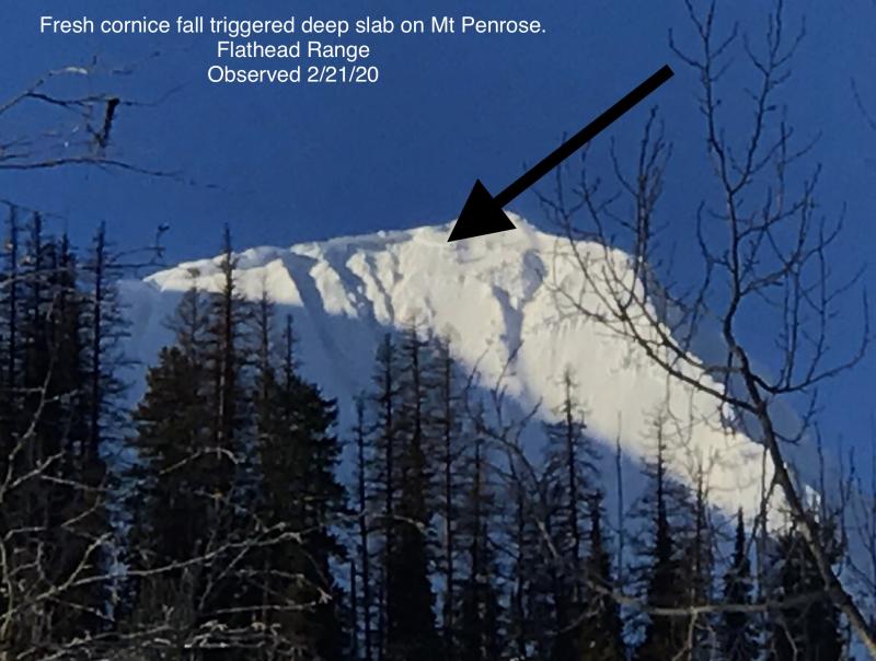
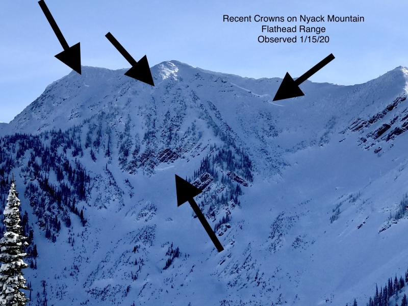
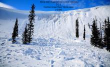
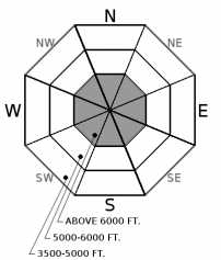
Several deep slabs, estimated 8 to 12' thick, ran earlier this week (Example A, Example B). These avalanches are unsurvivable and are capable of reaching their historic runouts. Weak layers near the ground have been most reactive on high elevation slopes with rocky or variable snow coverage. Avoid this type of terrain. Cornice falls are the most likely triggers for deep slabs. Reduce your exposure in the runouts of alpine start zones, especially once this storm ramps up.
-
Type ?
-
Aspect/Elevation ?
-
Likelihood ?CertainVery LikelyLikelyPossible
 Unlikely
 -
Size ?HistoricVery LargeLargeSmall

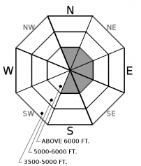
Winds have increased ahead of the next system, and are drifting recent snow into sensitive wind slabs at higher elevations behind leeward and crossloaded terrain features. These are generally small and isolated this morning but will increase in size and distribution with additional snow and wind loading forecasted for today and tonight. Monitor the weather for changing conditions. Look for blowing snow, fresh drifts, and cracking under foot or machine. Small wind slabs have potential to step down and produce larger avalanches.
Here we go again! Weather models have been struggling with handling the timing and intensity of arctic intrusions. Some models are calling for over 2" of SWE today, while the general consensus is for snowfall rates to amplify later tonight. The avalanche danger is generally Moderate at upper elevations this morning, low at lower elevations, and some hybrid of the two at mid elevations. That will change quickly once we see more than 6" of snow or intense snowfall rates. Watch for wind slabs to grow in size through the day and our next generation of storm slabs to form overnight, depending on how the weather plays out.
"This is the scariest snowpack I have seen since 2014" - words from Director Emeritus Erich Peitzch as two separate observations of huge deep slab avalanches came streaming into our observations page last night. These slides likely ran at the tail of our last storm on Sunday night/ Monday morning. We've bumped the likelihood of deep slabs back up today with the arrival of another system and changing weather. The good news: This problem isn't widespread. Thankfully it is showing us a pattern of a specific type of terrain thus far. The bad news: you will not survive a deep slab avalanche if you trigger one or find yourself in the runout zone below one. Given the disastrous consequences of a slide, it is easy to rule that type of terrain out for now and head towards the many other options.
The next weather system is knocking on the door. Winds have increased overnight, blowing 20 mph and gusting in the 30s. The arctic front is forecasted to move across the Continental Divide tonight, but models are struggling with the timing and intensity of snowfall around this event. For today, look for snowfall to favor the southern ranges, with as much as 6" to 9" on the high end. The real show kicks off tonight as the two air masses collide, similar to our Super Bowl Sunday storm. We could see more than 18" of snow in favored locations by Thursday night.
This advisory applies only to backcountry areas outside established ski area boundaries. This advisory describes general avalanche conditions and local variations always occur. This advisory expires at midnight on the posted day unless otherwise noted. The information in this advisory is provided by the USDA Forest Service who is solely responsible for its content.


