| Friday | Friday Night | Saturday | |
|---|---|---|---|
| Cloud Cover: | Snow | Snow with rain possible | Snow |
| Temperatures: | 30 to 35 deg. F. | 28 to 33 deg. F. | 25 to 30 deg. F. |
| Wind Direction: | SW | SW | W |
| Wind Speed: | 10 to 15 mph, gusting to 25 mph | 10 to 15 mph, gusting to 25 mph | 15 to 20 mph, gusting to 30 mph |
| Snowfall: | 2 to 3 in. | 3 to 5 in. | 2 to 4 in. |
| Snow Line: |
Whitefish Range
Swan Range
Flathead Range and Glacier National Park
How to read the forecast
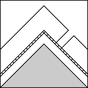
Dangerous avalanche conditions exist at upper elevations as dense snow and moderate winds form sensitive storm slabs on lower density snow. Natural or human triggered storm slabs are most likely on slopes steeper than 35 degrees at upper elevations. Additional load is stressing buried weak layers with heightened avalanche conditions at mid and lower elevations. Large and destructive upper elevation persistent slab avalanches may fail naturally and run long distances. Cautious route-finding and conservative decision making is recommended.

3. Considerable
?
Above 6500 ft.
2. Moderate
?
5000-6500 ft.
2. Moderate
?
3500-5000 ft.
- 1. Low
- 2. Moderate
- 3. Considerable
- 4. High
- 5. Extreme
-
Type ?
-
Aspect/Elevation ?

-
Likelihood ?CertainVery LikelyLikelyPossible
 Unlikely
 -
Size ?HistoricVery LargeLargeSmall

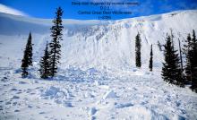
Overnight snowfall totals of 5-9” and 0.5-0.9” SWE combined with warming temperatures and moderate winds formed fresh “up-side-down” storm slabs at upper elevations. Sun or rain crust and stiff wind slabs formed earlier in the week exist below the lower density snow providing a slippery sliding surface for storm slabs. Storm slab instabilities will be easily triggered from the weight of a skier or rider, or fail naturally. Anticipate these slabs running fast and far while becoming thicker and more widespread throughout the day. Evaluate storm totals, wind-loading, and test small slopes before going into steeper terrain. Watch for cracking in new snow and avoid lens shaped pillows.
-
Type ?
-
Aspect/Elevation ?
-
Likelihood ?CertainVery LikelyLikelyPossible
 Unlikely
 -
Size ?HistoricVery LargeLargeSmall

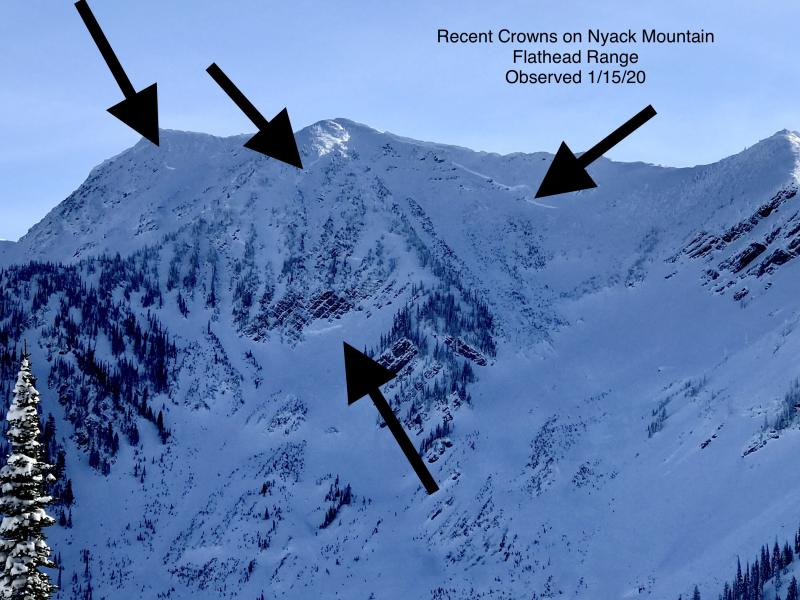
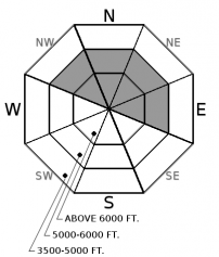
Persistent weak layers such as surface hoar and crust with large facets are found 2 to 4 feet deep on some slopes. Several destructive avalanches occurred last week in the Flathead Range and stability test continue to provide confirmation this stubborn problem still exist. Feedback from the snowpack has been limited and distribution is highly variable. This problem has become more difficult to trigger as the overlying slab stiffens and snowpack settles. The potential for lurking weak layers to reactivate is possible as we enter another loading event. Avoid an encounter with these large and destructive persistent slab avalanches by avoiding steep, un-supported slopes with convexities while sticking to lower angle, well-supported slopes.
-
Type ?
-
Aspect/Elevation ?
-
Likelihood ?CertainVery LikelyLikelyPossible
 Unlikely
 -
Size ?HistoricVery LargeLargeSmall

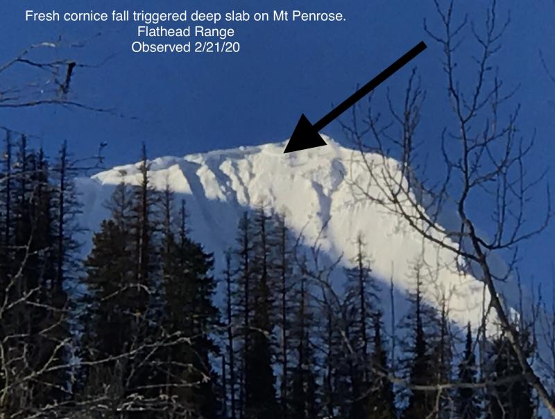
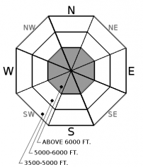
Basal facets and the Thanksgiving facet/ crust layer is buried under a 5 foot dense, hard slab. A skier on Tuesday intentionally triggered a deep slab avalanche in the Flathead Range from kicking a cornice and yesterday, we received a report of a large natural avalanche in the Swan Range that failed when a large piece of cornice failed from Monday’s warm temperatures. These are both in-your-face observations that our deep persistent slab problem has not gone to bed and is still found on some slopes. Likely trigger locations are found in shallow areas of the overlying slab, near rock outcrops, or when a massive cornice fails naturally. Conservative terrain selection at upper elevations is the best way to manage this unpredictable, deadly problem. Slopes with deep, uniform snow cover or lower slope angles are your best options.
24-hour snowfall totals range from 5-9”/ 0.5-0.9” SWE in Whitefish Range, 7”/ 0.7” at Noisy Basin, 2”/ 0.2” SWE in Flathead Range, and 5”/ 0.9” at Flattop in GNP. New snow combined with rising freezing levels today and moderate to strong winds, expect increasing avalanche hazard overnight and into the weekend. Some uncertainty exist around freezing levels and arrival of cold air from Canada so a mix bag of precipitation is possible.
So what have we learned from major loading events this season? Each one has produced several large and deadly avalanches whether it’s a Usain Bolt sprint to another gold medal or a slow and methodical Boston Marathon pace loading event. Initial impacts from our current storm will be improved riding conditions, but as snow depths increase storm slabs will be easier to initiate from the weight of a skier or rider. Then at some point, our complex snowpack and buried persistent weak layers won’t be able to support this new load. Our persistent and deep slab problems continue to rear their ugly head in erratic fashion and this warrants patience when traveling in the mountains over the next several days. Don’t be lured into complacency and treat all slopes as if they could avalanche until proven otherwise. Good habits save lives so make a plan, expose only one person at a time on the slopes, and get out of the way at the bottom. The mountains aren’t going anywhere, nor should you.
A moist northwest flow along with continued snowfall and rising snow levels can be expected today. Snow level is forecasted to rise to 4000' today and then lower for the remainder of the weekend. A shortwave passes to our north on Saturday with cold arctic air from Canada advancing into northwest Montana setting up for an excellent snow maker over the weekend. Forecast snowfall totals are hinting at 1-2' and 1-2" of SWE by Sunday.
This advisory applies only to backcountry areas outside established ski area boundaries. This advisory describes general avalanche conditions and local variations always occur. This advisory expires at midnight on the posted day unless otherwise noted. The information in this advisory is provided by the USDA Forest Service who is solely responsible for its content.


