| Thursday | Thursday Night | Friday | |
|---|---|---|---|
| Cloud Cover: | Snow showers | Snow | Snow |
| Temperatures: | 25 to 30 deg. F. | 15 to 20 deg. F. | 20 to 25 deg. F. |
| Wind Direction: | SW | SW | W |
| Wind Speed: | 10 to 15 mph, gusting 25 mph | 10 to 15 mph, gusting 20 mph | 10 to 15 mph, gusting 20 mph |
| Snowfall: | 1 to 2 in. | 2 to 4 in. | 1 to 3 in. |
| Snow Line: |
Whitefish Range
Flathead Range and Glacier National Park
How to read the forecast
Dangerous avalanche conditions exist as dense snow and strong winds formed sensitive storm slabs stressing buried weak layers. Natural or human triggered storm slabs are most likely on slopes steeper than 35 degrees at mid and upper elevations. Diligent snowpack evaluation and cautious route-finding are essential in managing our complex snowpack. Generally safer conditions are found at lower elevations.

3. Considerable
?
Above 6500 ft.
3. Considerable
?
5000-6500 ft.
2. Moderate
?
3500-5000 ft.
- 1. Low
- 2. Moderate
- 3. Considerable
- 4. High
- 5. Extreme
-
Type ?
-
Aspect/Elevation ?

-
Likelihood ?CertainVery LikelyLikelyPossible
 Unlikely
 -
Size ?HistoricVery LargeLargeSmall

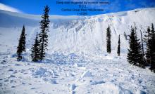
48-hour snowfall totals of 8-12” and 1-2” SWE combined with strong winds have formed fresh storm slabs at mid and upper elevations. Human triggering of storm slabs is likely today with slabs sitting above a variety of surfaces such as a stout rain or rime crust, low density snow, and sun crust. Yesterday, I found these slabs to be stubborn in the southern Whitefish Range but the WMR patrol was able to get foot plus slabs to run fast and far with explosive work. Evaluate storm totals, wind-loading, and test small slopes before going into steeper terrain while anticipating thicker slabs at upper elevations on leeward features and gullies. Watch for cracking in new snow and avoid lens shaped pillows.
-
Type ?
-
Aspect/Elevation ?

-
Likelihood ?CertainVery LikelyLikelyPossible
 Unlikely
 -
Size ?HistoricVery LargeLargeSmall

Our persistent slab problem has been quiet for over a week, but stability test continue to point at this problem being reactive. Multiple buried rain and sun crust with weak, faceted snow exist on some slopes as well as buried surface hoar (video). Dense snow and strong winds are stressing these buried weak layers making natural persistent slab avalanches possible today. Likely trigger locations are where the slab is thinnest or near rock outcrops. Be on the look-out for warning signs of instability such as shooting cracks or audible collapses. This complex problem exist as long as our poor snowpack structure lingers. Digging is the only way to determine if a slope harbors these weak layers and when in doubt, stick to low angle slopes with less consequential terrain.
-
Type ?
-
Aspect/Elevation ?
-
Likelihood ?CertainVery LikelyLikelyPossible
 Unlikely
 -
Size ?HistoricVery LargeLargeSmall

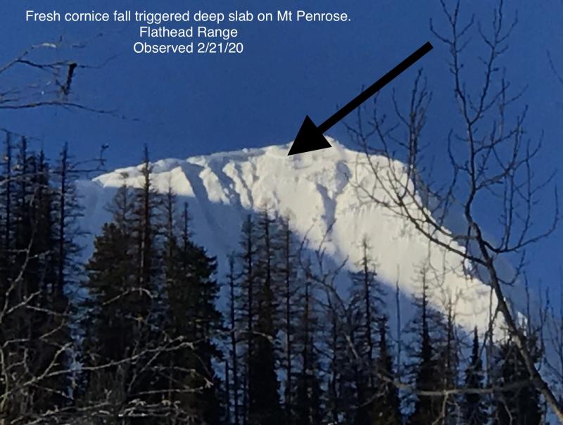
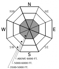
Deep slab avalanches breaking on weak facets (video) near the ground or above faceted crust are a low likelihood but high consequence concern in the Flathead and northern Whitefish Ranges. Whether or not our current loading event is enough to reactivate these buried weak layers is the million dollar question, but I’m not going “all in” against the house on this hand. Deep slabs are most likely to be triggered on upper elevation slopes containing variable snow depths and rocky terrain. They can be remotely triggered from shallower areas on adjacent slopes and below steep terrain. Snowpack assessment for deep weak layers is challenging and careful terrain selection is very important.
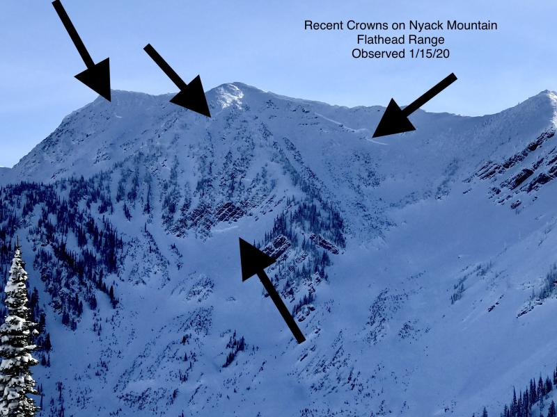
48-hour snowfall amounts of 12”/ 2” SWE at Big Mountain, 7-9”/ 1-1.2” in the northern Whitefish Range, 8”/ 1.7” at Noisy Basin, and 11”/ 1.4” at Flattop combined with strong winds have formed cohesive slabs stressing buried weak layers in our variable snowpack. Since mid-December, each major loading event has produced natural avalanches and we’ve received multiple reports of human triggered avalanches. Although this loading event is not the largest load we’ve seen this season, it has come in warm and fast. Snow has a difficult time adjusting to rapid loads and this storm is no different.
Recent observations of propagating stability test and skier triggered storm slabs point to instabilities being easy to trigger or possibly fail naturally. Reactive storm slabs are likely at mid and upper elevations and in wind-loaded slopes and gullies. Use small test slopes to evaluate new snow bonding to slick rain, rime, or sun crust and low density snow before going into steeper terrain.
Human triggered persistent slab avalanches become less likely as time passes and signs of instability can be limited to non-existent. Persistent slabs are erratic/ unpredictable and require digging to determine their existence. Managing this uncertainty is the greatest challenge of a persistent slab problem. Give a wide buffer around steeper terrain while avoiding terrain traps. Treat every slope as if it could slide and carefully evaluate the snowpack. When stability is in question, choose low angle terrain.
At 4 am, a cold front is positioned north to south from the Idaho panhandle to northern California with southwest flow aloft and light precipitation to our west. A cold front is expected to bring another round of precipitation to northwest Montana today with gusty southwest winds at mid to upper elevations. A shortwave will move through the central Rockies today and overnight bringing moderate snowfall accumulations to our area. We can anticipate 6-10" of snow and 0.5-0.75" SWE by Friday afternoon with an active pattern throught the weekend.
This advisory applies only to backcountry areas outside established ski area boundaries. This advisory describes general avalanche conditions and local variations always occur. This advisory expires at midnight on the posted day unless otherwise noted. The information in this advisory is provided by the USDA Forest Service who is solely responsible for its content.


