| Sunday | Sunday Night | Monday | |
|---|---|---|---|
| Cloud Cover: | Partly sunny and cold. | Mostly cloudy and cold. | Mostly cloudy and cold. |
| Temperatures: | 5 to 10 deg. F. | -5 to 0 deg. F. | 5 to 10 deg. F. |
| Wind Direction: | southwest | East | Northeast |
| Wind Speed: | 0 to 10 mph with gusts to 20 | 5 to 10 mph | 0 to 10 mph |
| Snowfall: | 0 in. | 0 in. | 0-1 in. |
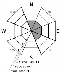
| Snow Line: |
Whitefish Range
Swan Range
Flathead Range and Glacier National Park
How to read the forecast
Recent dry weather has helped our snowpack adjust to the substantial load deposited earlier in the week. Unfortunately, a weak snowpack structure remains with human triggered slides possible resulting in large and destructive avalanches. Given the serious consequences of triggering a Persistent Slab, carefully evaluate the snow structure and terrain.

2. Moderate
?
Above 6500 ft.
2. Moderate
?
5000-6500 ft.
2. Moderate
?
3500-5000 ft.
- 1. Low
- 2. Moderate
- 3. Considerable
- 4. High
- 5. Extreme
-
Type ?
-
Aspect/Elevation ?

-
Likelihood ?CertainVery LikelyLikelyPossible
 Unlikely
 -
Size ?HistoricVery LargeLargeSmall

Earlier this week, 2 to 4 foot slabs formed on weak layers such as facets, surface hoar and low density snow at all elevations and aspects. These persistent slabs are benefiting from recent dry weather and are not as reactive as earlier in the week. Despite becoming more stubborn, a human triggered slide is still possible with resulting slides large and destructive. Dangerous avalanche conditions remain with careful snowpack evaluation, cautious route finding and conservative decision making essential. Terrain management is the easiest and safest way to answer this complex problem.
-
Type ?
-
Aspect/Elevation ?

-
Likelihood ?CertainVery LikelyLikelyPossible
 Unlikely
 -
Size ?HistoricVery LargeLargeSmall

Over the past 48 hours light westerly winds have transported up to a foot of low density snow onto leeward and crossloaded slopes in wind loaded slabs. These slabs are thin but have been formed on weak snow and may be sensitive to human triggering. A wind slab avalanche has the ability to step down into the snowpack triggering a larger persistent slab. These fresh slabs are easy to detect by the cracking in the snow surface beneath your skis or machine. Look for pillows of snow below ridgelines and in gullies.
As the drying trend continues our snowpack is exhibiting fewer signs of instability. Earlier in the week, it was relatively easy to identify shooting cracks (photo1 photo 2), collapsing (photo) and even trigger avalanches. Unfortunately our snowpack remains weak (photo) and may become reactive when the next load is put on it. That could be potential new snow later in the week or it could be you or your partner today resulting in large and destructive slides. With wonderful powder conditions at all elevations and the holiday season upon us it is easy to get caught up in the moment. However, Given the serious consequences of triggering a Persistent Slab, carefully evaluate the snow structure and terrain.
Join us at Stumptown Snowboards in Whitefish on January 3 at 7:00 pm for a free, engaging, and entertaining 1 hour avalanche awareness presentation. Details here.
Dry arctic air is firmly entrenched over our area producing some of the coldest temperatures of the season this morning. Westerly winds are light with partly cloudy skies and no new snow in the past 24 hours. A storm enters Western Montana late tonight but most of the energy will go south of our area producing just an inch or two of snow on Christmas Day.
This advisory applies only to backcountry areas outside established ski area boundaries. This advisory describes general avalanche conditions and local variations always occur. This advisory expires at midnight on the posted day unless otherwise noted. The information in this advisory is provided by the USDA Forest Service who is solely responsible for its content.


