| Friday | Friday Night | Saturday | |
|---|---|---|---|
| Cloud Cover: | Cloudy with snow, moderate winds, and strong gusts starting mid-day. | Continued snowfall, light winds, and moderate gusts. | Snow decreasing throughout the day. |
| Temperatures: | 25-30 deg. F. | 13-18 deg. F. | 20-25 deg. F. |
| Wind Direction: | Southwest -> West | West | West |
| Wind Speed: | 10-20 mph, gusts 26 mph. | 5-10 mph, gusts 17 | 0-5 mph |
| Snowfall: | 1-2 in. | 3-5 in. | 0-1 in. |
| Snow Line: |
Whitefish Range
Swan Range
Flathead Range and Glacier National Park
How to read the forecast
Expect increasing avalanche hazard over the next 24 hours with the arrival of new snow and strong west winds. For today, avalanche danger is LOW at lower/ mid elevations and will rise to MODERATE at upper elevations. Keep your head up for isolated areas of unstable, loose dry snow on steep, shady aspects and watch for fresh slab formation in windloaded features. Evaluate the addition of new snow to our snowpack before committing to a slope.

2. Moderate
?
Above 6500 ft.
1. Low
?
5000-6500 ft.
1. Low
?
3500-5000 ft.
- 1. Low
- 2. Moderate
- 3. Considerable
- 4. High
- 5. Extreme
-
Type ?
-
Aspect/Elevation ?
-
Likelihood ?CertainVery LikelyLikelyPossible
 Unlikely
 -
Size ?HistoricVery LargeLargeSmall

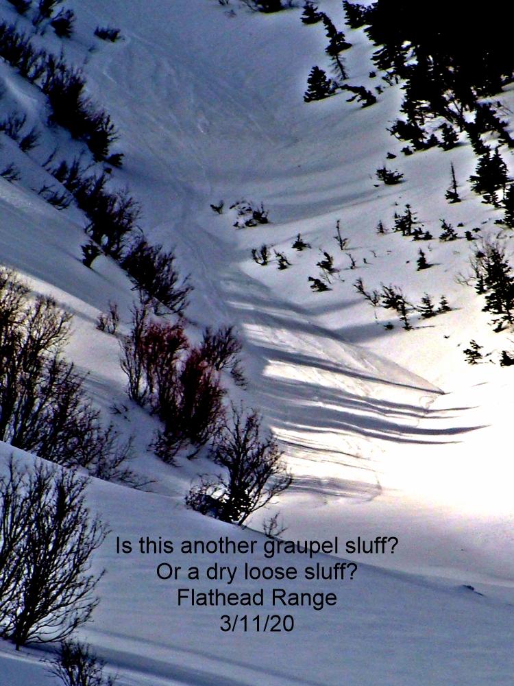
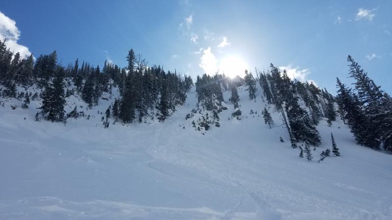
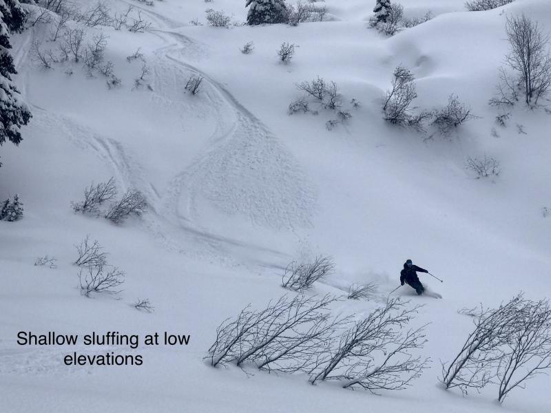
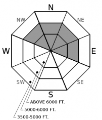
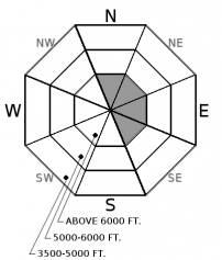
The upper 6-12” of snow has become cohesionless and weak during our recent dry spell. The weight of a skier or rider can easily trigger a loose dry or point release “sluff” avalanche. Loose dry avalanches will be isolated to shady, wind protected slopes steeper than 40 degrees at mid to upper elevations. These slides are generally small and harmless but can run fast and far in steep, consequential terrain. Use small test slopes to evaluate the ease of initiating a loose dry avalanche where weak, sugary snow sits on top of a slick rain crust before committing to bigger terrain.
-
Type ?
-
Aspect/Elevation ?
-
Likelihood ?CertainVery LikelyLikelyPossible
 Unlikely
 -
Size ?HistoricVery LargeLargeSmall

With the arrival of snow and strong winds this afternoon, anticipate wind slabs to form on leeward and cross loaded slopes that benefit from southwest to west winds. Wind slabs will initially be small and isolated to upper elevations or extreme terrain, but could increase in distribution and depth with additional snowfall and wind. Look for rounded pillows of snow near ridgelines and recognize signs of instability such as cracking in the surface snow.
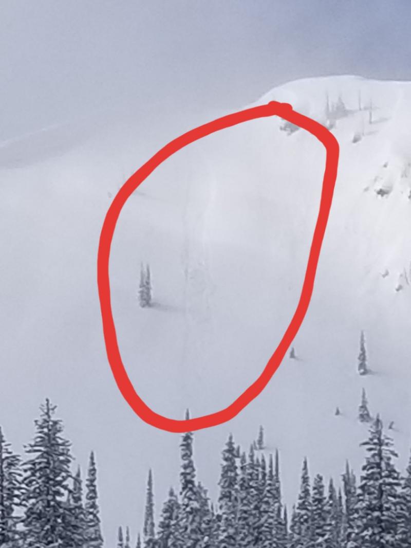
The top 6-12” of our snowpack consist of weak, cohesionless facets (observation) found in shaded, wind sheltered terrain sitting above a slick rain crust. Observers yesterday (observation) noted loose dry avalanches or sluffs running fast and far with potentially grave consequences (observation) if occurring in the wrong terrain; especially if they drag you into trees, rocks, or over cliffs.
With the possibility of 7-11” of new snowfall and strong winds over the next 24 hours, the old weak and cohesionless snow surface is our next weak layer once buried. This is not the time to let your guard down so evaluate each slope carefully and pay attention to changes at the snow surface such as lens shaped drifts, dense surface snow, or surface cracking. Travel one at a time in avalanche terrain and always carry rescue gear.
Thanks to everyone for submitting observations as this helps make our community safer.
A much anticipated change in our weather pattern arrives today. Our next storm system and associated cold front are positioned off the Washington coast at 4 am and forecasted to arrive in northwest Montana by mid-day Friday. Moisture and strong southwest to west winds with gust of 40+ mph will accompany arrival of the cold front. Anticipate widespread snowfall throughout the mountains later today with highest snowfall amounts occurring Friday night. We can expect 7-11" by Saturday morning with snowfall tapering throughout the day on Saturday. Another storm is forecasted for Sunday into Monday.
This advisory applies only to backcountry areas outside established ski area boundaries. This advisory describes general avalanche conditions and local variations always occur. This advisory expires at midnight on the posted day unless otherwise noted. The information in this advisory is provided by the USDA Forest Service who is solely responsible for its content.


