

THIS AVALANCHE FORECAST EXPIRED ON December 7, 2017 @ 9:04 pmAvalanche Forecast published on December 4, 2017 @ 9:04 am
Issued by
Zach Guy - Flathead Avalanche Center
Whitefish Range
Swan Range
Flathead Range and Glacier National Park
How to read the forecast
Early Season Snowpack Update: Recent snowfall has brought improved riding conditions at upper elevations, but isolated instabilities may exist as you climb into wind affected terrain. Watch for shallow wind slabs on steep, wind-loaded slopes where the consequences of a slide could be dangerous. Stability will continue to improve over the course of the week under a stagnant weather pattern. The FAC will begin daily forecasts on December 9th.

No Rating
?
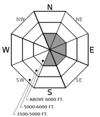
Above 6500 ft.
No Rating
?
5000-6500 ft.
No Rating
?
3500-5000 ft.
Avalanche Problem 1: Wind Slab
-
Type ?

-
Aspect/Elevation ?
-
Likelihood ?CertainVery LikelyLikelyPossible
 Unlikely
 -
Size ?HistoricVery LargeLargeSmall

Upwards of a foot of new snow has accumulated in the past week, accompanied by winds that shifted from the southwest to northwest. This formed reactive slabs of wind drifted snow up to 18" thick over a buried rain crust (see this observation) or on mid storm layers (such as this observation). Wind slabs will become increasingly stubborn under our stable weather pattern this week, but the consequences of getting dragged over rocks, cliffs, or into the trees warrants caution if you are traveling in alpine terrain. Give the fresh snow time to heal by steering around lens shaped pillows of drifted snow in gullies or below leeward ridgelines, and look for cracking snow to clue you in to potential instabilities.


Forecast discussion
Settled storm totals over the past week range from 12" in the Northern Whitefish Range to 10" in the Swan Range to 5" in the far eastern edge of the Flathead/GNP. This snow accumulated over a thick, strong crust from our Thanksgiving rain event. Over the weekend, observers in Jewel Basin, Spider Bowl, and at Big Mountain reported few signs of instability in wind protected areas, thanks to gradual loading over non-persistent weak layers. We can expect generally stable conditions to carry through the rest of the week under stagnant high pressure. The lurking exceptions are those high elevation, wind loaded slopes that may need a little more time to adjust. Keep an eye for fresh drifting if winds exceed forecasted levels. If you are traveling in consequential terrain, it is also worth monitoring very steep, sun-baked slopes for the threat of small, wet loose avalanches as the combination of solar input and warming temperatures may be enough to tip the scales. Look for rollerballs on sunny slopes to identify decreasing stability (such as this observation).
Thanks to everyone who submitted observations this weekend! We will start daily avalanche advisories and danger ratings next weekend.
Weather and CURRENT CONDITIONS
weather summary
It's time to dig out the sunscreen from your storage closet! A strong high pressure ridge will build over the West Coast this week, bringing a clear and dry weather pattern to NW Montana. Mountain temperatures will peak in the 20s early this week and will gradually climb into the low 30s under a gradual warming trend. Winds will ease to single digits speeds and sunshine will be abundant. Valley inversions will strengthen over the course of the week.
Disclaimer
This advisory applies only to backcountry areas outside established ski area boundaries. This advisory describes general avalanche conditions and local variations always occur. This advisory expires at midnight on the posted day unless otherwise noted. The information in this advisory is provided by the USDA Forest Service who is solely responsible for its content.
Search
Follow or Subscribe


In Partnership With

In Partnership With
