

Avalanche Forecast published on November 19, 2017 @ 7:53 am
Issued by
Zach Guy - Flathead Avalanche Center
Whitefish Range
Swan Range
Flathead Range and Glacier National Park
How to read the forecast
Early Season Snowpack Update: Dangerous avalanche conditions will be developing at mid to upper elevations over the next several days as heavy precipitation, intense winds, and rising freezing levels take aim on Northwest Montana. Natural avalanche activity will increase as this system evolves. Backcountry travelers should expect rapidly changing conditions and avoid traveling on or below steep avalanche terrain, especially in terrain receiving intense windloading or rain on snow.

No Rating
?
Above 6500 ft.
No Rating
?
5000-6500 ft.
No Rating
?
3500-5000 ft.
Avalanche Problem 1: Storm Slab
-
Type ?
-
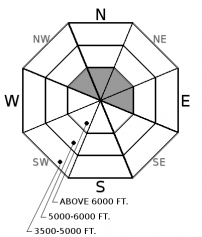
Aspect/Elevation ?
-
Size ?HistoricVery LargeLargeSmall

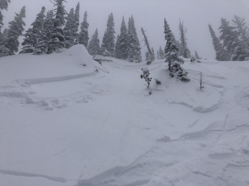
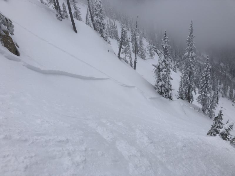
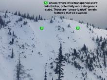
5-10" of relatively dense new snow is forecasted for Monday, with potential for even higher snow totals in the Swan Range. Southest winds will be gusting into the 50's, making fresh storm slabs larger and more sensitive in wind affected terrain. Monitor how well the new snow is bonding to older surfaces and avoid windloaded slopes.


Avalanche Problem 2: Persistent Slab
-
Type ?

-
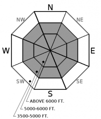
Aspect/Elevation ?
-
Size ?HistoricVery LargeLargeSmall
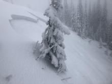
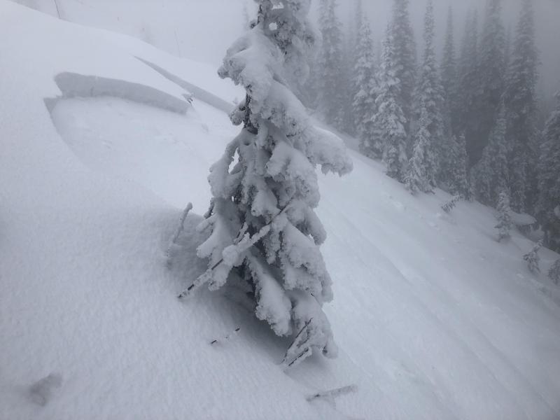
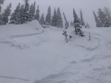
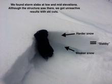
Intense wind loading on Monday followed by rain on snow later in the week will be adding weight to a crust/facet layer that is lurking near the ground on some high elevation, northerly aspects (see this observation). Avalanches will have potential to fail on these layers, releasing a surprisingly large persistent slab up to 3 or 4 feet thick. You can reduce your risk to this dangerous problem by traveling on lower angled terrain during this rapid loading event.


Avalanche Problem 3: Loose Wet
-
Type ?

-
Aspect/Elevation ?
-
Size ?HistoricVery LargeLargeSmall
Freezing levels will rise to over 8,000 feet by Wednesday morning, and more than an inch of rainfall by Thanksgiving day will be saturating the upper snowpack. Expect wet loose avalanches to run naturally out of steep terrain as temperatures warm over the next few days. These could become large enough to injure or bury you, so be mindful of your overhead hazards.


Forecast discussion
Due to early season coverage and limited operational resources for this time of year, we are not issuing danger ratings and daily advisories yet. However, we are staring down the barrel of our first significant avalanche cycle of our season this week. Heavy snow and wind loading will offer a preview of the action on Monday, but the feature presentation gets rolling on Wednesday with rain on snow coming to all elevations. This warm and soggy system will be a shock to our dry snowpack that has been developing all of November. Keep your overhead hazards in mind if you are venturing into the backcountry this week.
Weather and CURRENT CONDITIONS
weather summary
The jet stream is tapping into sub-tropical moisture to bring an exciting change to our weather pattern. Warm, wet, and windy sums it up the next week pretty well. Look for 5-10" of relatively dense new snow to accumulate by Monday evening, with up to 15" in the Swan Range. The snow level will start around 4,000 feet today, but will spike to 8,000+ feet by Wednesday, bringing rain on snow to all elevations through Thanksgiving. Southwest winds will prevail through the first half of the week, gusting into the 50's at alpine locations on Monday and ramping up again on Tuesday evening.
Disclaimer
This advisory applies only to backcountry areas outside established ski area boundaries. This advisory describes general avalanche conditions and local variations always occur. This advisory expires at midnight on the posted day unless otherwise noted. The information in this advisory is provided by the USDA Forest Service who is solely responsible for its content.
Search
Follow or Subscribe


In Partnership With

In Partnership With
