THIS AVALANCHE FORECAST EXPIRED ON April 6, 2017 @ 12:00 am
Avalanche Forecast published on April 5, 2017 @ 7:00 am
Issued by Seth Carbonari - Flathead National Forest

Whitefish Range
Swan Range
Flathead Range and Glacier National Park

How to read the forecast

Warm temperatures and clouds are forecasted for today. The avalanche danger will be LOW today at all elevations.  The danger may rise to MODERATE if the sun does break through. Warm temperatures may weaken the surface snow, making it possible to trigger a loose wet avalanche. Pay attention to changing conditions.  If the sun does make an appearance, expect it to enhance the impacts of the warm temperatures leading to increased instability.


1. Low

?

Above 6500 ft.
Generally safe avalanche conditions. Watch for unstable snow on isolated terrain features.

1. Low

?

5000-6500 ft.
Generally safe avalanche conditions. Watch for unstable snow on isolated terrain features.

1. Low

?

3500-5000 ft.
Generally safe avalanche conditions. Watch for unstable snow on isolated terrain features.
    Generally safe avalanche conditions. Watch for unstable snow on isolated terrain features.
  • 1. Low
  • 2. Moderate
  • 3. Considerable
  • 4. High
  • 5. Extreme
Avalanche Problem 1: Loose Wet
  • Type ?
  • Aspect/Elevation ?
  • Likelihood ?
    Certain
    Very Likely
    Likely
    Possible
    Unlikely
  • Size ?
    Historic
    Very Large
    Large
    Small

Temperatures aren't starting as cool today as yesterday and will rise to above freezing at all elevations.  The avalanche danger will increase through the day with the impacts of the warming.  Forecasted cloud cover should lessen the impacts of the sun, but watch for changing conditions.  If the sun does break through, it will quickly warm the surface snow and increase the avalanche danger. Watch for loose wet avalanches initiating on steep slopes near rocks and trees. Pay attention to how the surface snow is changing today. Snow sticking to your skis/skins and snowmobiles are signs that the snow surface is starting to become unstable. If you start seeing rollerballs and/or natural wet loose avalanche activity, move to more shaded terrain.

Avalanche Problem 2: Cornice
  • Type ?
  • Aspect/Elevation ?
  • Likelihood ?
    Certain
    Very Likely
    Likely
    Possible
    Unlikely
  • Size ?
    Historic
    Very Large
    Large
    Small

Mammoth cornices exist along many of the ridgelines across the advisory area. Warming temperatures will weaken these features and it is best to give them a wide berth. Be aware that cornices can break farther back on the windward side of the ridge than you might expect. Also keep in mind that falling cornices can trigger avalanches on the slopes beneath them. Avoid travelling on slopes underneath cornices.

Forecast discussion

Winds over the past few days have been light and variable and with warm daytime temperatures and heavier surface snow, the amount of blowing snow has been minimal. However, there may be some reactive wind slabs lurking up in the alpine terrain, especially on the more shaded aspects. Look for signs of wind drifted snow such as rounded pillows on leeward slopes if you're travelling above 6000 feet elevation today. Carefully evaluate any terrain where you find a cohesive slab and avoid slopes where you see the tell-tale signs of instability such as shooting cracks or recent avalanche activity.

Glide cracks have been opening up in many locations. Glide avalanches are notoriously unpredictable and it is best to avoid travelling on or beneath slopes where glide cracks are present. 

The last daily avalanche advisory of the season will be Sunday, April 9.

recent observations

Tuesday: FAC Staff toured the Skookaleel Ridge area in the Southern Whitefish Range.  Sunshine was abundant and warming the 1 to 2 inches of new snow above the crust on solar aspects.  The surface snow in shaded areas and non-solar aspects was not impacted.  The crust at the surface varied considerably in strength and thickness.  Stronger and thicker on slopes exposed to the sun and thinner and weaker on non-solar aspects

Monday: Skiers on Elk Mountain in southern Glacier Park found about 4 inches of new snow on top of a supportable crust at 7000 feet and noted that wind-loading was minimal. They conducted an extended column test in a snowpit at 6700 feet on a WSW aspect and did not get full propagation on any layer.

Sunday: FAC staff visited Skiumah Creek, in the Flathead Range where they noted old, large and impressive wet avalanche debris piles. The snow surface at low and mid elevations was moist and unsupportable on skis throughout the day. New snow that fell during the tour was being transported at all elevations by strong wind gusts.  

See below for all observations this season.

Weather and CURRENT CONDITIONS
weather summary

Tuesday started with cool temperatures but quickly warmed with copious sunshine.   As of 6:00 am this morning, mountain temperatures range from 26 to 31º F. Winds are 2-15 mph gusting to 24 mph out of the south to southwest. Today, expect a warm spring day with mostly cloudy skies and warm temperatures. Temperatures may climb into the low 50s °F below 5000 feet elevation and into the mid 40s °F above this. Winds should be light, blowing mostly from the southwest.

Today’s weather observations near 6000 feet in the region
0600 temperature: 26 to 31 deg. F.
Max. temperature in the last 24 hours: 28 to 40 deg. F.
Average wind direction during the last 24 hours: Southwest
Average wind speed during the last 24 hours: 2-18 mph
Maximum wind gust in the last 24 hours: 2-26 mph
New snowfall in the last 24 hours: 0 inches
Total snow depth: 84-126 inches
Two-Day Mountain Weather Forecast Produced in partnership with the Missoula NWS
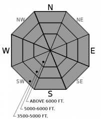
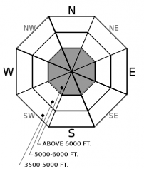
For 5000 ft. to 7000 ft.
Wednesday Wednesday Night Thursday
Cloud Cover: Warm and mostly cloudy Partly cloudy Warm and mostly cloudy
Temperatures: 39 to 52 deg. F. 27 to 36 deg. F. 43 to 57 deg. F.
Wind Direction: southwest south south
Wind Speed: 7-9 with gusts to 20 mph 6-7 mph 7-9 mph
Snowfall: 0 in. 0 in. 0 in.
Snow Line:
Disclaimer

This advisory applies only to backcountry areas outside established ski area boundaries. This advisory describes general avalanche conditions and local variations always occur. This advisory expires at midnight on the posted day unless otherwise noted. The information in this advisory is provided by the USDA Forest Service who is solely responsible for its content.