| Tuesday | Tuesday Night | Wednesday | |
|---|---|---|---|
| Cloud Cover: | Overcast skies and warming temperatures throughout the day | Showers beginning in the evening | Showers tapering and warming temperatures |
| Temperatures: | 35-49 deg. F. | 22-33 deg. F. | 35-51 deg. F. |
| Wind Direction: | East | South | Southwest |
| Wind Speed: | 5-8 mph | 5-8 mph | 10 mph with gusts up to 25 mph |
| Snowfall: | 0 in. | 0 in. | 0 in. |
| Snow Line: |
Whitefish Range
Swan Range
Flathead Range and Glacier National Park
How to read the forecast
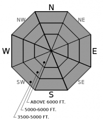
The avalanche danger is LOW at all elevations today, but will increase this evening. Despite cloud cover today, rising temperatures and a bit of rain this evening will create the potential for triggering a loose, wet avalanche. Be aware of changing conditions today. Expect the avalanche danger to rise rapidly this evening into tonight as rain moves into the area. LOW danger does not mean no danger. Practice appropriate avalanche travel techniques.

1. Low
?
Above 6500 ft.
1. Low
?
5000-6500 ft.
1. Low
?
3500-5000 ft.
- 1. Low
- 2. Moderate
- 3. Considerable
- 4. High
- 5. Extreme
-
Type ?
-
Aspect/Elevation ?

-
Likelihood ?CertainVery LikelyLikelyPossible
 Unlikely
 -
Size ?HistoricVery LargeLargeSmall

Recent rain and refreezing has sculpted our upper snowpack into a strong supportable crust. During the day, the surface softens with warming temperatures and direct sunlight. Overnight, the snow surface has been re-freezing. Last night, most locations experienced a refreeze. As the day progresses, daytime warming will increase the loose, wet danger at all elevations beginning at lower elevations. However, cloud cover will limit this wet, loose avalanche activity in size and distribution. As precipitation arrives in our advisory area this evening, expect the avalanche danger to rise rapidly. Be aware of deteriorating surface snow conditions, and avoid slopes as they soften and can't support the weight of a skier or machine.
Over the past week, we've seen the variability of spring weather in the mountains. We observed large natural avalanches last Tueday-Wednesday (3/14-3/15) and Saturday (3/18) sliding on the Feb. 10 crust associated with rain storms. The Feb. 10 crust has weak sugary snow (facets) sitting on top of it in many locations and, although buried up to 4 feet deep, may continue to pose future issues. Use snowpits to continue to assess the recent, substantial load sitting atop the Feb. 10 crust. When we dig into our current snowpack, it tells a story of past powder days, a bit of wind, a whole lot of rain, and some clear temperature shifts. Each of these events that slowly shaped our snowpack throughout the season can come into play within one single day during the spring. Awareness of rapidly changing conditions is vital while enjoying the longer spring days in the mountains.
Monday: FAC staff traveled to the the Red Meadow area in the northern Whitefish Range. The surface snow moistened throughout the day, but no wet snow instability was observed. They also noted glide crack formation on some slopes.
Sunday: FAC staff traveled to Cascadilla Creek in the Flathead Range where they noted numerous large avalanches that occurred during the March 15 wam rain event. In the morning the snow surface was unsupportable at low elevations and by early afternoon the sun had broken down the thin surface crust on sunny aspects at mid elevations making the surface unsupportable. FAC Staff also toured to Skook Ridge in the southern Whitefish Range where they found a strong supportable surface crust on all aspects. This crust was noticeably thicker on sunny aspects and the light winds kept the surface firm through most of the day. Skiers on Elk Mountain, in southern Glacier Park, found a frozen snow surface above 5600' due to strong west winds and cool temperatures.
See below for all observations this season.
Beautiful blue skies and warm spring temperatures held over the advisory area throughout most of yesterday. Clouds rolled in during the afternoon as our upper elevations began to cool. Overnight, most weather stations reported sub-freezing temperatures, while those at lower elevations only crept down into the low 30s. Today, expect mild temperatures reaching into the low 40s F, light winds from the southeast , and little (if any) precipitation during the daylight hours. Another small system will arrive this evening and bring a spring mix of rain and snow to our area.
| 0600 temperature: | 23-34 deg. F. |
| Max. temperature in the last 24 hours: | 35-42 deg. F. |
| Average wind direction during the last 24 hours: | East - Northeast |
| Average wind speed during the last 24 hours: | 4-18 mph |
| Maximum wind gust in the last 24 hours: | 17-29 mph |
| New snowfall in the last 24 hours: | 0 inches |
| Total snow depth: | 94-116 inches |
This advisory applies only to backcountry areas outside established ski area boundaries. This advisory describes general avalanche conditions and local variations always occur. This advisory expires at midnight on the posted day unless otherwise noted. The information in this advisory is provided by the USDA Forest Service who is solely responsible for its content.


