| Wednesday | Wednesday Night | Thursday | |
|---|---|---|---|
| Cloud Cover: | Heavy snowfall with strong winds. | Snow with strong winds. | Snow showers with decreasing winds. |
| Temperatures: | 27 to 38 deg. F. | 18 to 26 deg. F. | 30 to 40 deg. F. |
| Wind Direction: | west | west | southwest |
| Wind Speed: | 23-28 with gusts to 57 mph | 13-16 with gusts to 41 mph | 14-16 with gusts to 30 |
| Snowfall: | 5-12 in. | 2-9 in. | 2-5 in. |
| Snow Line: |
Whitefish Range
Swan Range
Flathead Range and Glacier National Park
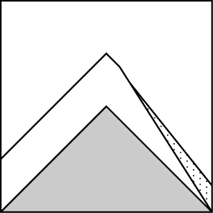
How to read the forecast
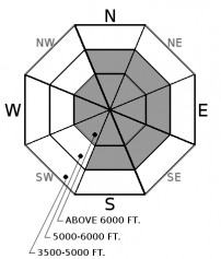
The avalanche danger is CONSIDERABLE above 5000 feet. Recent snowfall and winds have created dangerous avalanche conditions. Expect more snow today with strong to extreme winds. You are likely to trigger an avalanche on wind-loaded terrain and conservative decision-making is essential. In terrain sheltered from the wind, loose snow avalanches are possible due to deep unconsolidated snow. Below 5000 feet the avalanche danger is MODERATE.

3. Considerable
?
Above 6500 ft.
3. Considerable
?
5000-6500 ft.
2. Moderate
?
3500-5000 ft.
- 1. Low
- 2. Moderate
- 3. Considerable
- 4. High
- 5. Extreme
-
Type ?
-
Aspect/Elevation ?
-
Likelihood ?CertainVery LikelyLikelyPossible
 Unlikely
 -
Size ?HistoricVery LargeLargeSmall

Predicted gusts up to 74 mph from the West will have a dramatic effect on the current low density snow. Expect substantial loading on lee aspects and cross loading on other slopes. Yesterday, light to moderate winds were filling in deep skin and snowmobile tracks in less than an hour and today the winds will be much stronger. Careful evaluation of wind-loaded terrain is essential for safe travel. For much of Sunday winds were from the E-NE and would have loaded westerly aspects. Cracking in the snow under your skis or sled is a bull's eye clue that you have found an unstable wind slab.
-
Type ?
-
Aspect/Elevation ?
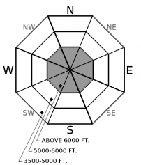
-
Likelihood ?CertainVery LikelyLikelyPossible
 Unlikely
 -
Size ?HistoricVery LargeLargeSmall

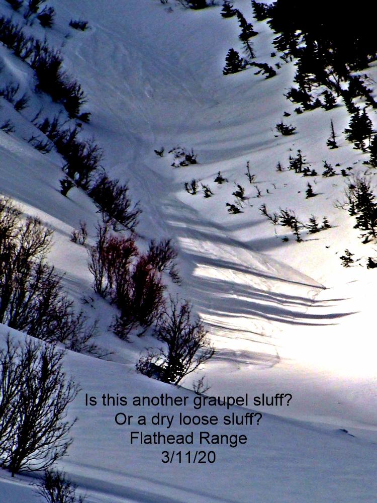
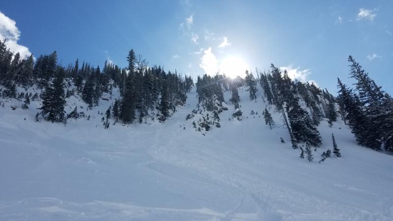
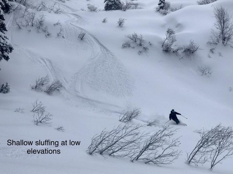
We have some very deep, low density powder snow out in the mountains right now, especially in the Whitefish and Swan Ranges. Despite the predicted strong winds today, sheltered areas will see more snow and may still see dry loose avalanches. The snow has made for some great skiing and riding, but in some locations it has been more unstable than what is typical here in NW Montana. You could trigger loose dry avalanches while skiing or riding today. These avalanches will generally be isolated to steep slopes and could knock you off of your machine or your feet. Also be careful of gullies and road cuts, and other terrain traps where debris from one of these avalanches could build up enough to bury you.
With so much new snow in the past few days, more on the way and warming temperatures, storm slabs could also become a concern. So far we haven't seen much for slab development, but that could change, so watch out for cracking and collapsing in the storm layers.
We removed persistent slab from the problem list due to the time that has passed since avalanches associated with older buried weak layers were observed or reported. But it is important to keep in mind that there are locations at all elevations in the advisory area where a weak snow pack structure still exists. The most commonly observed deeper instabilities are weak snow surrounding the Jan 19th crust and depth hoar near the ground. Because these weak layers do not always present obvious signs of instability, digging into the snowpack is the best way to determine their location and reactivity. Where you find a poor snowpack structure, terrain selection is important. You are more likely to trigger a deeper weak layer in locations with shallow snow (where a weak layer is closer to the surface) like steep, rocky terrain and areas that are wind scoured.
Join the Flathead Avalanche Center, Jesco Marine and Power Sports, and Bonsai Brewing Project for an afternoon of companion rescue. Various stations will be set up around the Bonsai Brewery with raffle tickets awarded for every station completed. Stop by for one station, or all of them, any time after 2:00 pm. The final raffle will be drawn at 6:30 pm.
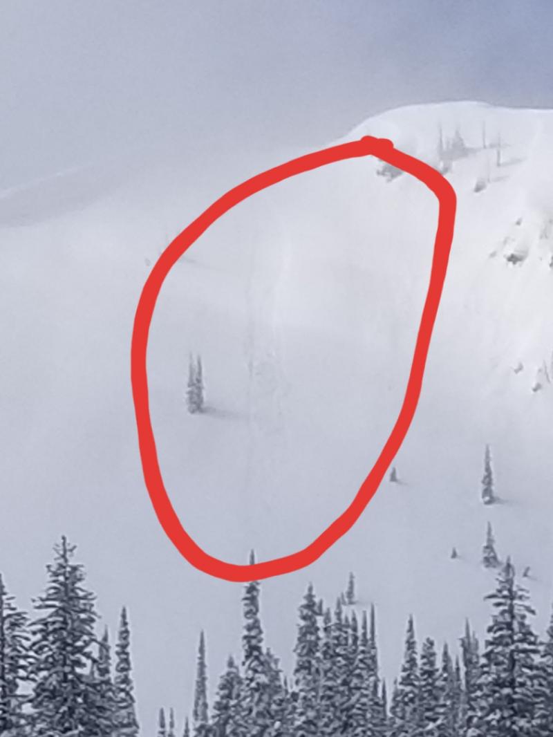
Tuesday: Todd and Seth snowmobiled through deep powder to Kimmerly Basin and ascended the ridgeline there. They found 3 to 4 feet of light snow on top of the February 9/10 rain crust. Although mostly low density, they were able to get propagation with easy force in a storm layer approximately 14 inches from the surface. Something to watch as we add stress to the snowpack. Winds were light to moderate, but more than enough to easily transport impressive amounts of snow.
Monday: Guy and Zach were in Spider Bowl in the Swan Range. They found some deep powder and observed multiple small loose dry avalanches on steep slopes. They also noted very little wind-loading. Two different parties of skiers in the Flathead Range also noted minimal wind-slab development, but mentioned that they stuck to more sheltered terrain below 7000 feet. Both groups experienced some sluffing in the loose surface snow. BNSF Avalanche Safety toured in John F. Stevens Canyon in southern Glacier Park. Light to moderate SW winds were actively loading easterly aspects on terrain above 6000 feet. They noted some minor shooting cracks in the newest wind slabs.
Sunday: Mark was out on peak 6996 in southern Glacier National Park. He observed moderate to strong easterly winds throughout his tour that were actively loading westerly aspects. He also noticed recently formed windslabs on easterly slopes. All of the recent wind loading was building surprisingly deep wind slabs that were tender and reactive. Adam, Jenny, and Zach were teaching an Avalanche class at WMR and found up to 18" of new low density snow. They also observed moderate winds out of the north that transported snow throughout the day. Skiers in the Swan Range reported sensative deep snow that was sluffing on slopes above 35º.
See below for all observations this season.
Above 6000 feet WSW winds are light to moderate, blowing 8-23 mph with gusts to 35 mph, but expected to increase substantially today. Temperatures range from 10 to 17º F. Today expect another 5-12 inches of snow with the Swan Range being favored for higher accumulations. West winds are predicted to increase with gusts reaching up to 74 mph nea the Continental Divide. Temperatures will rise into the high 20sº F to low 30sº F .
| 0600 temperature: | 10 to 17 deg. F. |
| Max. temperature in the last 24 hours: | 14 to 21 deg. F. |
| Average wind direction during the last 24 hours: | west-southwest |
| Average wind speed during the last 24 hours: | 1-25 mph |
| Maximum wind gust in the last 24 hours: | 10-25 mph |
| New snowfall in the last 24 hours: | 2-6 inches |
| Total snow depth: | 100-118 inches |
This advisory applies only to backcountry areas outside established ski area boundaries. This advisory describes general avalanche conditions and local variations always occur. This advisory expires at midnight on the posted day unless otherwise noted. The information in this advisory is provided by the USDA Forest Service who is solely responsible for its content.


