| Monday | Monday Night | Tuesday | |
|---|---|---|---|
| Cloud Cover: | Light snow with cool temperatures and light winds. | Increasing snow with cold temperatures. | Moderate snowfall with increasing winds. |
| Temperatures: | 17-26 deg. F. | 6-17 deg. F. | 19-28 deg. F. |
| Wind Direction: | Southwest | Southwest | West |
| Wind Speed: | 6-8 mph | 5-7 mph | 10-13 mph gusting to 33 |
| Snowfall: | 1-4 in. | 2-7 in. | 4-11 in. |
| Snow Line: |
Whitefish Range
Swan Range
How to read the forecast
Winds from varying directions has drifted the recent substantial snowfall and has elevated the avalanche hazard. The avalanche danger is CONSIDERABLE above 6000 feet where fresh wind slabs should be expected on all aspects. Below 6000 feet the avalanche danger is MODERATE. Evaluate all terrain that has received wind loading or substantial new snow before committing to a slope. Dangerous avalanche conditions exist and conservative decision-making is essential today.

3. Considerable
?
Above 6500 ft.
2. Moderate
?
5000-6500 ft.
2. Moderate
?
3500-5000 ft.
- 1. Low
- 2. Moderate
- 3. Considerable
- 4. High
- 5. Extreme
-
Type ?
-
Aspect/Elevation ?

-
Likelihood ?CertainVery LikelyLikelyPossible
 Unlikely
 -
Size ?HistoricVery LargeLargeSmall

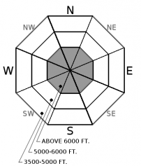
Atypical N and E winds dominated our forecast areas over the past 24 hours. Winds were from the SW as the storm began on Friday evening and, currently, winds have begun to shift back around to our usual SW flow. These variable winds, coupled with the 15+ total inches of light powder snow from the current storm, have continued to build fresh wind slabs on all aspects above 6000'. By this morning, wind slabs could be quite thick and widespread. Careful evaluation of wind-loaded terrain is essential for safe travel today. Fresh slabs should be easy to identify by observing cracking in the surface snow beneath your skis or sled.
Older wind slabs formed with SW winds early in the storm, that proved reactive a couple of days ago, will be harder to identify with the recent covering of new snow.
Although unnoticed yesterday, be aware of potential storm slabs forming as the new snow begins to settle into more cohesive slabs in isolated wind-sheltered areas.
-
Type ?
-
Aspect/Elevation ?
-
Likelihood ?CertainVery LikelyLikelyPossible
 Unlikely
 -
Size ?HistoricVery LargeLargeSmall

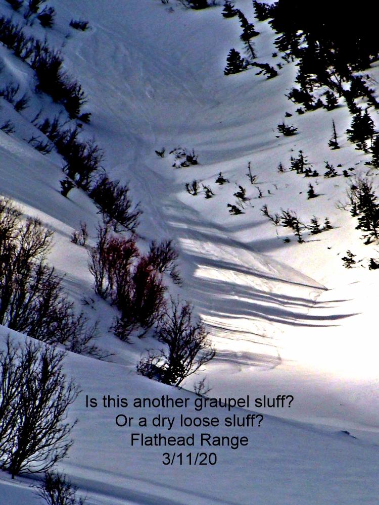
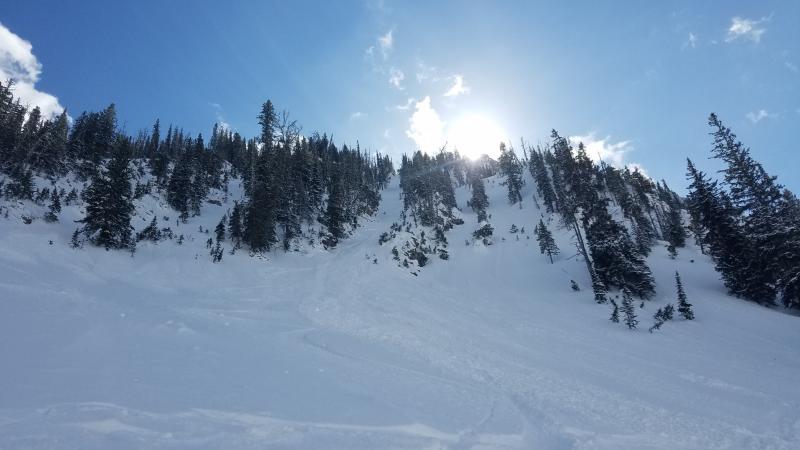
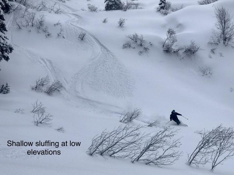
Storm totals in the Swan Range and Whitefish Ranges of over 15" came in much lighter than usual. The uniquely low density snow will be more sensitive than our usual NW Montana creamy powder. You could trigger Loose Dry avalanches while out skiing or riding today. These avalanches are generally isolated to steeper slopes and can knock you off of your machine or your feet. Be aware of gullies and other terrain traps where one of these small avalanches could ruin your day.
We removed persistent slab from the problem list due to the time that passed since avalanches associated with these layers were observed or reported. Also, due to the more stubborn results in stability testing. It is important to keep in mind that there are locations at all elevations in the advisory area where a weak snow pack structure still exists. The most commonly observed deeper instabilities are weak snow surrounding the Jan 19th crust and depth hoar near the ground. Because these weak layers do not always present obvious signs of instability, digging into the snowpack is the best way to determine their location and reactivity. Where you find a poor structure terrain selection is important. You are more likely to trigger a deeper weak layer in an area with shallow snow (where weak layer is closer to the surface) like steep, rocky terrain and areas that are prone to being wind scoured.
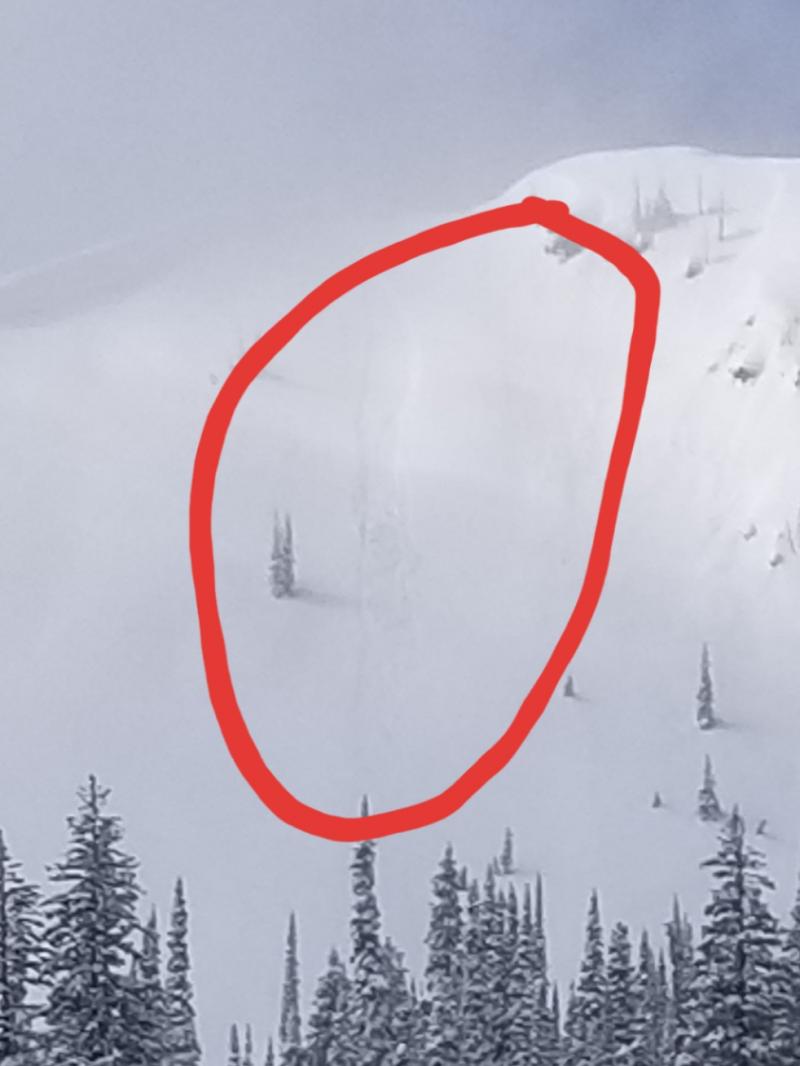
Sunday: Mark was out yesterday on peak 6996 in southern Glacier National Park. He observed moderate to strong easterly winds throughout his tour that were actively loading westerly aspects. He also noticed recently formed windslabs on easterly slopes. All of the recent wind loading was building surprisingly deep wind slabs that were tender and reactive. Adam, Jenny, and Zach were teaching an Avalanche class at WMR and found up to 18" of new low density snow. They also observed moderate winds out of the north that transported snow throughout the day. Skiers in the Swan Range reported sensative deep snow that was sluffing on slopes above 35º.
Friday: Guy and Mark visited the Skyland area of the Flathead Range. We observed up to 16" of "right side up" snow that was resting on the February 16 rain crust. The February 9 rain crust was a couple of inches below this with the January 19 rain crust approximately 1 meter below the surface. Instabilities were limited to the February rain crusts with no propagation observed. New surface hoar growth was observed on all aspects at all elevations. Skiers in the Mt. Furlong area of the Flathead Range noted storm totals of 30-40 cm with minimal wind affect. They did note that westerly aspects were becoming slightly sun affected and they were able to release sluffs on steep pitches. Skiers in the backcountry outside of WMR did not have propagation in any of their tests but did have instabilities associated with the new snow 25 cm below the surface.
Thursday: Todd was in the Jewel Basin in the Swan Range. On our ascent we noted new large surface hoar crystals developing. We observed some cracking in the surface snow while traveling across short, steep terrain features. We also observed a skier triggered avalanche that appeared to have occurred in the previous 48 hours. The thin storm/wind slab was triggered on a steep slope and ran through a chute. When the snow came out of the narrow chute it propagated about 50 feet in both directions across the apron. Maximum crown height was estimated at 1 foot. Snowboarders in Rescue Creek in the Flathead Range found 40 cm of recent snow on top of the Feb. 10th rain crust and had minimal results in stability tests.
See below for all observations this season.
Winds shifted to the northeast yesterday morning, which shut down precipitation for the Flathead Range and decreased precipitaion rates in the Whitefish and Swan Ranges. As of 5am this morning, the winds have shifted back to a westerly flow. As of 6am, temperatures above 6000' range from 4-14º F with westerly winds at 4-9mph gusting to 12mph. Today expect light snow with light westerly winds.
| 0600 temperature: | -1 to 14 deg. F. |
| Max. temperature in the last 24 hours: | 10 to 23 deg. F. |
| Average wind direction during the last 24 hours: | Northeast |
| Average wind speed during the last 24 hours: | 5-11 mph |
| Maximum wind gust in the last 24 hours: | 11-21 mph |
| New snowfall in the last 24 hours: | 2-15 inches |
| Total snow depth: | 79-109 inches |
This advisory applies only to backcountry areas outside established ski area boundaries. This advisory describes general avalanche conditions and local variations always occur. This advisory expires at midnight on the posted day unless otherwise noted. The information in this advisory is provided by the USDA Forest Service who is solely responsible for its content.


