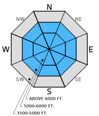
Friday | Friday Night | Saturday | |
---|---|---|---|
Cloud Cover: | Partly/Mostly cloudy. | Partly cloudy. | Partly cloudy, warming temps. |
Temperatures: | 23-29 deg. F. | 7-22 deg. F. | 26-37 deg. F. |
Wind Direction: | west - southwest | west - southwest | west - southwest |
Wind Speed: | 8-9 gusts 21 | 8-10 gusts 23 | 7-11 gusts 25 |
Snowfall: | 0 in. | 0 in. | 0 in. |
Snow Line: |
Whitefish Range
Swan Range
Flathead Range and Glacier National Park
How to read the forecast
The avalanche danger is MODERATE above 6000 feet. Several layers of weak, faceted snow exist in the mid-snow pack with depth hoar near the ground. These weak layers are more difficult to affect due to recent settlement and stabilizing but still warrant digging into the snow to evaluate them. Given the high consequence of triggering an avalanche on one of these deeper weak layers, it is important to choose less complex terrain where you find a weak snow pack structure.
![](/sites/all/themes/responsive_sac/img/advisory-mountain.png)
2. Moderate
?
Above 6500 ft.![](/sites/all/themes/responsive_sac/img/dli/2.png)
1. Low
?
5000-6500 ft.![](/sites/all/themes/responsive_sac/img/dli/1.png)
1. Low
?
3500-5000 ft.![](/sites/all/themes/responsive_sac/img/dli/1.png)
- 1. Low
- 2. Moderate
- 3. Considerable
- 4. High
- 5. Extreme
-
Type ?
-
Aspect/Elevation ?
-
Likelihood ?CertainVery LikelyLikelyPossibleUnlikely
-
Size ?HistoricVery LargeLargeSmall
Multiple buried weak layers exist in most locations across the advisory area. These include several layers of weak, faceted snow formed during a series of cold, dry periods, depth hoar near the ground, and in isolated areas shallowly buried surface hoar. It is possible for one or more of these layers to fail given the added weight of a sled or skier. Avoid steep, rocky terrain that often harbors a shallower snowpack. Here you are more likely to trigger one of these persistent weak layers. We have observed very few persistent slab avalanches this season, but do not become complacent about this hazard. Take a little extra time to dig into the snowpack and look for layers of weak snow in areas where you are recreating.
With a bit of new snow on top of a great sliding surface that is the Jan. 19 crust pay attention to small, loose, snow avalanches particularly if the sun sticks around for a while. These will be more prevalent in the Swan Range which picked up the lion's share of the recent snow. Loose snow sliding on smooth crust can pick up a good head of steam and be particularly consequential if traveling near terrain traps like cliffs, trees, and narrow gullies.
Thursday: Skiers were in the Marion Lake/ Dickey Ridge area in the Flathead Range. Above 6000 feet they found 8-9 inches of recent snow atop the supportable Jan. 19 crust. They did not observe any recent avalanche activity or obvious signs of instability.
Wednesday: A party of snow bikers was in the Lost Johnny drainage in the Swan Range and found 8 inches of snow on top of the Jan. 19 crust. They noted multiple small, loose snow avalanches sliding on that crust. They also noted thin, slabs that were reported as running fairly long. Skiers on Elk Mountain in southern Glacier National Park reported areas where 5-10 cm of recent snow easily sluffed on the Jan 19 crust. They also noted poor snow pack structure with several layers of weak (faceted) snow and depth hoar at the ground. In one of their Extended Column Tests the column failed on the depth hoar while isolating it.
Tuesday: Adam and Todd were on Elk Mountain in southern Glacier National Park and found the breakable Jan. 19 crust buried by only 2-3 cm of snow. Snow coverage was thin and sparse at upper elevations. In wind loaded areas the snow surface was very firm and supportable with poor structure below. They noted well developed depth hoar at the ground and a layer of weak facets 20 cm from the surface. A party of skiers toured Tunnel Creek to Mt. Liebig in the Flathead Range and found 2 inches of snow above the Jan. 19 crust below 6000 feet. Above 6000 feet conditions improved with additional snow on top of the supportable crust. They did not observe any recent avalanche activity or wind loading.
See below for all observations this season.
SNOTEL sites stopped reporting at 4:00 yesterday afternoon so weather data over the past 24 hours is limited. They recorded 0-2 inches of new snow before that time. Mountain temperatures at remote weather stations currently range from 12-23ºF, and winds are out of the west southwest at 4-8 mph with gusts from 11-17 mph. Today should bring partly cloudy skies and slightly warmer temperatures in the mid-upper 20s. Winds will increase today out of the west at 5-15 mph with gusts in the upper 20s and potentially stronger gusts along the divide.
0600 temperature: | 12-23 deg. F. |
Max. temperature in the last 24 hours: | 14-28 deg. F. |
Average wind direction during the last 24 hours: | west-southwest |
Average wind speed during the last 24 hours: | 5-10 mph |
Maximum wind gust in the last 24 hours: | 11-25 mph |
New snowfall in the last 24 hours: | 0-2 inches |
Total snow depth: | 53-68 inches |
This advisory applies only to backcountry areas outside established ski area boundaries. This advisory describes general avalanche conditions and local variations always occur. This advisory expires at midnight on the posted day unless otherwise noted. The information in this advisory is provided by the USDA Forest Service who is solely responsible for its content.