| Saturday | Saturday Night | Sunday | |
|---|---|---|---|
| Cloud Cover: | Partly cloudy, warm. | Wind shift to northeast, and cooler. | Partly cloudy, and a bit cooler. |
| Temperatures: | 54-66 deg. F. | 28-36 deg. F. | 46-58 deg. F. |
| Wind Direction: | NW-W | N-NE | E |
| Wind Speed: | 10-12 gusts 21 | 10-11 gusts 21-24 | 10-13 gusts 21-24 |
| Snowfall: | 0 in. | 0 in. | 0 in. |
| Snow Line: |
Whitefish Range
Swan Range
Flathead Range and Glacier National Park
How to read the forecast
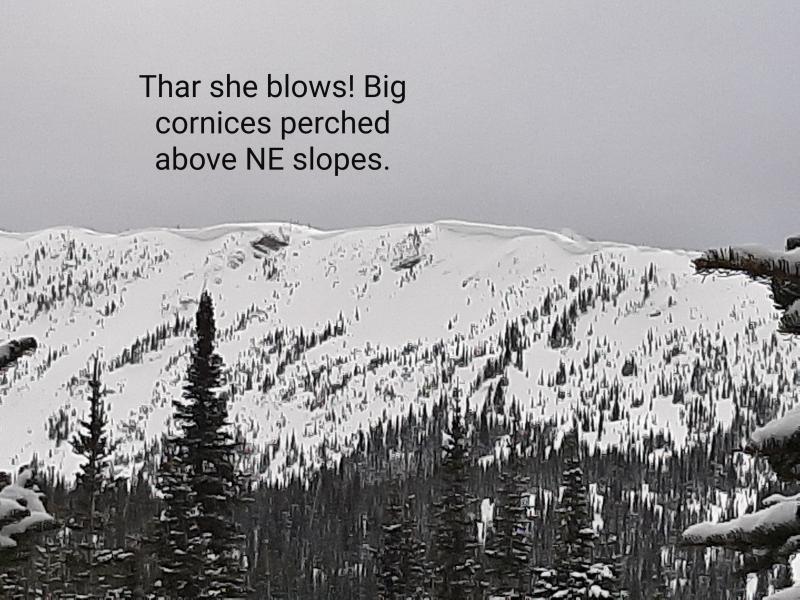
Temperatures will slightly cool today, but instability in the wake of yesterday's heat wave will persist. Heat and sun weakened cornices, moist surface snow, and wet slab/glide avalanche problems due to free water in the snowpack will linger ahead of a substantial re-freeze. Natural and human triggered loose, wet avalanches are likely. The avalanche danger is CONSIDERABLE above 5000 feet. Choose conservative terrain to recreate in, and steer clear of overhead hazards like cornices, glide cracks, and run-out zones.

3. Considerable
?
Above 6500 ft.
3. Considerable
?
5000-6500 ft.
2. Moderate
?
3500-5000 ft.
- 1. Low
- 2. Moderate
- 3. Considerable
- 4. High
- 5. Extreme
-
Type ?
-
Aspect/Elevation ?
-
Likelihood ?CertainVery LikelyLikelyPossible
 Unlikely
 -
Size ?HistoricVery LargeLargeSmall

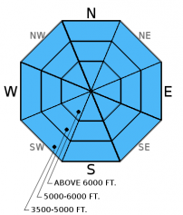
Expect both natural and human triggered avalanches to continue today. With the warm temperatures overnight it should not take long to break down the thin surface crust. Avoid sun exposed slopes and run-out zones when the snow surface becomes moist and you begin to sink deep into the snow. As we move further into spring, the best conditions and the safest travel are in the early part of the day. Keep in mind that recent, abnormally warm temperatures have also moistened and weakened the surface snow on shaded slopes so look for the signs of increasing wet avalanche potential on all aspects today.
-
Type ?
-
Aspect/Elevation ?
-
Likelihood ?CertainVery LikelyLikelyPossible
 Unlikely
 -
Size ?HistoricVery LargeLargeSmall

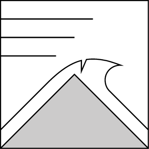
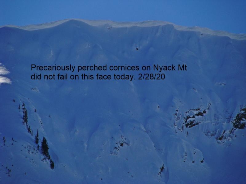
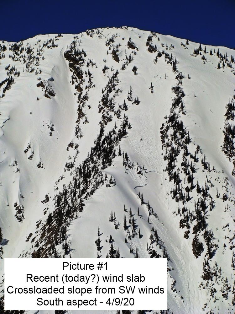
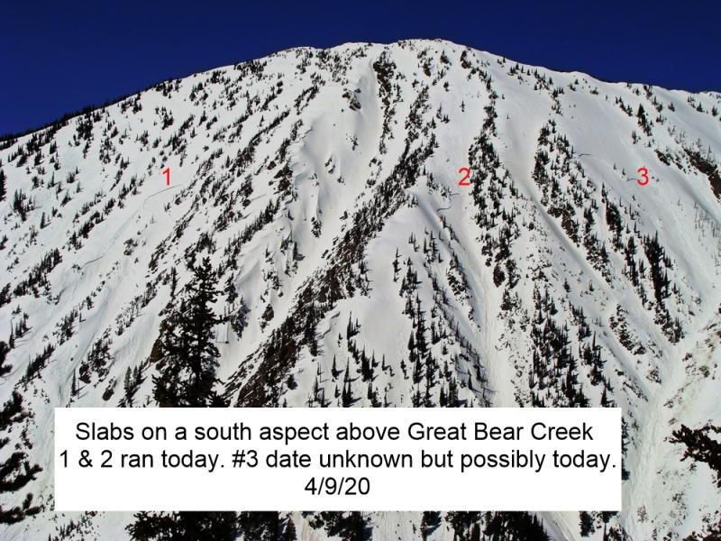
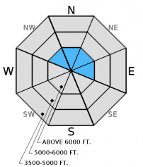
Recent warm temperatures and sunshine weakened the numerous large cornices in the area over the past week. Last Friday, a cornice fall on Nyack Mountain in the Flathead Range triggered a slab and resulted in a very large avalanche up to 5 feet deep (observation). Last Saturday, we witnessed another cornice fall that triggered a wind slab avalanche in the Swan Range (observation and video). On Monday, we noted another large slab avalanche triggered by cornice fall on Mt. Cameahwait in the Flathead Range. When they hit the slope below cornices are capable of triggering even deeper weak layers that would otherwise remain dormant in the snowpack. Cornices can pull far back from behind the ridge line making it important to keep an exaggerated distance away from the edge. Skiers on Great Northern Mountain noted cornices that were pulling away from the ridges, and created "cornice crevasses" (observation) further illustrating the importance of keeping a safe distance from them. Simply avoid traveling on the slopes below cornices as well today.
Also, numerous glide cracks exist throughout the advisory area and several have even failed. Forecasters with the Going-to-the-Sun Road outside the advisory area noted recent glide avalanche activity on upper elevation north aspects (observation and image). Whitefish Mountain Resort Ski Patrol reported widening glide cracks last week. Glide avalanches are very difficult to predict, so the best strategy is to avoid playing on slopes where glide cracks exist.
-
Type ?
-
Aspect/Elevation ?
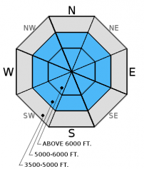
-
Likelihood ?CertainVery LikelyLikelyPossible
 Unlikely
 -
Size ?HistoricVery LargeLargeSmall

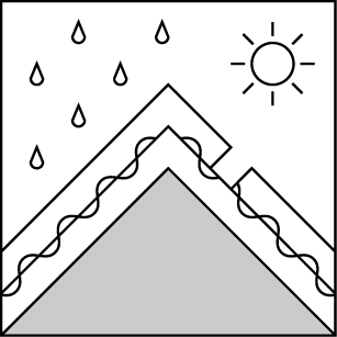
Wet slab avalanches are difficult to predict. Free water moving through the snowpack can awaken weak layers that have been dormant for the better part of the winter. Wet slab avalanches occur when melt or rain water water moves through the snowpack and weakens bonds below a slab. This most commonly occurs above a crust that can pool the free water. Given the difficulty in predicting this type of avalanche and the fact that instability can often go undetected in testing it would be a good day to put the big objectives aside, keep the hill climbing at bay, and wait for cooler temperatures.
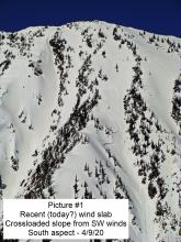
Additional Concern: Watch for lingering wind slabs at upper elevations. Cornices falling on previously wind loaded slopes could cause large avalanches, and it is still possible for humans to trigger wind slabs at the upper most elevations.
The last advisory of the season will be issued on Sunday, April 10, 2016.
Friday: The Going-to-the-Sun Road avalanche program reported new glide avalanche activity that occured between 4/7/2016 at 4:00 pm and 4/8/16 at 8:30 am. They also noted widespread loose, wet avalanche activity due to warm temperatures and a lot of sun (observation). Mark and I were on Ghoulie Point in the southern Whitefish Range and found moist surface snow on all aspects and elevations late in the day. A series of crusts in the upper-snow pack had water pooling above them on sunny slopes, and these crusts were decomposing on shaded slopes.
Thursday: The Going-to-the-Sun Road avalanche program reported substantial recent glide, wet loose, and soft slab avalanches just outside our advisory area in Glacier National Park (observation). Skiers on Great Northern Mountain in the Flathead Range observed a lot of recent and older avalanche debris on multiple aspects. They also noted large cornice that had begun to crack and formed "cornice crevasses" (observation).
Tuesday: The Going-To-the-Sun-Road avalanche program reported up to 7 inches of new snow at low elevations with small wind slabs forming above 5500 feet. Impressive wet loose debris on all aspects was noted from the weekends above freezing temperatures (observation).
Monday: We traveled to the Tunnel Ridge area in the Flathead Range we observed the aftermath of the recent wet loose avalanche cycle on all aspects at mid and upper elevations. We noted a large wind slab avalanche triggerred by cornice fall on Mt. Cameahwait (observation).
Visit our Observations page and our You Tube channel for more observations from the entire season.
Thanks to everyone for submitting observations. They are extremely useful and could help save lives.
HOW TO SUBMIT OBSERVATIONS:
Email: [email protected]
Call and leave a message: 406.387.3821
You can also submit quick observations via text: 406.241.4571 (FAC mobile)
OR
Submit Snowpack Observations: http://www.flatheadavalanche.org/node/add/snowobs
Submit Avalanche Observations: http://www.flatheadavalanche.org/node/add/avyobs
June called, and wants its weather back. Yesterday saw mostly sunny skies, and temperatures climbed to the upper 50s to low 60s. Currently, temperatures above 6000 feet range from 41º-49º F, and winds are out of the west-southwest at 3-16 mph with gusts from 15-21 mph. Today, expect partly cloudy skies with cloud coverage increasing this afternoon. Temperatures will not be quite as warm as yesterday, but should still rise to the mid-50s.
| 0600 temperature: | 41-49 deg. F. |
| Max. temperature in the last 24 hours: | 54-61 deg. F. |
| Average wind direction during the last 24 hours: | SW |
| Average wind speed during the last 24 hours: | 5-15 mph |
| Maximum wind gust in the last 24 hours: | 16-34 mph |
| New snowfall in the last 24 hours: | 0 inches |
| Total snow depth: | 72-109 inches |
This advisory applies only to backcountry areas outside established ski area boundaries. This advisory describes general avalanche conditions and local variations always occur. This advisory expires at midnight on the posted day unless otherwise noted. The information in this advisory is provided by the USDA Forest Service who is solely responsible for its content.


