| Monday | Monday Night | Tuesday | |
|---|---|---|---|
| Cloud Cover: | Increasing clouds and then rain with an approaching cold front. Snow levels 7000-7500 feet. | Cooling with snow levels dropping to about 3500-4000 feet. | Showery and cool. |
| Temperatures: | 43 to 56 deg. F. | 23 to 31 deg. F. | 38 to 48 deg. F. |
| Wind Direction: | Southwest | West-Southwest | West-Southwest |
| Wind Speed: | 10-15 mph with gusts to 40 mph. | 15-20 mph with gusts to 45 mph. | 10-15 mph with gusts to 30 mph. |
| Snowfall: | 0 in. | 1-2 in. | 0 in. |
| Snow Line: |
Whitefish Range
Swan Range
Flathead Range and Glacier National Park
How to read the forecast
Warm temperatures continue, and sunshine will be replaced by clouds and rain to 7000 feet later today sustaining the wet avalanche problems and dangerous conditions. Widespread wet, loose avalanches occurred over the past 72 hours and will continue today due to rain. Cornices continue to break and trigger slab avalanches (some large) on the slopes below. The danger remains CONSIDERABLE above 5000 feet and MODERATE below until tonight when temperatures finally drop.

3. Considerable
?
Above 6500 ft.
3. Considerable
?
5000-6500 ft.
2. Moderate
?
3500-5000 ft.
- 1. Low
- 2. Moderate
- 3. Considerable
- 4. High
- 5. Extreme
-
Type ?
-
Aspect/Elevation ?
-
Likelihood ?CertainVery LikelyLikelyPossible
 Unlikely
 -
Size ?HistoricVery LargeLargeSmall

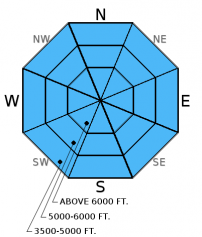
Most mountain locations remained above freezing yet again last night making it 72 hours without a solid refreeze. A widespread cycle of wet, loose avalanches has now lasted three days. The largest avalanches occurred on sunny slopes, but they were also present on more shaded slopes. Rain later today up to 7500 feet will exacerbate this problem on all aspects. These avalanches are starting early in the day as witnessed by skiers in the Flathead Range yesterday at 9:00 am. The first signs of wet snow instability are roller balls and pinwheels which means it's time to move to less steep terrain and avoid run out zones or simply pack it up and go home.
An additional concern following yet another night without a refreeze is the potential for wet slab avalanches. Free water continues to move through the snowpack. Wet slab avalanches can potentially release when this melt water pools on a crust and weakens the bond with the overlying slab. Wet slab instability is difficult to predict and assess so the best way to manage this problem is to choose conservative terrain until we see cooler temperatures.
-
Type ?
-
Aspect/Elevation ?
-
Likelihood ?CertainVery LikelyLikelyPossible
 Unlikely
 -
Size ?HistoricVery LargeLargeSmall

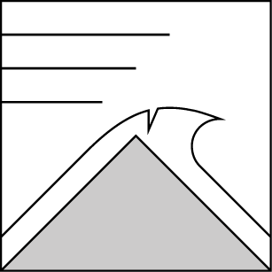
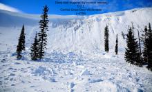
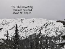
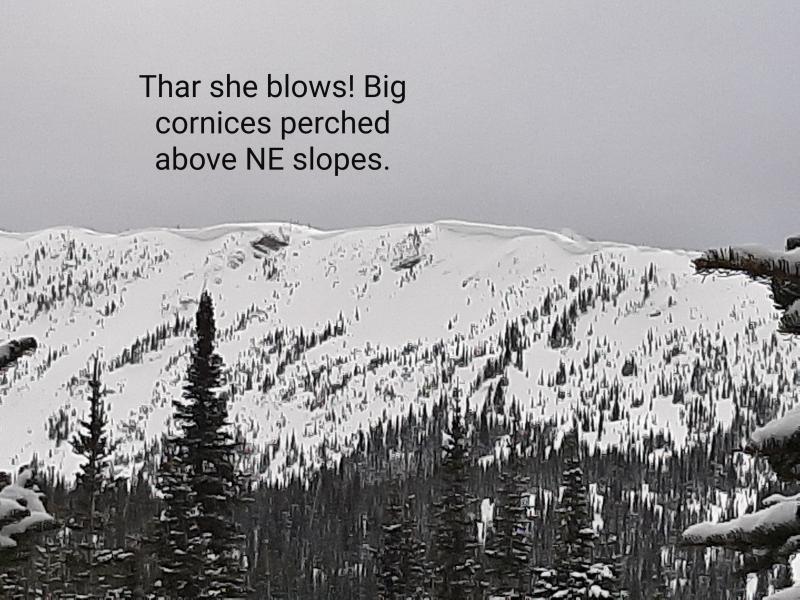
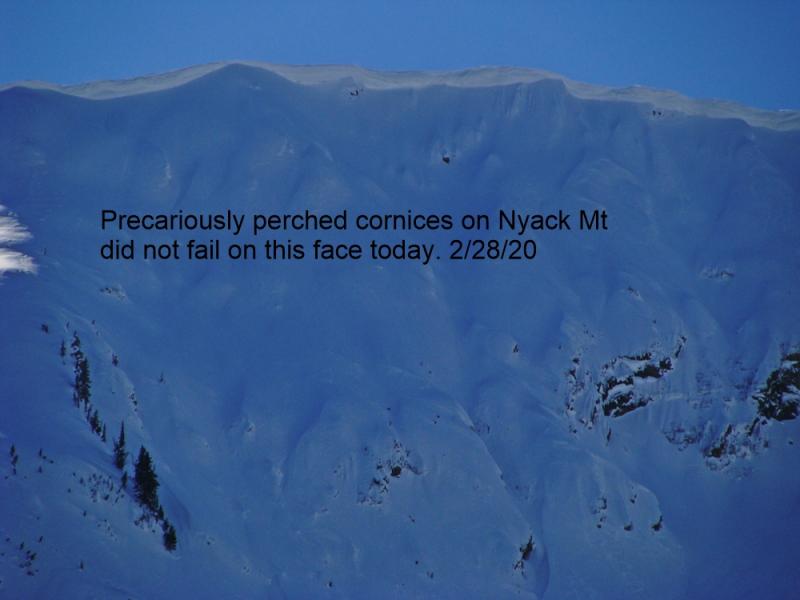
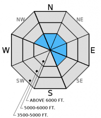
Warm temperatures and sunshine continue to weaken the numerous large cornices in the area (photo). Friday, a cornice fall on Nyack Mountain in the Flathead Range triggered a deeper slab and resulted in a very large avalanche (observation). On Saturday, we witnessed another cornice fall that triggered a wind slab avalanche in the Swan Range (observation and video). When they hit the slope these behemoths are capable of triggering even deeper weak layers that would otherwise remain dormant in the snowpack. Cornices can pull far back from behind the ridge line making it important to keep an exaggerated distance away from the edge when traveling above cornices. Avoid traveling on the slopes below cornices as well.
Also, numerous glide cracks exist throughout the advisory area (image) and several have even failed. Whitefish Mountain Resort Ski Patrol reported widening glide cracks on Thursday. Glide avalanches are very difficult to predict, so the best strategy is to avoid playing on slopes where glide cracks exist. Today's continued above normal temperatures and then rain could cause glide cracks to release as avalanches.
-
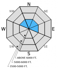
Type ?
-
Aspect/Elevation ?
-
Likelihood ?CertainVery LikelyLikelyPossible
 Unlikely
 -
Size ?HistoricVery LargeLargeSmall

Several generations of wind slabs formed last week on multiple aspects. These slabs are not presenting obvious signs of instability and most recent observations suggest they have strengthened. However, large triggers over the past few days in the form of cornice fall produced a few large wind slab avalanches, and warm temperatures may continue to weaken them.
The last advisory of the season will be issued on Sunday, April 10, 2016.
Sunday: Skiers in the Tunnel/Pinnacle Creek area in the Middle Fork of the Flathead Range reported hearing and seeing numerous natural wet, loose avalanches by 9:00 am. They wisely called it a day and headed home.
Saturday: We were in the Lost Johnny Drainage in the Swan Range. We observed widespread natural loose, wet activity on all aspects and large cornices. In the afternoon, we witnessed a slab avalanche triggered by cornice fall above Lamoose Lake at the head of the drainage (observation, video). On a south facing slope near 7000 feet we found a shallow snowpack that was moist throughout (photo) where there was a prominent crust about 18 inches from the surface that had pooled water above the crust. Skiers on Huckleberry Ridge in Glacier National Park found a variety of crusts in the upper snowpack and stability tests produced fractures nearly a foot from the surface. They noted thick, older windslabs that were minimally reactive in stability tests but produced clean shears (observation).
Friday: Skiers in the Cascadilla Drainage in the Flathead Range reported a large natural avalanche thought to have been triggered by cornice fall (observation). Skiers outside of the advisory in the St. Mary area of Glacier National Park reported multiple natural, loose, wet avalanches on sun exposed slopes that began at about 10:30 am.
Thursday: A skier on Glacier View Mountain in the Whitefish Range intentionally triggered a wet, loose avalanche on a north aspect at 5400 feet (observation). Whitefish Mountain Resort Ski Patrol reported skier triggered loose, wet avalanche (photo) and widening glide cracks. Erich and I observed a softening snow surface on most aspects despite cloud cover in China Basin and Werner Peak in the Whitefish Range yesterday. We did not observe any avalanche activity by mid to late afternoon (observation).
Visit our Observations page and our You Tube channel for more observations from the entire season.
Thanks to everyone for submitting observations. They are extremely useful and could help save lives.
HOW TO SUBMIT OBSERVATIONS:
Email: [email protected]
Call and leave a message: 406.387.3821
You can also submit quick observations via text: 406.241.4571 (FAC mobile)
OR
Submit Snowpack Observations: http://www.flatheadavalanche.org/node/add/snowobs
Submit Avalanche Observations: http://www.flatheadavalanche.org/node/add/avyobs
Currently, temperatures above 6000 feet range from 35º-41º F, and winds are blowing out of the southwest at 5-10 mph with gusts from 9-15 mph. Today, a cold front will move through the region mid-day bringing clouds and rain. Temperatures are expected to remain in the mid-40s to mid-50s F until tonight with snow levels around 7000-7500 feet. Winds will increase out of the southwest to 10-20 mph with gusts to 40 mph. Most of the precipitation appears to occur before snow levels drop, but we could see 1-4 inches of snow above 6000 feet by tomorrow morning. Tomorrow will be showery and much cooler.
| 0600 temperature: | 35 to 41 deg. F. |
| Max. temperature in the last 24 hours: | 43 to 54 deg. F. |
| Average wind direction during the last 24 hours: | Southwest |
| Average wind speed during the last 24 hours: | 1-16 mph |
| Maximum wind gust in the last 24 hours: | 17-25 mph |
| New snowfall in the last 24 hours: | 0 inches |
| Total snow depth: | 76-112 inches |
This advisory applies only to backcountry areas outside established ski area boundaries. This advisory describes general avalanche conditions and local variations always occur. This advisory expires at midnight on the posted day unless otherwise noted. The information in this advisory is provided by the USDA Forest Service who is solely responsible for its content.


