| Friday | Friday Night | Saturday | |
|---|---|---|---|
| Cloud Cover: | Sunny and Warm. | Clear. | Sunny, then increasing clouds in the afternoon. |
| Temperatures: | 47 to 57 deg. F. | 33 to 38 deg. F. | 48 to 60 deg. F. |
| Wind Direction: | West | West-Southwest | Southwest |
| Wind Speed: | 4-6 mph. | 5-10 mph with gusts to 20 mph. | 10-15 mph with gusts to 30 mph. |
| Snowfall: | 0 in. | 0 in. | 0 in. |
| Snow Line: |
Whitefish Range
Swan Range
Flathead Range and Glacier National Park
How to read the forecast
Above normal temperatures and intense spring sunshine will create wet avalanche problems and dangerous conditions as the day progresses. Get an early start and be off sunny slopes early in the day. Expect natural and human triggered wet, loose avalanches on most aspects and elevations. Cornices could also fail and trigger avalanches on the slope below, and watch for wind slabs at upper elevations. The danger will rise to CONSIDERABLE above 5000 feet and MODERATE below.

3. Considerable
?
Above 6500 ft.
3. Considerable
?
5000-6500 ft.
2. Moderate
?
3500-5000 ft.
- 1. Low
- 2. Moderate
- 3. Considerable
- 4. High
- 5. Extreme
-
Type ?
-
Aspect/Elevation ?
-
Likelihood ?CertainVery LikelyLikelyPossible
 Unlikely
 -
Size ?HistoricVery LargeLargeSmall

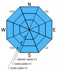
Today is a good day to avoid being on or under slopes receiving direct sunlight as the day progresses. Unfortunately, this includes most slopes this time of year. Rapidly rising temperatures today combined with the strength of the spring sun can have dramatic effects on the snowpack, and conditions can change rapidly. Given the intense spring sun, even more shaded northerly aspects will begin to feel the effects of the sun and warmth today. Yesterday, a skier easily triggered a wet, loose avalanche at about 5500 feet on a northerly aspect. The first signs of wet snow instability are rollerballs and pinwheels developing on a slope. If you are sinking to the top of your boots in wet snow when you step off your machine or out of your skis, then you are too late. This means it is time to move to a more shaded aspect or simply pack it in for the day. Wet, loose avalanches can entrain a fair amount of snow and knock you off your feet or machine and potentially bury you.
-
Type ?
-
Aspect/Elevation ?
-
Likelihood ?CertainVery LikelyLikelyPossible
 Unlikely
 -
Size ?HistoricVery LargeLargeSmall

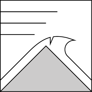
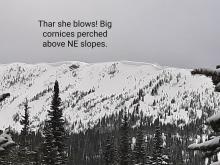
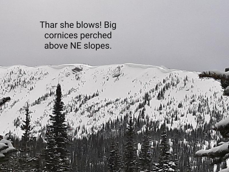
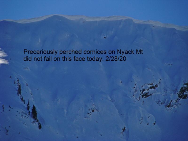
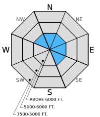
Warm temperatures and intense spring sun can cause these large behemoths to fail. We observed or received reports of cornice failure every week over the past 2-3 weeks with a few of them triggering avalanches on the slopes below. Stay well back from the edge while traveling along ridges and minimize your time moving below them. Cornice fall can trigger wind slab avalanches and even awaken deeper instabilities in the snowpack such as the weak snow around the late February or March crusts.
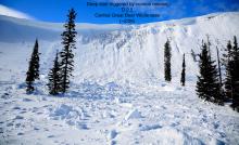
Also, we observed glide cracks on numerous slopes throughout the advisory area (image) and several have even failed. Glide avalanches are very difficult to predict, so the best strategy is to avoid playing on slopes where glide cracks exist. Today's above normal temperatures and abundant sunshine could cause glide cracks to release as avalanches.
-
Type ?
-
Aspect/Elevation ?
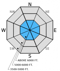
-
Likelihood ?CertainVery LikelyLikelyPossible
 Unlikely
 -
Size ?HistoricVery LargeLargeSmall

Southwest winds earlier in the week, and then east-northeast winds mid week, formed both hard and soft wind slabs. On Tuesday, we observed two small natural wind slab avalanches on a northeast aspect that likely occurred on Monday on Nyack Peak in the Flathead Range. We also observed large plumes of snow blowing off the highest ridges by strong northeast winds loading aspects on the south half of the compass. Pay attention to obvious signs of instability like recent avalanches or cracks shooting out from your skis or machine, and assess each slope before committing to it. Above freezing temperatures and plenty of sunshine could make wind slabs more sensitive to human triggering today.
Additional concern: You may find weak snow surrounding a series of melt-freeze and rain crusts from late February and March located 1.5 to 3 feet from the surface. These layers have not produced recent avalanches. However, digging into the snow and performing stability tests is the only way to determine if deeper weak layers exist.
Thursday: A skier on Glacier View Mountain in the Whitefish Range intentionally triggered a wet, loose avalanche on a north aspect at 5400 feet (observation). Todd and I observed a softening snow surface on most aspects despite cloud cover in China Basin and Werner Peak in the Whitefish Range yesterday. We did not observe any avalanche activity by mid to late afternoon (observation).
Tuesday: We found 8-10 inches of snow above the melt-freeze crust from 3/25 in the Skyland area in the Flathead Range. We observed substantial wind loading from north-northeast winds along the ridges of the highest peaks. We also observed two recent natural avalanches on a northeast aspect of Nyack Mountain that likely occurred Monday 3/28 (observation). Skiers in the Wahoo/Rescue Creek area of the Flathead Range noted recent small wind slab avalanches (same ones we observed?) on north aspects along with point release activity from the previous few days (observation).
Visit our Observations page and our You Tube channel for more observations from the entire season.
Thanks to everyone for submitting observations. They are extremely useful and could help save lives.
HOW TO SUBMIT OBSERVATIONS:
Email: [email protected]
Call and leave a message: 406.387.3821
You can also submit quick observations via text: 406.241.4571 (FAC mobile)
OR
Submit Snowpack Observations: http://www.flatheadavalanche.org/node/add/snowobs
Submit Avalanche Observations: http://www.flatheadavalanche.org/node/add/avyobs
Yesterday, mostly cloudy conditions prevailed with above freezing temperatures at most locations. Currently, temperatures above 6000 feet range from 29º-34º F, and winds are out of the west at 2-8 mph with gusts to 13 mph. Today, expect temperatures to rise into the mid-40s to mid-50s F above 6000 feet, and into the mid-60s at lower elevations (No April Fool's joke). Winds will be 5-10 mph out of the west-southwest. Sunny and warm conditions will continue into Saturday morning.
| 0600 temperature: | 29 to 34 deg. F. |
| Max. temperature in the last 24 hours: | 32 to 48 deg. F. |
| Average wind direction during the last 24 hours: | Northeast switching to West |
| Average wind speed during the last 24 hours: | 2-15 mph |
| Maximum wind gust in the last 24 hours: | 12-27 mph |
| New snowfall in the last 24 hours: | 0 inches |
| Total snow depth: | 84-123 inches |
This advisory applies only to backcountry areas outside established ski area boundaries. This advisory describes general avalanche conditions and local variations always occur. This advisory expires at midnight on the posted day unless otherwise noted. The information in this advisory is provided by the USDA Forest Service who is solely responsible for its content.


