| Monday | Monday Night | Tuesday | |
|---|---|---|---|
| Cloud Cover: | Snow showers increasing in intensity in the late afternoon/early evening. | Snow and increasing wind. | Snow showers. |
| Temperatures: | 30-42 deg. F. | 21-28 deg. F. | 33-45 deg. F. |
| Wind Direction: | W-SW | NE | NE |
| Wind Speed: | 6-8 | 7-10 gusts 21-25 | 19-20 gusts 39 |
| Snowfall: | 2-8 in. | 1-3 in. | 0-1 in. |
| Snow Line: |
Swan Range
How to read the forecast
Fresh windslabs continue to form with a bit of new snow and continued drifting of storm snow from earlier in the week. The avalanche danger is CONSIDERABLE on wind loaded slopes above 6000 feet. Human triggered avalanches are likely. Carefully assess terrain for recently formed windslabs along ridgelines and cross-loaded features before committing. Elsewhere, the danger is MODERATE. Wind and snow added mass to large cornices so give them a wide margin while traveling above and minimize exposure below.

3. Considerable
?
Above 6500 ft.
2. Moderate
?
5000-6500 ft.
1. Low
?
3500-5000 ft.
- 1. Low
- 2. Moderate
- 3. Considerable
- 4. High
- 5. Extreme
-
Type ?
-
Aspect/Elevation ?

-
Likelihood ?CertainVery LikelyLikelyPossible
 Unlikely
 -
Size ?HistoricVery LargeLargeSmall

Relatively cool temperatures and minimal sun exposure since the last big storm kept most of the upper elevation snow light and unconsolidated. This is great for the skiing and riding conditions, but when the wind picks up it easily drifts an creates new slabs. A bit of new snow provided additional ammunition for the moderate to strong winds to drift. The Swan Range was favored yesterday with 4 inches of snow and 0.6 inches of snow water equivalent. Yesterday, experienced skiers in the Skiumah/Great Bear Creek area in the Flathead Range altered their plans to avoid traveling steep, wind loaded areas after triggering a small pocket of wind slab from the ridgeline. Avoid steep, exposed windloaded slopes today. Pay attention to obvious signs of instability like recent avalanches and cracks shooting out from your skis or machine.
The Swan Range picked up the bulk of the 24 hour precipitation in a short period of time. On non-windloaded slopes pay attention to thin but potentially unsettled storm slabs. Especially in steep terrain, and around terrain traps like rocks, trees, or narrow gullies.
-
Type ?
-
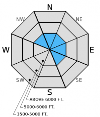
Aspect/Elevation ?
-
Likelihood ?CertainVery LikelyLikelyPossible
 Unlikely
 -
Size ?HistoricVery LargeLargeSmall

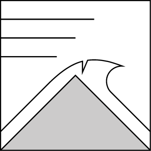
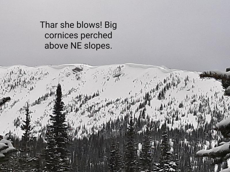
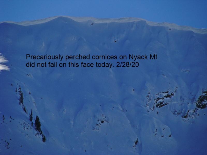
Very large cornices continue to grow across the advisory area. Heat and sun can cause these to fail, but the additional load brought by wind and snow can also tip the scale. Cornices can pull out from surprising distances behind the ridgeline. Keep a good buffer between you and cornices while traveling above them, and minimize your exposure time when traveling below. Remember that cornice fall can also awaken deeper instabilities in the snowpack, and trigger much larger avalanches like wind slabs or weak snow near the late Feb. or March crusts.
Additional concern: Weak snow surrounds a series of crusts 1.5 to 3 feet from the surface, but has not produced recent avalanches. However, digging into the snow and performing stability tests is the only way to determine if this weak layer exists. Stability tests in some locations last week show these layers can fracture and propagate (video1, video2).
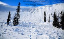
As we continue into spring and day-time temperatures approach the freezing mark conditions can change rapidly. Short periods of sunshine can weaken the snow surface and result in loose, wet avalanches. Pay attention to the signs of increasing instability like roller balls forming on steep slopes or a moist snow surface. These are indications that it is time to move to shaded or less steep slopes. Also, we have observed glide cracks starting to open in many locations and several have even failed (image). Given the unpredictable nature of glide avalanches it is best to avoid slopes where they are present.
Sunday: Skiers in the Skiumah/Great Bear Drainages in the Flathead Range noted increasing winds as the cold front moved into the area yesterday that was actively drifting the recent snow. They triggered a small pocket of windslab from the ridge, and wisely altered their plan due to new wind slab formation (observation).
Saturday: Skiers in Noisy Basin in the Swan Range reported four skier triggered avalanches on steep, north-northeast facing slopes. The avalanches were up to a foot deep and triggered within recent storm snow. Luckily, no one was caught in these slides (observation). Mark and Guy were in the Red Meadow area in the northern Whitefish Range. They found up to 18 inches of recent snow. They noted ongoing cornice formation, large glide cracks opening, and active wind drifting (observation). Skiers on Snowshed Mountain in the Flathead Range noted new cornice build-up in the area. They also found lingering instability in recent windslabs almost 2 feet from the surface that were on top of a layer of weak, faceted snow (observation).
Friday: Erich and I rode into the Lost Johnny drainage in the Swan Range. We found 14-22 inches of recent snow on top of a crust. We observed fresh windslabs formed on the leeward sides of ridges, and moderate winds continued to drift the recent snow (observation).
Thursday: Erich toured along the Marion Lake/Dickey Creek ridgeline yesterday in the Flathead Range. They observed shooting cracks on most wind loaded terrain and triggered a 100 ft. wide and 10-14 inch deep wind slab on a northeast aspect (image and video). Strong winds were loading multiple aspects (observation). Deeper weak layers around a series of crusts were unreactive in our stability tests at this location.
Visit our Observations page and our You Tube channel for more observations from the entire season.
Thanks to everyone for submitting observations. They are extremely useful and could help save lives.
HOW TO SUBMIT OBSERVATIONS:
Email: [email protected]
Call and leave a message: 406.387.3821
You can also submit quick observations via text: 406.241.4571 (FAC mobile)
OR
Submit Snowpack Observations: http://www.flatheadavalanche.org/node/add/snowobs
Submit Avalanche Observations: http://www.flatheadavalanche.org/node/add/avyobs
The area saw moderate to strong winds yesterday associated with the passing of a vigorous cold front. Snow showers intensified late in the day, and delivered an additional 2-4 inches of snow. Currently, temperatures above 6000 feet range from 19º-27º F, and winds are out of the southwest at 3-11 mph with gusts from 8-18 mph. Today, expect to see snow showers continue with light winds out of the west and southwest. In the late afternoon/early evening winds should shift out of the northeast and bring increased snow intensity and wind speeds starting in the northern portion of the advisory area and moving south.
| 0600 temperature: | 19-27 deg. F. |
| Max. temperature in the last 24 hours: | 26-33 deg. F. |
| Average wind direction during the last 24 hours: | SW |
| Average wind speed during the last 24 hours: | 5-15 mph |
| Maximum wind gust in the last 24 hours: | 18-28 mph |
| New snowfall in the last 24 hours: | 2-4 inches |
| Total snow depth: | 86-116 inches |
This advisory applies only to backcountry areas outside established ski area boundaries. This advisory describes general avalanche conditions and local variations always occur. This advisory expires at midnight on the posted day unless otherwise noted. The information in this advisory is provided by the USDA Forest Service who is solely responsible for its content.


