| Sunday | Sunday Night | Monday | |
|---|---|---|---|
| Cloud Cover: | Showers begin in the early afternoon. | Continued showers. | Showers. |
| Temperatures: | 32-44 deg. F. | 20-27 deg. F. | 31-42 deg. F. |
| Wind Direction: | S-SW | SW | W-SW |
| Wind Speed: | 9-14 gusts 20-29 | 8-11 gusts 20-25 | 6-8 |
| Snowfall: | 0-2 in. | 1-3 in. | 2-11 in. |
| Snow Line: |
Whitefish Range
Swan Range
Flathead Range and Glacier National Park
How to read the forecast
Moderate winds with strong gusts continue to drift the recent abundant snow and thicken wind slabs. Human triggered avalanches are possible, particularly in steep, wind loaded terrain. Heightened avalanche conditions exist above 5000 feet where the danger is MODERATE. Continue to carefully evaluate wind loaded and cross loaded terrain before committing to a slope. Also, wind and snow added mass to large cornices so give them a wide margin while traveling above and minimize exposure below.

2. Moderate
?
Above 6500 ft.
2. Moderate
?
5000-6500 ft.
1. Low
?
3500-5000 ft.
- 1. Low
- 2. Moderate
- 3. Considerable
- 4. High
- 5. Extreme
-
Type ?
-
Aspect/Elevation ?
-
Likelihood ?CertainVery LikelyLikelyPossible
 Unlikely
 -
Size ?HistoricVery LargeLargeSmall

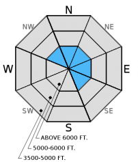
Moderate to strong winds continue to drift the ample snow from the past week and add depth to existing wind slabs. On sunny aspects many of these slabs formed on a crust that will provide a good sliding surface and delay the time to strengthen. Avoid steep, exposed windloaded slopes. Look for rounded pillows of wind drifted snow along leeward ridgelines and cross loaded mid-slope features especially on convex rollovers. Pay attention to obvious signs of instability like recent avalanches and cracks shooting out from your skis or machine.
-
Type ?
-
Aspect/Elevation ?

-
Likelihood ?CertainVery LikelyLikelyPossible
 Unlikely
 -
Size ?HistoricVery LargeLargeSmall

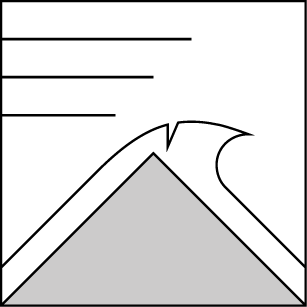
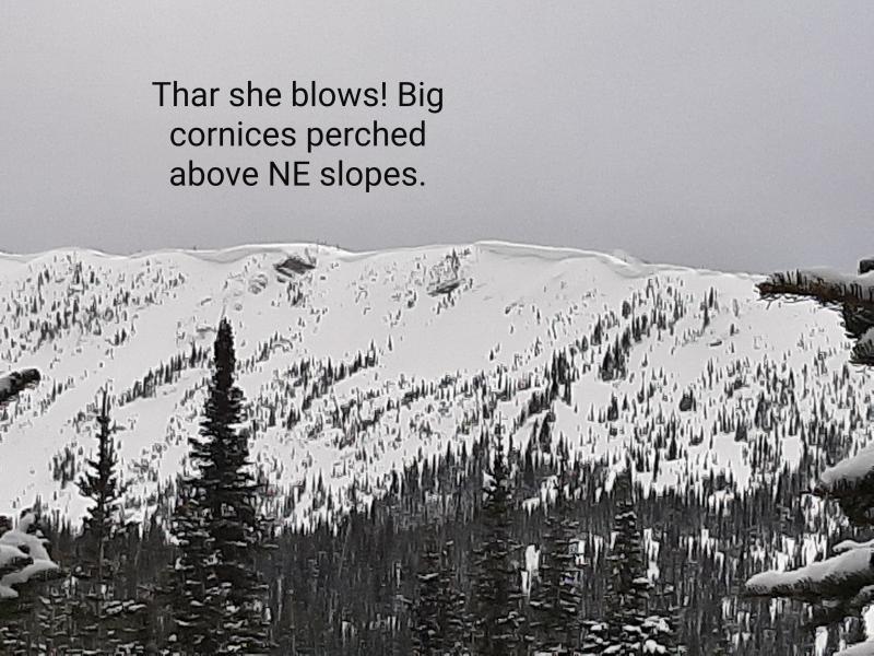
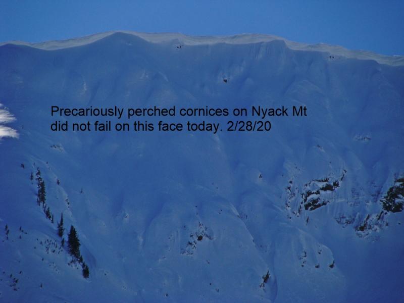
Very large cornices continue to grow across the advisory area. Heat and sun can cause these to fail, but the additional load brought by wind and snow can also tip the scale. Cornices can pull out from surprising distances behind the ridgeline. Keep a good buffer between you and cornices while traveling above them, and minimize your exposure time when traveling below. Remember that cornice fall can also awaken deeper instabilities in the snowpack, and trigger much larger avalanches like wind slabs or weak snow near the late Feb. or March crusts.
-
Type ?
-
Aspect/Elevation ?
-
Likelihood ?CertainVery LikelyLikelyPossible
 Unlikely
 -
Size ?HistoricVery LargeLargeSmall

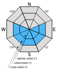
Though clouds are expected to move in today, I see a lot of stars in the sky early this morning. If the sun sticks around for a while pay attention to the deteriorating crust and snow surface that becomes moist and unstable. Move to shaded terrain when you see roller balls forming on steep slopes. At lower elevations where there is less recent snow, consider the terrain you are traveling in and the amplified effect of small avalanches by terrain traps like trees, cliffs, and narrow gullies.
Additional concern: Weak snow surrounds a series of crusts 1.5 to 3 feet from the surface, but has not produced recent avalanches. However, digging into the snow and performing stability tests is the only way to determine if this weak layer exists. Stability tests in some locations including yesterday in the Swan Range show these layers can fracture and propagate (video1, video2).
As we continue into spring we have observed glide cracks starting to open in many locations and several have even failed (image). Given the unpredictable nature of glide avalanches it is best to avoid slopes where they are present.
Saturday: Skiers in Noisy Basin in the Swan Range reported four skier triggered avalanches on steep, north-northeast facing slopes. The avalanches were up to a foot deep and triggered within recent storm snow. Luckily, no one was caught in these slides (observation). Mark and Guy were in the Red Meadow area in the northern Whitefish Range. They found up to 18 inches of recent snow. They noted ongoing cornice formation, large glide cracks opening, and active wind drifting (observation). Skiers on Snowshed Mountain in the Flathead Range noted new cornice build-up in the area. They also found lingering instability in recent windslabs almost 2 feet from the surface that were on top of a layer of weak, faceted snow (observation).
Friday: Erich and I rode into the Lost Johnny drainage in the Swan Range. We found 14-22 inches of recent snow on top of a crust. We observed fresh windslabs formed on the leeward sides of ridges, and moderate winds continued to drift the recent snow (observation).
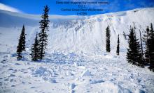
Thursday: Erich toured along the Marion Lake/Dickey Creek ridgeline yesterday in the Flathead Range. They observed shooting cracks on most wind loaded terrain and triggered a 100 ft. wide and 10-14 inch deep wind slab on a northeast aspect (image and video). Strong winds were loading multiple aspects (observation). Deeper weak layers around a series of crusts were unreactive in our stability tests at this location.
Tuesday: Mark, along with a Glacier NP ranger, visited Peak 6996 in southern Glacier Park to follow up on the avalanche incident from last Friday. A snowboarder triggered an 18 inch thick wind slab. The fracture propagated up to the cornice which then failed onto the slope. This slab sat on top of a thin layer of facets which capped a recent rain crust. There was also a surface melt freeze crust that formed Sunday extending from the valley floor to the summit (observation).
Visit our Observations page and our You Tube channel for more observations from the entire season.
Thanks to everyone for submitting observations. They are extremely useful and could help save lives.
HOW TO SUBMIT OBSERVATIONS:
Email: [email protected]
Call and leave a message: 406.387.3821
You can also submit quick observations via text: 406.241.4571 (FAC mobile)
OR
Submit Snowpack Observations: http://www.flatheadavalanche.org/node/add/snowobs
Submit Avalanche Observations: http://www.flatheadavalanche.org/node/add/avyobs
Yesterday was a bit cloudier than expected. Moderate winds with some strong gusts blew out of the southwest. Currently, mountain temperatures range from 16º-24º F, and winds continue out of the southwest at 5-12 mph with gusts from 11-18 mph. Today, clouds should move in ahead of a cold front that will bring a return to snow showers and increasing winds. Temperatures should rise to the mid-30s, and winds will blow out of the south and southwest at 5-15 mph with gusts in the 30s.
| 0600 temperature: | 16-24 deg. F. |
| Max. temperature in the last 24 hours: | 25-36 deg. F. |
| Average wind direction during the last 24 hours: | SW |
| Average wind speed during the last 24 hours: | 5-15 mph |
| Maximum wind gust in the last 24 hours: | 17-31 mph |
| New snowfall in the last 24 hours: | 0 inches |
| Total snow depth: | 86-114 inches |
This advisory applies only to backcountry areas outside established ski area boundaries. This advisory describes general avalanche conditions and local variations always occur. This advisory expires at midnight on the posted day unless otherwise noted. The information in this advisory is provided by the USDA Forest Service who is solely responsible for its content.


