| Friday | Friday Night | Saturday | |
|---|---|---|---|
| Cloud Cover: | Snow and wind. | Tapering snow and clearing skies. | Sunny. |
| Temperatures: | 31 to 40 deg. F. | 20 to 26 deg. F. | 34 to 45 deg. F. |
| Wind Direction: | West | West | West-Southwest |
| Wind Speed: | 5-10 mph. | 3-5 mph. | 5-15 mph with gusts to 25 mph. |
| Snowfall: | 3-5 in. | 0-1 in. | 0 in. |
| Snow Line: |
Whitefish Range
Swan Range
Flathead Range and Glacier National Park
How to read the forecast
12-15 inches of new snow the past 48 hours combined with strong winds and continued snow today will make human triggered avalanches likely. Wind slabs can be up to 3 feet thick and exist on many aspects due to variable and strong winds. Cautious route finding and careful snowpack evaluation are essential. Also, give large cornices a wide berth. The avalanche danger is CONSIDERABLE above 6000 feet, MODERATE between 5000-6000 feet and LOW below.

3. Considerable
?
Above 6500 ft.
2. Moderate
?
5000-6500 ft.
1. Low
?
3500-5000 ft.
- 1. Low
- 2. Moderate
- 3. Considerable
- 4. High
- 5. Extreme
-
Type ?
-
Aspect/Elevation ?
-
Likelihood ?CertainVery LikelyLikelyPossible
 Unlikely
 -
Size ?HistoricVery LargeLargeSmall

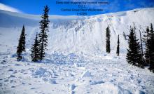
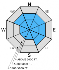
Wind slab avalanches were sensitive to human triggering yesterday, and I suspect they will remain sensitive today with continued snow and wind. New snow over the past 48 hours accumulated on a crust on the south half of the compass and old, soft snow on more shaded aspects. Yesterday, we triggered a 100 ft. wide wind slab from a ridge, and it released 10-14 inches deep on the old snow/new snow interface (image). We also observed active wind loading. Continued snow and wind will add to the depth of these wind slabs on all aspects at upper elevations and in cross-loaded gullies at mid-elevations. Wind slabs could be 1.5 to 3 feet thick. Look for rounded pillows of wind drifted snow especially on convex rollovers. Pay attention for obvious signs of instability like recent avalanches and cracks shooting out from your skis or machine.
-
Type ?
-
Aspect/Elevation ?
-
Likelihood ?CertainVery LikelyLikelyPossible
 Unlikely
 -
Size ?HistoricVery LargeLargeSmall

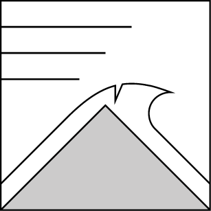
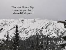
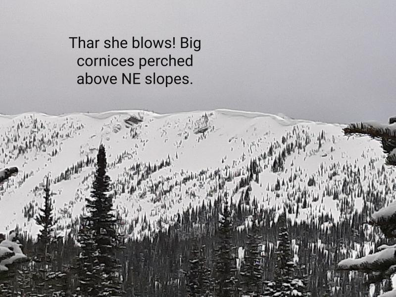
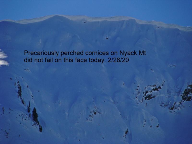
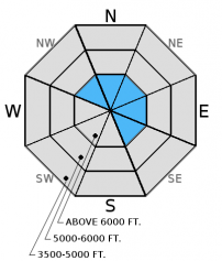
Recent strong winds added to the mass of already large cornices across the advisory area. Reports and observations of both natural and human triggered cornice fall occurred last weekend (image) including a snowboarder caught in a wind slab and cornice fall (observation). We observed large cornices yesterday and active wind loading (image). The large amount of stress a falling cornice puts on the snowpack can trigger deeper weak layers like wind slabs or weak snow near the late Feb. or March crusts. Cornices can break back further than expected so give them a wide berth when traveling above them and limit your exposure time when traveling below.
Additional concern: Weak snow surrounds a series of crusts 1.5 to 3 feet from the surface, but has not produced recent avalanches. However, digging into the snow and performing stability tests is the only way to determine if this weak layer exists. Stability tests just last week in some locations show these layers can fracture and propagate (video1, video2).
Variable spring weather can produce harsh, stormy conditions one minute with sun and warmth the next. Thus, intense spring sun can begin to produce wet, loose avalanches if it pokes out for an extended period of time during the day. So, watch for rapidly changing weather conditions and how it affects the surface snow stability.
Thursday: My partner and I toured along the Marion Lake/Dickey Creek ridgeline yesterday in the Flathead Range. We observed shooting cracks on most wind loaded terrain and triggered a 100 ft. wide and 10-14 inch deep wind slab on a northeast aspect (image and video). Strong winds were loading multiple aspects (observation). Deeper weak layers around a series of crusts were unreactive in our stability tests at this location.
Tuesday: Mark, along with a Glacier NP ranger, visited Peak 6996 in southern Glacier Park to follow up on the avalanche incident from last Friday. A snowboarder triggered an 18 inch thick wind slab. The fracture propagated up to the cornice which then failed onto the slope. This slab sat on top of a thin layer of facets which capped a recent rain crust. There was also a surface melt freeze crust that formed Sunday extending from the valley floor to the summit (observation).
Monday: Mark observed glide cracks on south facing terrain in Canyon Creek in the southern Whitefish Range, and easily initiated pinwheels, rollerballs, and small wet loose avalanches on top of a rain crust (observation).
Saturday and Sunday: Numerous parties reported wet, loose avalanches up to size D2 (enought to bury, injure, or kill a person) and abundant cornice fall throughout the advisory area (observations). Skiers in the Middle Fork corridor of the Flathead Range observed cornice triggered wind slab avalanches (image) and glide avalanches that also triggered a slab below (image).
Visit our Observations page and our You Tube channel for more observations from the entire season.
Thanks to everyone for submitting observations. They are extremely useful and could help save lives.
HOW TO SUBMIT OBSERVATIONS:
Email: [email protected]
Call and leave a message: 406.387.3821
You can also submit quick observations via text: 406.241.4571 (FAC mobile)
OR
Submit Snowpack Observations: http://www.flatheadavalanche.org/node/add/snowobs
Submit Avalanche Observations: http://www.flatheadavalanche.org/node/add/avyobs
The advisory area received 6-9 inches of new snow over the past 24 hours.
48 hour storm totals (weather station map):
BigMountain = 1.5 inches SWE, 14 inches snow
Stahl Peak = 2.4 inches SWE, 14 inches snow
Noisy Basin = 2.2 inches SWE, 15 inches snow
Shed 7 = 9.5 inches of snow
Flattop Mountain = 1.3 inches of SWE, 12 inches snow
Currently, mountain temperatures are 22º-28º F with winds out of the west-southwest at 4-16 mph with gusts to 22 mph. Expect continued snow today with another 3-6 inches of snow. Temperatures will be in the upper 20s to low 30s F with winds moving out of the southwest at 5-15 mph gusting to 25 mph.
| 0600 temperature: | 22 to 28 deg. F. |
| Max. temperature in the last 24 hours: | 26 to 33 deg. F. |
| Average wind direction during the last 24 hours: | West-Southwest |
| Average wind speed during the last 24 hours: | 4-30 mph |
| Maximum wind gust in the last 24 hours: | 28-40 mph |
| New snowfall in the last 24 hours: | 6-9 inches |
| Total snow depth: | 86-115 inches |
This advisory applies only to backcountry areas outside established ski area boundaries. This advisory describes general avalanche conditions and local variations always occur. This advisory expires at midnight on the posted day unless otherwise noted. The information in this advisory is provided by the USDA Forest Service who is solely responsible for its content.


