| Thursday | Thursday Night | Friday | |
|---|---|---|---|
| Cloud Cover: | Snow and strong southwest winds. | Snow showers and wind. | Continued snow showers. |
| Temperatures: | 32 to 42 deg. F. | 21 to 29 deg. F. | 33 to 43 deg. F. |
| Wind Direction: | Southwest | West | Northwest |
| Wind Speed: | 15-20 mph with gusts to 44 mph. | 15-20 mph with gusts to 40 mph. | 5-10 mph. |
| Snowfall: | 3-6 in. | 1-3 in. | 3-5 in. |
| Snow Line: |
Whitefish Range
Swan Range
Flathead Range and Glacier National Park
How to read the forecast
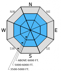
New snow yesterday combined with more snow and strong winds today will create dangerous avalanche conditions. Cautious route finding and careful snowpack evaluation are essential. Human triggered storm slab and wind slab avalanches are likely. Be cautious of cornices as they get larger with today's wind, and assess weak layers around a crust 1.5 to 3 feet from the surface. The avalanche danger is CONSIDERABLE above 5000 feet and MODERATE below.

3. Considerable
?
Above 6500 ft.
3. Considerable
?
5000-6500 ft.
2. Moderate
?
3500-5000 ft.
- 1. Low
- 2. Moderate
- 3. Considerable
- 4. High
- 5. Extreme
-
Type ?
-
Aspect/Elevation ?
-
Likelihood ?CertainVery LikelyLikelyPossible
 Unlikely
 -
Size ?HistoricVery LargeLargeSmall

The recipe is simple. New snow + strong wind + crust (bed surface) = avalanches. The new snow yesterday accumulated on a crust, and with today's additional load I expect wind and storm slabs to be quite sensitive to human trggering. We could also see natural avalanches. The crust will serve as a great bed surface for these avalanches to slide on. Today's strong winds will also form sensitive wind slabs at upper elevations and mid-elevations in cross-loaded gullies. Wind slabs could be up to 2 feet thick. Thus, watch for sensitive slabs further downslope than we've recently seen. Look for rounded pillows of wind drifted snow especially on convex rollovers. Pay attention for obvious signs of instability like cracks shooting out from your skis or machine.
-
Type ?
-
Aspect/Elevation ?
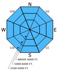
-
Likelihood ?CertainVery LikelyLikelyPossible
 Unlikely
 -
Size ?HistoricVery LargeLargeSmall

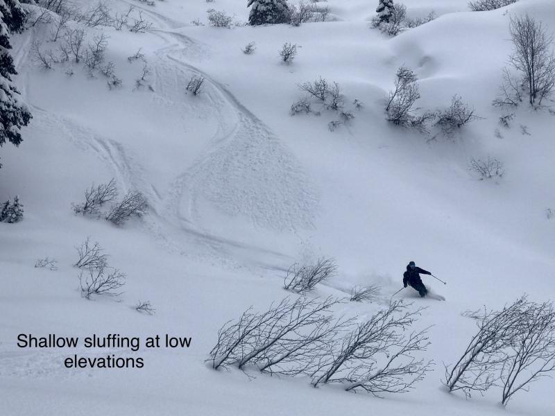
Loose avalanches are possible today given that the new snow is falling on a crust. I expect loose avalanches to run easily on this crust. Even small loose avalanches can cause problems near terrain traps. These avalanches are more manageable than slab avalanches and typically release near your skis or sled, but they can easily catch you off guard and carry you. Watch for loose snow sluffs in steeper terrain.
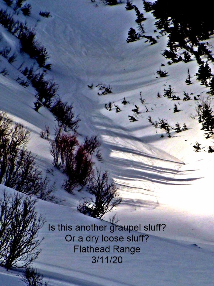
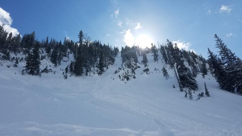
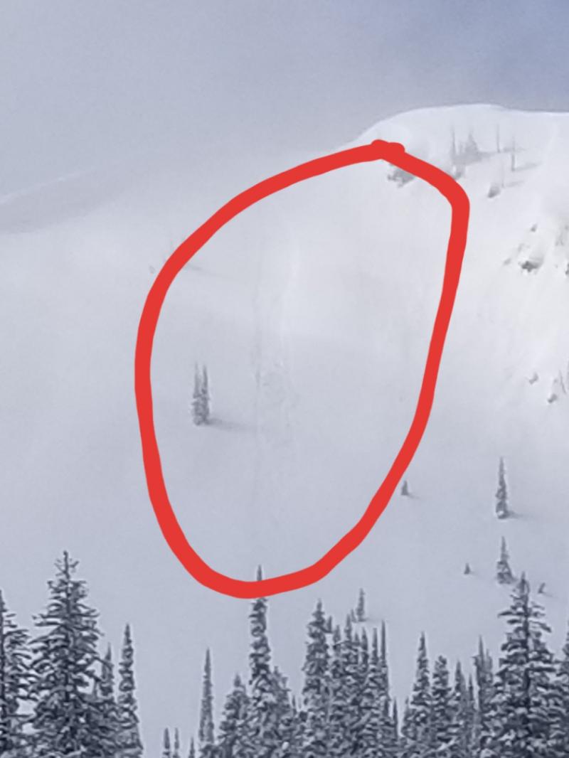
Additional concerns: Recent observations report both natural and human triggered cornice fall. The large amount of stress a falling cornice puts on the snowpack can trigger deeper weak layers like wind slabs or weak snow around the late February crust. Skiers near Mt. Grant in the Flathead Range observed cornice fall and subsequent slab avalanches last Saturday (image). Skiers in the Avalanche Lake area in Glacier Park reported a substantial amount of cornice blocks that had fallen over the past week. Cornices can break back further than expected so it is important to keep a safe distance when traveling above them and limit your exposure time when traveling below. Cornices will grow larger and potentially more sensitive today as well.
Weak snow surrounds a series of crusts that are 1.5 to 3 feet from the surface. Digging into the snow and performing stability tests is the only way to determine if this weak layer exists. Stability tests just last week in some locations show they still have the potential to break across a slope (video1, video2). Put the odds in your favor by avoiding steep, convex roll-overs, and rocky terrain where the snowpack is shallow.
Tuesday: Mark, along with a Glacier NP ranger, visited Peak 6996 in southern Glacier Park to follow up on the avalanche incident from last Friday. A snowboarder triggered an 18 inch thick wind slab. The fracture propagated up to the cornice which then failed onto the slope. This slab sat on top of a thin layer of facets which capped a recent rain crust. There was also a surface melt freeze crust that formed Sunday extending from the valley floor to the summit (observation).
Monday: Mark observed glide cracks on south facing terrain in Canyone Creek in the southern Whitefish Range, and easily initiated pinwheels, rollerballs, and small wet loose avalanches on top of a rain crust (observation).
Saturday and Sunday: Numerous parties reported wet, loose avalanches up to size D2 (enought to bury, injure, or kill a person) throughout the advisory area (observations). Skiers in the Middle Fork corridor of the Flathead Range observed cornice triggered wind slab avalanches (image) and glide avalanches that also triggered a slab below (image).
Visit our Observations page and our You Tube channel for more observations from the entire season.
Thanks to everyone for submitting observations. They are extremely useful and could help save lives.
HOW TO SUBMIT OBSERVATIONS:
Email: [email protected]
Call and leave a message: 406.387.3821
You can also submit quick observations via text: 406.241.4571 (FAC mobile)
OR
Submit Snowpack Observations: http://www.flatheadavalanche.org/node/add/snowobs
Submit Avalanche Observations: http://www.flatheadavalanche.org/node/add/avyobs
The advisory area received up to 8 inches of new snow (up to 1.2 inches of SWE at Stahl Peak in Whitefish Range and 1.1 inches at Noisy Basin in Swan Range) over the past 24 hours, and another 5-10 inches is expected by tomorrow morning. Currently, mountain temperatures are 24º-30º F with winds out of the west-southwest at 7-11 mph with gusts to 21 mph. Expect continued snow and southwest winds 15-25 mph with gusts to 55 mph. Temperatures will be in the upper 20s to low 30s F.
| 0600 temperature: | 24 to 30 deg. F. |
| Max. temperature in the last 24 hours: | 26 to 33 deg. F. |
| Average wind direction during the last 24 hours: | Southwest |
| Average wind speed during the last 24 hours: | 2-30 mph |
| Maximum wind gust in the last 24 hours: | 23-42 mph |
| New snowfall in the last 24 hours: | 3-8 inches |
| Total snow depth: | 81-108 inches |
This advisory applies only to backcountry areas outside established ski area boundaries. This advisory describes general avalanche conditions and local variations always occur. This advisory expires at midnight on the posted day unless otherwise noted. The information in this advisory is provided by the USDA Forest Service who is solely responsible for its content.


